
The natural world is full of examples of animals that have evolved camouflage. Check out this list and see how many of the animals you can find. Another example that I find particularly interesting is the Potoo bird. Some animals, like the Potoo, use camouflage to hide from predators, while others, like the Polar Bear, are predators who use camouflage to hide from their prey and make it easier to sneak up on them. Clouds also use camouflage (or at least it seems that way) to hide from weather satellites. Are they predators trying to hunt down and destroy innocent weather forecasts? Are they hiding because they fear some atmospheric phenomenon will find them and glaciate them? It’s tough to tell what goes on in the mind of a cloud, since it isn’t alive and has no brain.
Did you click on the first link above and take the test? If so, you are now aware of the skills you’ll need to detect clouds in the Arctic.
Let’s start with an infrared (IR) image of Alaska taken by VIIRS at 23:29 UTC on 3 February 2014:

The question is: where are all the clouds?
Colors correspond to the color table in the lower right corner of the image. IR images typically use color tables like this one to highlight the structures of cold cloud tops. And given the long Arctic winter nights, IR images like this are typically all that are available. The problem that arises is that low clouds, like fog and stratus, have a brightness temperature similar to the background surface, making them hard to spot. Sometimes temperature inversions exist and the low clouds in the image are warmer than the background surface. Cloud-free valleys and the ice in the Arctic Ocean may be colder than the clouds you’re trying to see, so you can’t always use temperature or temperature differences to detect clouds.
Now, we’ll get some help for this case, since 23:29 UTC is 2:30 in the afternoon (for most of Alaska), so there is some sunlight. This allows us to compare the IR image above with visible-wavelength images. Of course, that doesn’t always help, since clouds can be camouflaged at many different wavelengths. Here’s the VIIRS “True Color” RGB composite (a composite of M-3, M-4 and M-5, which are at blue, green and red portions of the visible spectrum, respectively):
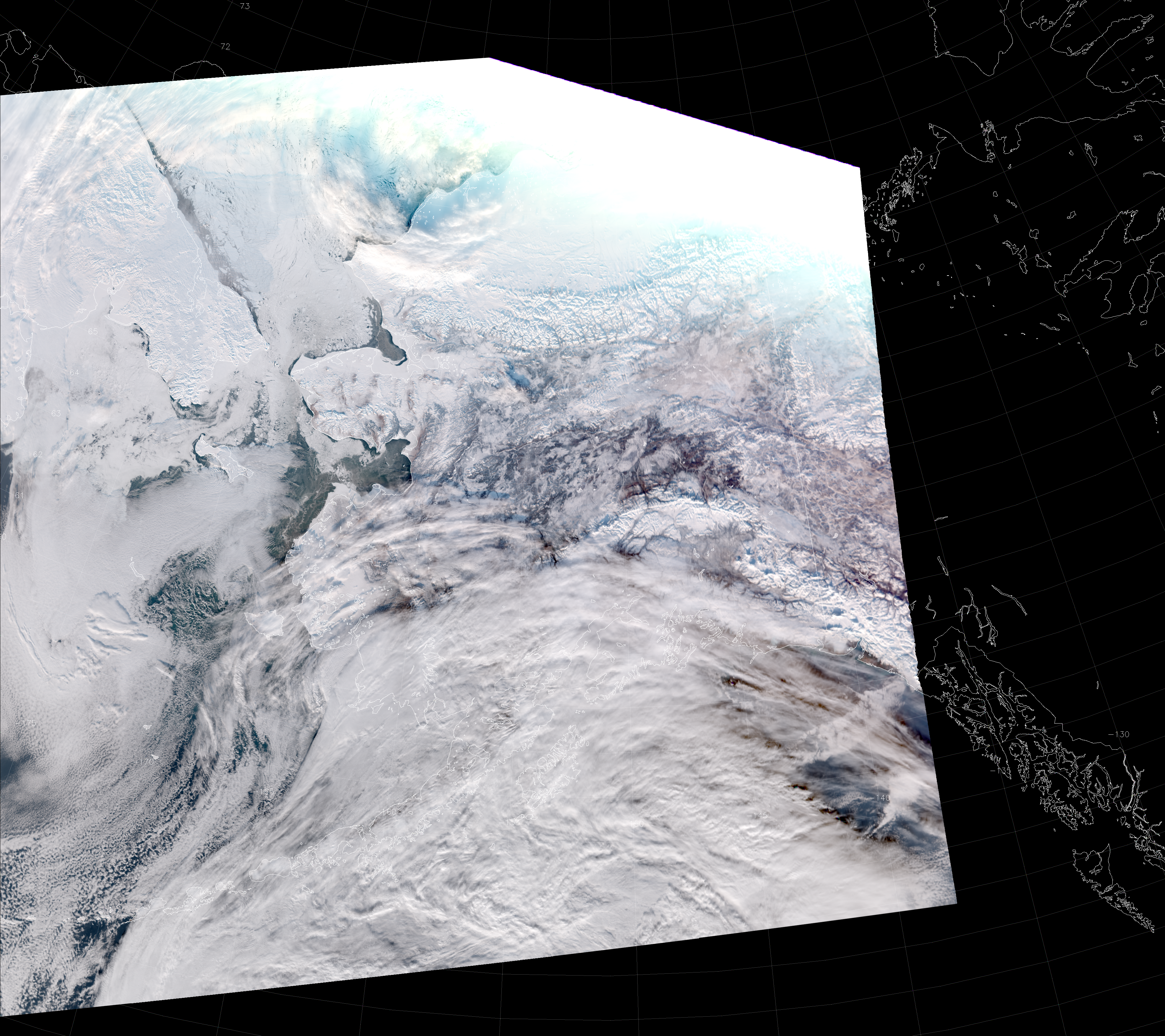
Many of the clouds here are still camouflaged because the clouds and snow and ice all appear white. The clouds that are easy to spot in the IR image (e.g. over the Gulf of Alaska) are similarly easy to spot in the True Color image. But, what about the clouds that are still hiding?
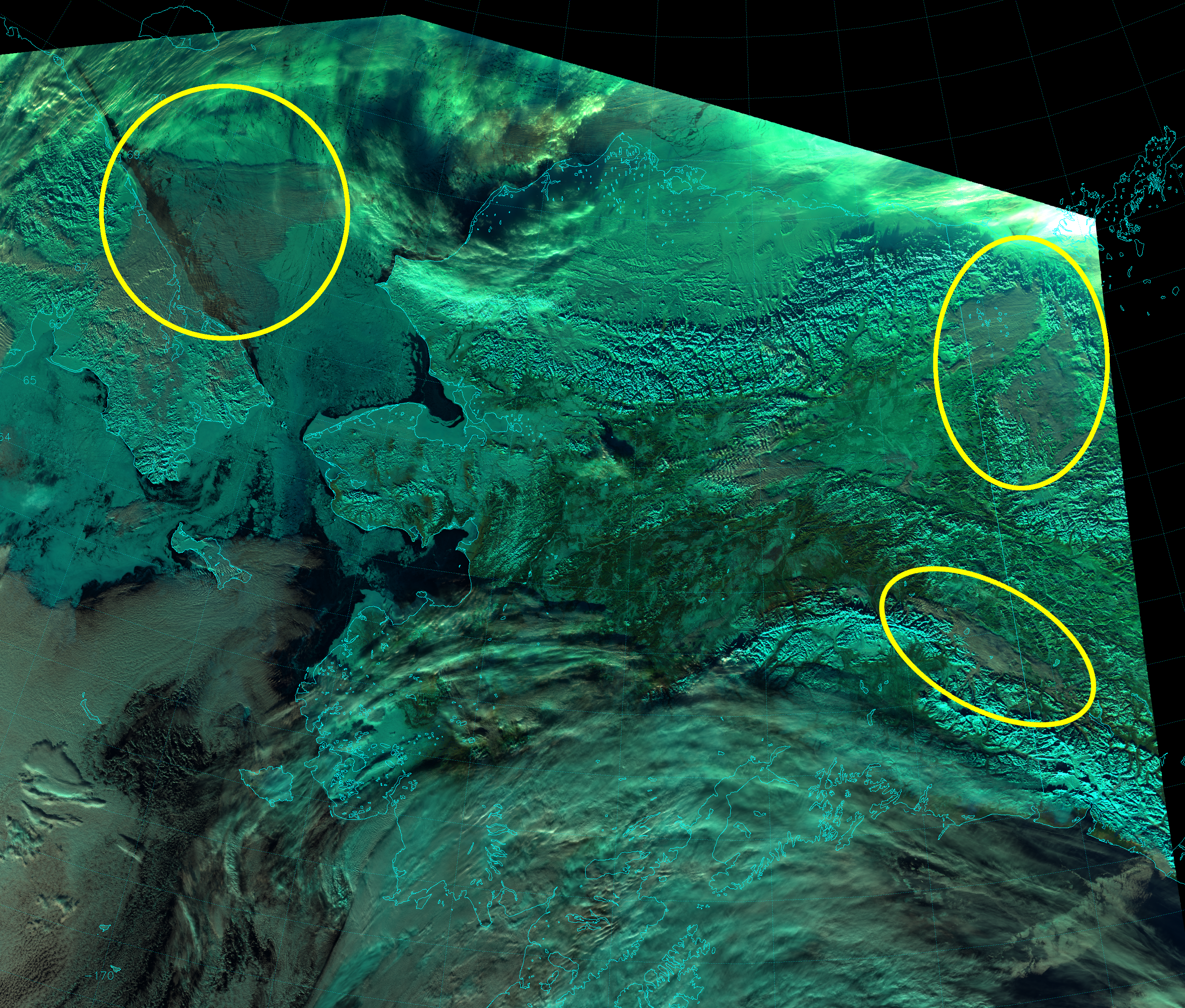
For now, we’re going to focus on three interesting regions that contain camouflage clouds: the Tanana River valley near Tok, the Arctic Ocean north of Russia, and the northern tip of the Yukon Territory. Keen-eyed observers may already be able to spot the clouds I’m referring to by noticing cloud shadows or by remembering where forests or mountains are located that are now obscured. (Although, the clouds in the northwest Yukon Territory are really difficult to see because of saturation issues at the terminator.) The three areas I’m referring to are highlighted below:
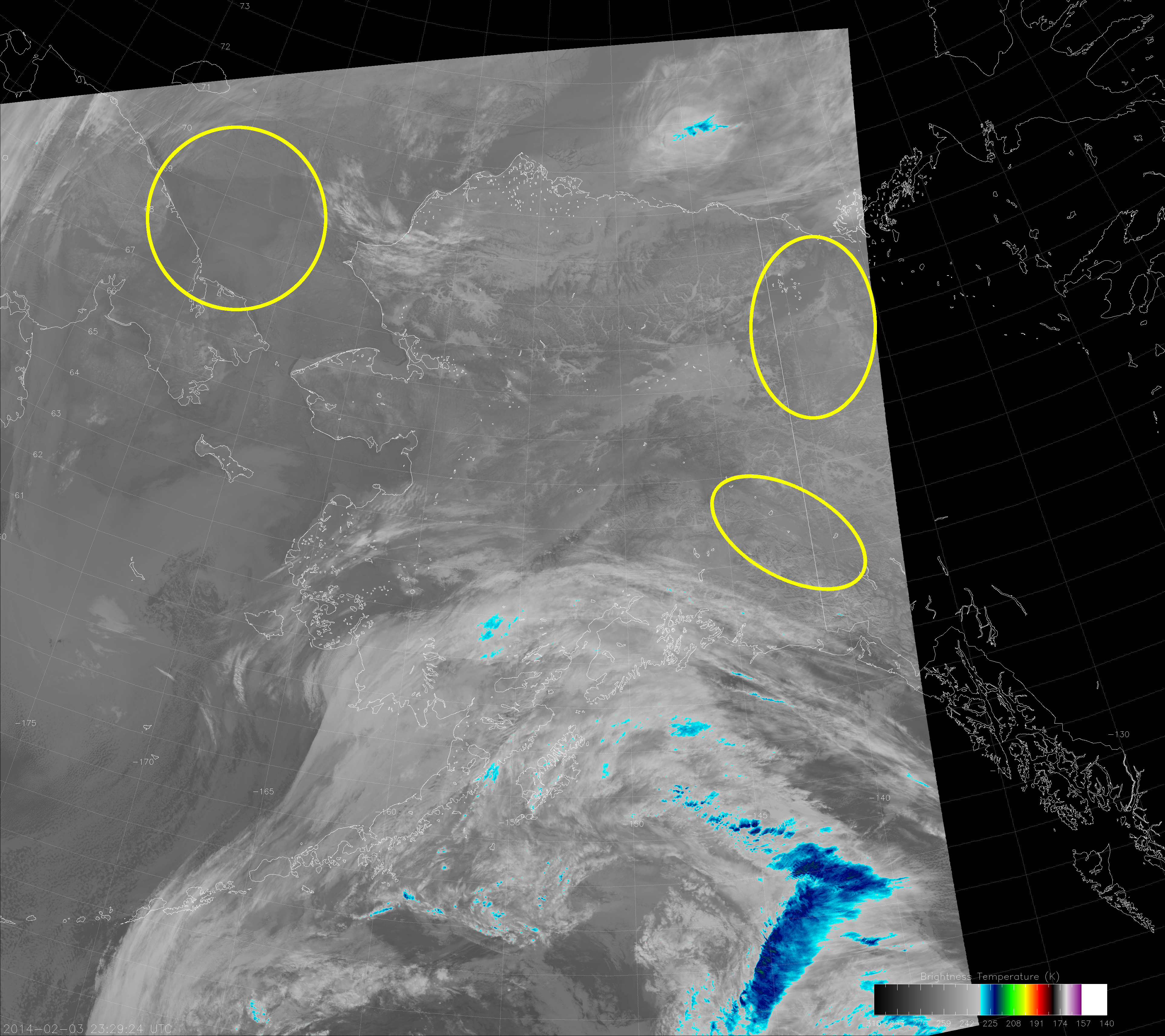
Clouds are not so easy to see in these three areas, are they? (Remember, you can click on any image to see the high-resolution version.)
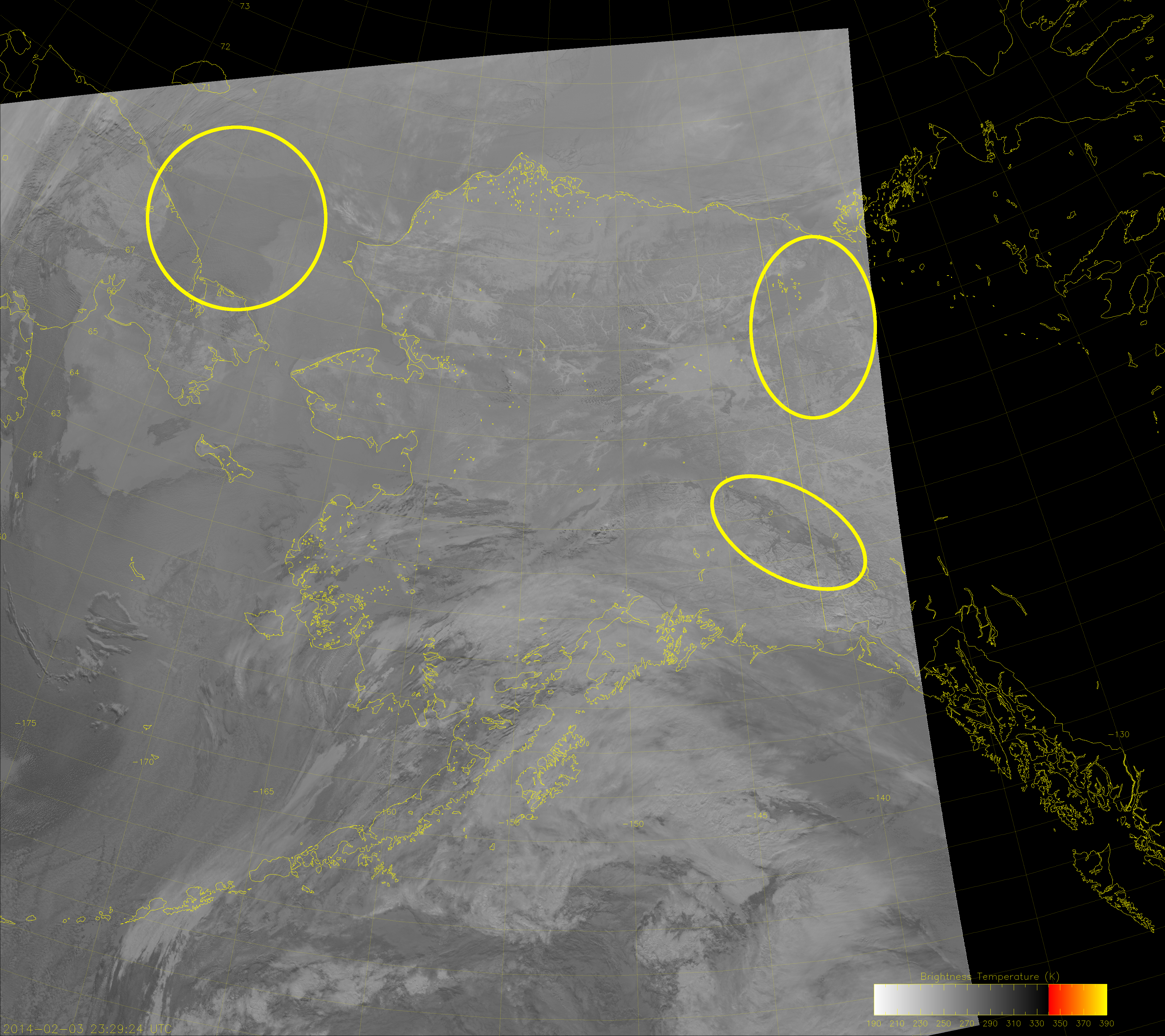
The Day/Night Band (and its Near Constant Contrast counterpart) show the clouds in these areas a bit better than the True Color image (and certainly better than the IR image). Here we show the Near Constant Contrast (NCC) image, so we’re not impacted by the presence of the day/night terminator:
The clouds over Tok (lower right oval) are bit difficult to see, but you should be able to see the shadow they cast.
The clouds over northern Yukon Territory (upper right oval) are interesting for a couple of reasons: they obscure the terrain (the easiest way to tell those are clouds); they hug the surface so they aren’t casting any shadows; and the cloud on the northwest side of the oval is much warmer than the cloud on the southeast side of the oval even though they look similar at visible wavelengths (compare the visible images with the IR images).
The left oval over the Arctic Ocean shows the big difference in opacity between looking at a cloud in the IR versus the visible wavelengths. The IR image shows an opaque, slightly darker (i.e. warmer) shape barely discernible from the background ocean and ice. The NCC image shows a semi-transparent cloud (also slightly darker [i.e. less reflective] than the background ice) with a lot of structure due to gravity waves. Underneath the cloud feature, you can clearly see where the icebergs and open water are located. Try doing that with the IR image.
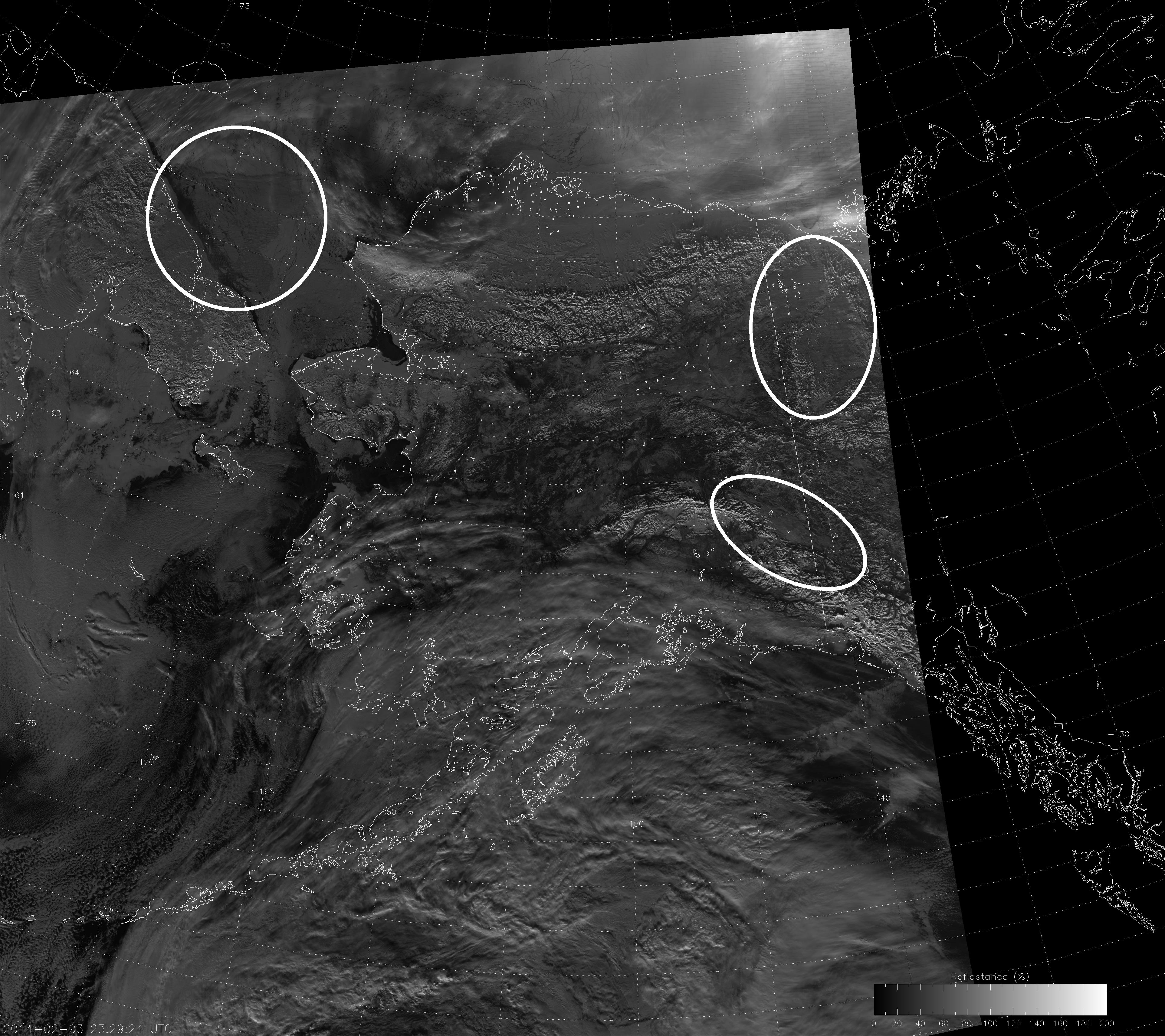
The shortwave (or what the JPSS program office calls “midwave”) IR image (I-4) is not the most intuitive to interpret, but it also shows these camouflage clouds (some better than others):
The I-4 band is centered at 3.74 µm, a wavelength where reflection of solar radiation and the Earth’s emission both play an important role in what you are seeing. In the color table used here (best at highlighting wildfires and volcanic eruptions), highly reflective objects and warm objects show up darker. Ice clouds, snow and sea ice are all poorly reflective and cold, so they appear brighter. Liquid clouds are highly reflective, which makes the clouds over Tok easily visible.
The Yukon clouds are still pretty camouflaged because, even though they are liquid, they are colder, and don’t have as big a contrast with the background surface. As mentioned before, the clouds to the northwest in the oval are darker (warmer) than the clouds in the southeast part of the oval.
The Arctic Ocean clouds are interesting here. The reflective component reveals the gravity waves, but the emissive component obscures the ice and open water below. These clouds are not only camouflaged in certain wavelengths, they also act as camouflage for the ice below!
This example shows that not all clouds are easy to see with individual channels – even when looking at two or three different wavelengths. But, it does show that the visible-wavelength information provided by the NCC image is quite a bit different from the IR information that is typically used. And, even though this was a daytime scene, all the stuff I wrote still applies at night (except you lose the reflective component to the shortwave IR imagery).
Finally, let’s look at another RGB composite, what EUMETSAT calls “Natural Color”:
This composite uses bands I-1 (0.67 µm), I-2 (0.86 µm) and I-3 (1.61 µm) as the blue, green and red components, respectively. Snow, ice and ice clouds appear the bluish color known as cyan because they are highly reflective in I-1 and I-2, but poorly reflective in I-3. Liquid clouds appear white, to dirty white, to a grayish, pale cyan color depending on particle size and reflectivity. Vegetation is very green. Unlike the True Color RGB composite, the low liquid clouds in all three ovals are easier to see here because now they are a significantly different color than their respective backgrounds. Plus, the Arctic Ocean clouds are still transparent enough to show the ice and open water below.
The Natural Color composite may be the best way to detect low liquid clouds in this region, but it’s only available when the sun is above the horizon. The Day/Night Band (or NCC) is a useful stand-in, when it’s not available.
It just goes to show: the clouds may try to hide, but VIIRS can always find them!