Upon inspection of the synthetic infrared (10.35 micron) imagery from the NSSL WRF-ARW model:
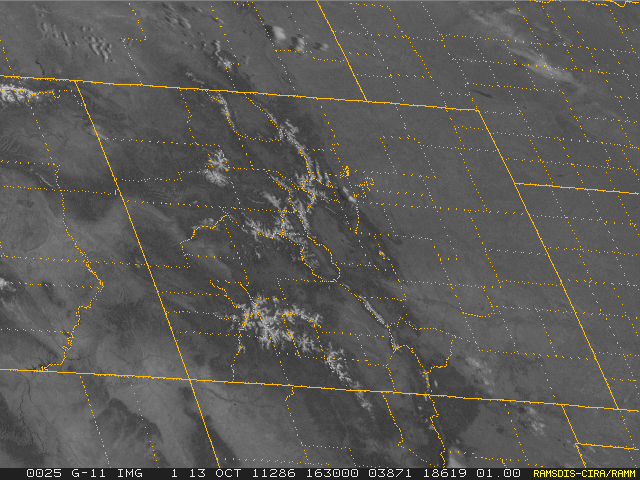
your attention may be drawn to the region of southwest Colorado since we see a region of cold brightness temperatures that does not move and persists for the duration of the loop (1600-0000 UTC). Could these be low clouds / fog? Let’s look at the GOES visible imagery for 1630 UTC:

Skies are clear across southwest Colorado, so we are not looking at low clouds / fog. However, note that there is snow cover over the mountains.
What we’re looking at in the synthetic imagery is a representation of snow cover. The snow cover data that goes into the NSSL WRF-ARW model is relatively coarse, therefore the cold ground signature is spread out over relatively large areas when there is snow cover in the model. This signature shows up quite easily early in the cold season with the large temperature difference between snow cover and no snow cover, and will increase in coverage moving into winter as snowfall coverage increases.
