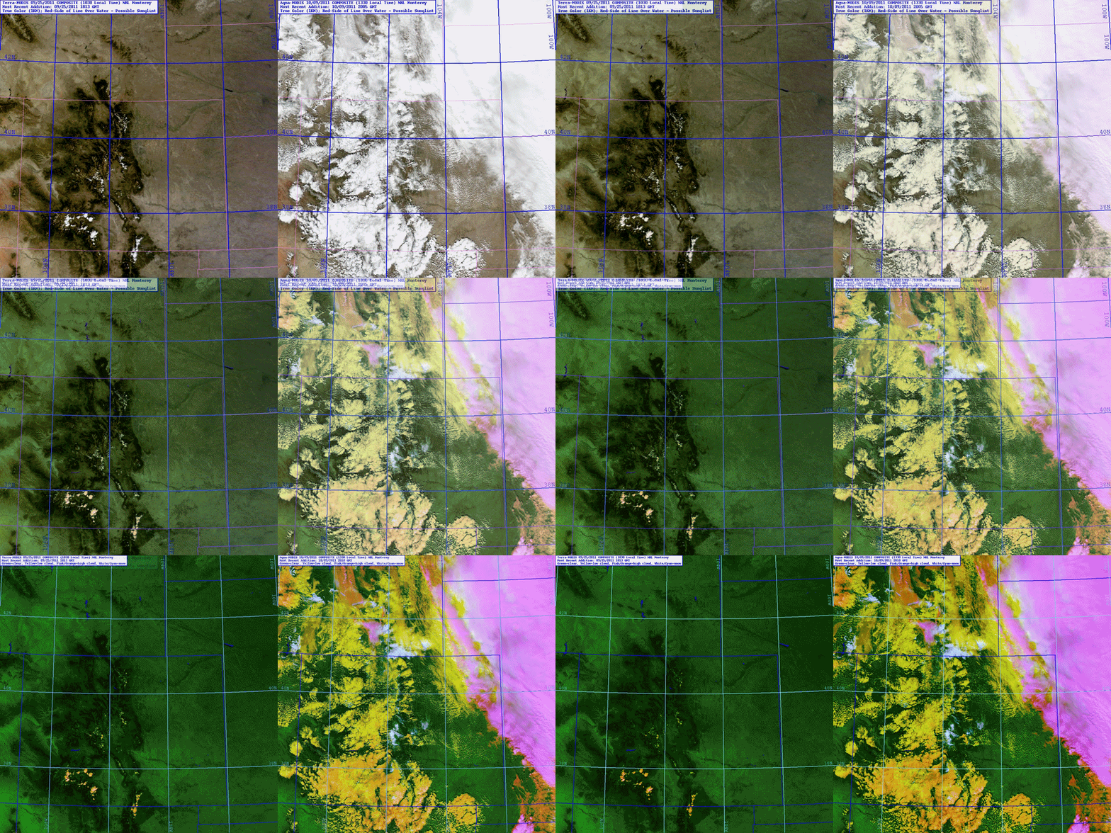
As part of the GOES-R Satellite Proving Ground, NASA MODIS data are being used to preview the kinds of snow detection capabilities that will become available from the GOES-R ABI. The fading image example above demonstrates the MODIS Snow/Cloud Discriminator product, coupled with the true color product which presents the scene as “color-vision imagery” but does not discriminate snow from clouds. The discriminator product, presented here as enhanced imagery, takes advantage of shortwave infrared bands currently not availble to GOES to present high clouds in magenta, mid/low and overlapping level clouds in orange/yellow, snow cover in white, and clear-sky over land as green (water bodies, when present, appear as blue).
On the left side of this example is an image from 9/25/2011 centered over Colorado near the end of the ‘water year’ (which runs from Oct 1 to Sep 30, and corresponds roughly to the storage cycle of snowpack in the Rockies). On the right side is an image from 10/9/2011, entering the new water year and shortly after one of the first Colorado high-country snow events. The 9/25/2011 fading loop is MODIS true color imagery in which no snow cover is discerned (with only a few broken cumulus clouds over the mountains). After the snow event, a large portion of the domain is filled with what might be low clouds, high clouds, or snow (right). Using the true color imagery alone, a forecaster would have trouble discriminating between the clouds and snow in this complex scene. However, the snow/cloud discriminator product makes the identification less ambiguous.
With GOES-R, this capability will be further improved by virtue of the high temporal refresh rate (5 minute, standard), enabling detection of snowfields that are currently obscured by cloud cover. Through the Proving Ground, forecasters are able to familiarize themselves with and evaluate the capabilities of improved snow/cloud discriminators in anticipation of operation commission of the GOES-R ABI later this decade.

