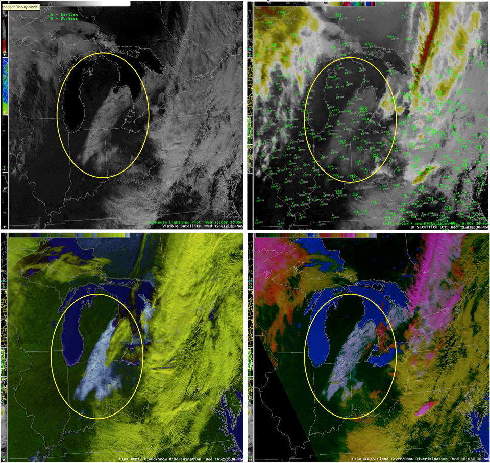
Buffalo WFO SOO David Zaff collected this imagery from one of the forecasters, Robert Hamilton, who sent him the following message: “I found it very interesting to see snow cover on the basic IR imagery late this afternoon, so I have attached both the IR and VIS imagery from 19z. ‘Sampling’ over the snow cover on the IR imagery, I was getting consistent temps of -2 to -3c, and when I moved off the snow cover to the dry land, I was getting readings of +2 to +3c.
After showing Paone (another forecaster), he went into the MODIS imagery and noted how well it was shown in both the Cloud/Snow Discriminator image and the Cloud Layer/Snow Discriminator image.”

Figure 1. The images saved by the Buffalo WFO have been assembled here in a 4-panel for comparison, with the oval highlighting the snow cover discussed in the above quote. Shown is a visible (upper left) and IR image (upper right), both at 1900 UTC, CIRA MODIS Cloud/Snow Discrimination Image at 1625 UTC (lower left), and MODIS Cloud Layer/Snow Discrimination Image at 1803 UTC (lower right).

