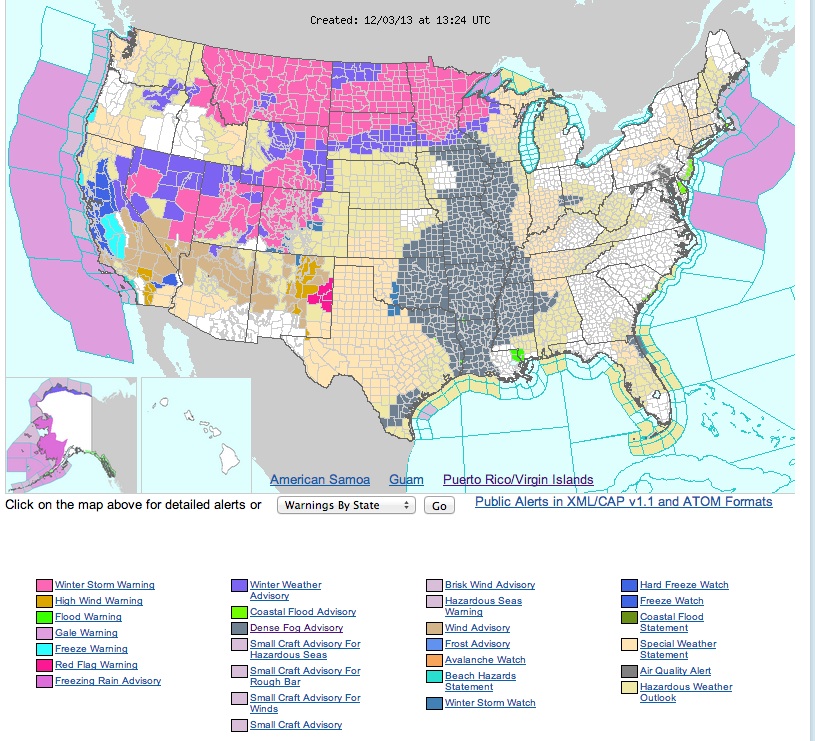
Widespread fog and low clouds covered much of the nation east of the Rockies 0n the morning of 3 Dec in the moist airmass ahead of the developing western storm and strong cold front that has since pushed south. Dense Fog Advisories were issued by many WFOs, as seen in the graphic below valid at 1324 UTC on 3 Dec.
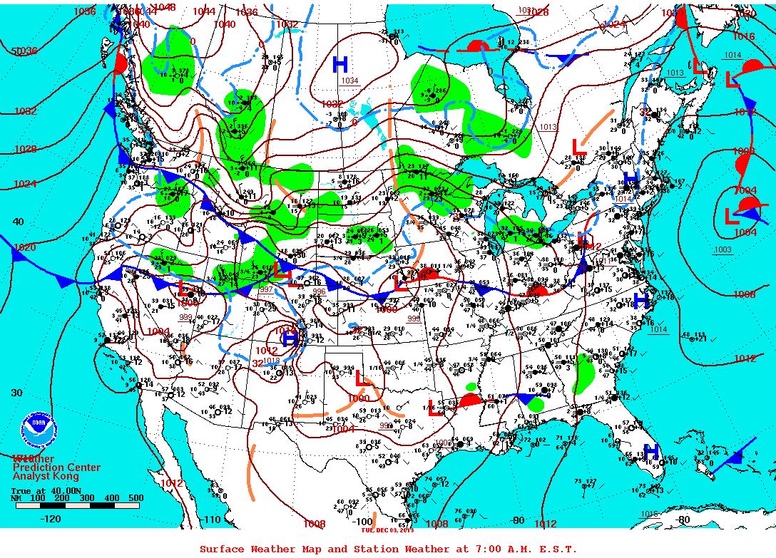
The surface weather map at 1300 UTC on 3 Dec is shown below. A complex storm system is taking shape in the Rockies while an Arctic high pushes cold air southward into the Northern Plains.
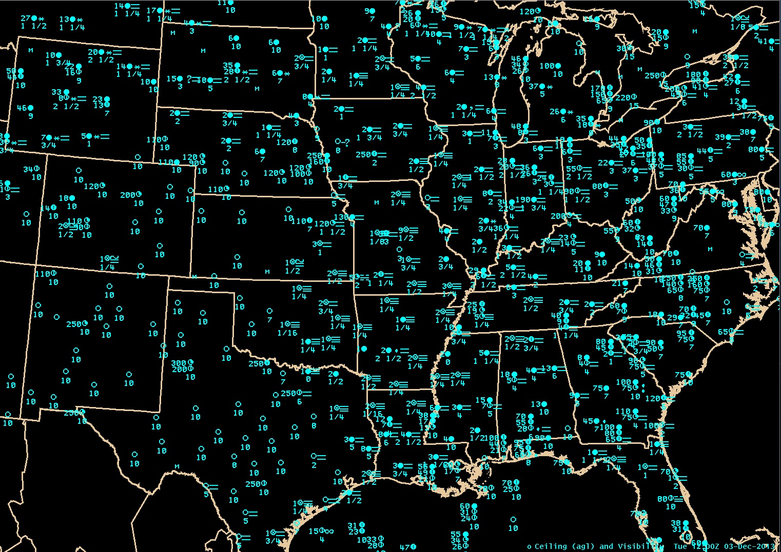
A closer look at the observations is given in the plot below. In this plot visibility is given below the station circle, weather to the right, and ceiling height (feet, AGL) to the left. Note the large number of stations reported low visibilities due to fog. East of the dense fog area was a huge area with more scattered fog reports but widespread low overcast conditions.
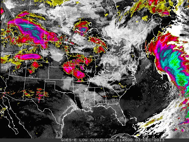
CIRA has two types of overview imagery that make fog and low clouds easier to see, and both will be available in improved versions in the GOES-R era. Below we see an example of GeoColor imagery, one version with night lights and the other without, both for 1145 UTC on 3 Dec. In this imagery low clouds and fog appear in red/pink tones, while clouds or snow cover are white. Much of North America east of the Rockies is covered by low clouds and fog, interrupted in the imagery in some areas by higher clouds. GeoColor imagery is intended as a general overview type of satellite imagery.
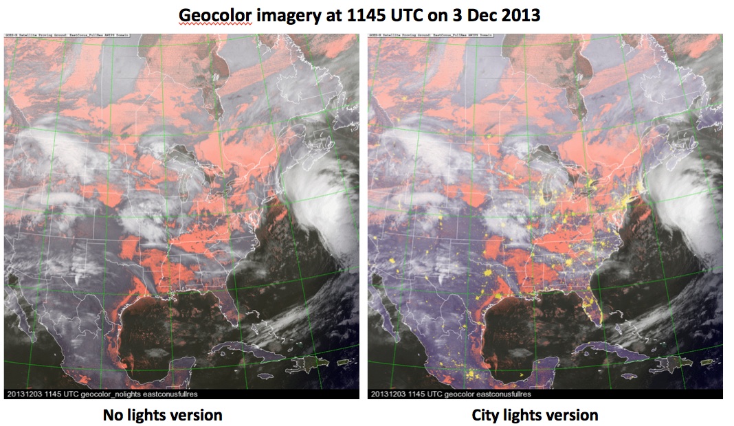
In the GeoColor imagery all clouds other than low clouds (or fog) appear white. Another type of imagery (called Low-cloud/fog imagery) is designed to highlight low clouds and fog in a whitish color both during the night and during the day, but also colors higher clouds thereby giving more information about them. An image also for 1145 UTC is shown below. Note that thin cirrus appears as black during nighttime imagery, and we see that there are areas of thin cirrus covering some of the regions of low clouds and fog.
