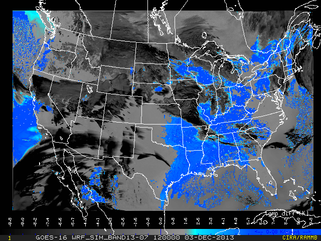
The previous blog entry discussed CIRA satellite imagery that can be useful in highlighting fog and low clouds. These images utilize existing satellite imagery to create images that try to replicate those that will be available in the GOES-R era. Another method to create GOES-R type imagery is to use output from a high-resolution model (in this case NSSL’s 4-km WRF-ARW model run at 0000 UTC) to create “synthetic” satellite imagery. An advantage to synthetic imagery is the ability to replicate many of the bands that will be on GOES-R. We also replicate satellite imagery that forecasters currently use, such as IR, so that they can determine how well the model actually does in comparison to real-time available imagery. A number of forecasters have found synthetic imagery to be a useful way to visualize model output, much in the way model radar reflectivity is now widely used.
One of the synthetic images being generated by CIRA replicates the AWIPS fog product, and uses the 10.35 minus 3.9 µm difference to highlight fog and low clouds as blue. Higher level clouds appear as black. The image shown below is a 12-h forecast valid at 1200 UTC on 3 Dec, the type highlighted in the earlier blog.

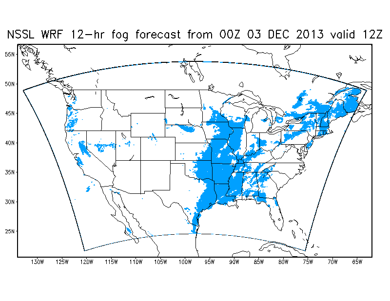
Of course this synthetic image, like its real image counterpart available in AWIPS, does not in itself discriminate between low clouds and fog. But the model provides output that does allow one to better determine areas of fog. This is shown in the image below, where the blue represents areas in which the cloud liquid water content at the lowest model level is nonzero, a proxy for fog.

Comparison of the two images shows that some of the areas in blue in the first image was not fog but low clouds. Another advantage to the image above is that areas of fog are shown beneath the higher clouds (for example across Missouri and eastern Iowa) that obscure the fog in the synthetic image that includes higher level cloudiness.
