Orographic cirrus (i.e., mountain wave) clouds can have a significant influence on temperature forecasts, particularly during the cold season when a reduction in insolation can drastically affect temperatures during the daytime.
On December 18, 2013 the CIRA synthetic 4-km NSSL-WRF ARW and NAM-Nest initialized at 0000 UTC 18 December forecasted orographic cirrus downwind of the Front Range of Colorado during the early morning hours:
the synthetic NSSL WRF-ARW is shown on the left, while the synthetic NAM-Nest is shown on the right, the loop spans from 0900 UTC 18 December – 0300 UTC 19 December (9 to 27 hr forecast). During the mid-day time period, the forecasts begin to diverge with the NSSL WRF-ARW showing a thinning out of the orographic cirrus while the NAM-Nest does not show this trend. Both models indicate redevelopment of orographic cirrus in the evening hours.
The NWS Boulder forecast discussion issued at 4:49 AM MST 18 December highlighted the importance of orographic cirrus potentially limiting the daytime high temperature forecast, note the use of the CIRA synthetic imagery as a forecast tool:
SHORT TERM
MAIN QUESTION TODAY IS THE AMOUNT OF CLOUD COVER AND
ITS EFFECT ON TEMPERATURES. PLENTY OF MOISTURE UPSTREAM THOUGH
THERE IS SOME VARIABILITY. WITH NOT MUCH CHANGE IN THE WIND
PATTERN…EXPECT THE WAVE CLOUD COVERING THE PLAINS TO CHANGE
LITTLE TODAY WHILE THERE MAY BE SOME DECREASE IN THE HIGH CLOUDS
OVER THE MOUNTAINS. CIRA SIMULATED SATELLITE IMAGERY SHOWS A
PRETTY SOLID WAVE CLOUD PERSISTING DOWNSTREAM OF THE FRONT RANGE
THROUGH TONIGHT WITH POOR AGREEMENT ON THE TIMING OF ANY CLEARING
ELSEWHERE. SHOULD BE ENOUGH CLOUDS TO LIMIT TEMPERATURES…BUT THE
AIRMASS HAS ALSO WARMED A LITTLE SINCE YESTERDAY. WE WILL BE OFF
TO A WARM START…ALREADY IN THE 50S IN THE LOWER FOOTHILLS. UNDER
CLEAR SKIES IT WOULD PROBABLY BE 70 IN DENVER TODAY…SO THE
CURRENT MID 60S FORECAST IS PROBABLY STILL ALRIGHT.
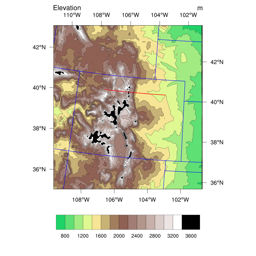
An interesting way to view the influence of the mountain wave is a cross section (red line) oriented east-west across the Front Range as shown here:

The cross section of potential temperature from the NSSL WRF-ARW between 1300 UTC 18 December – 0300 UTC 19 December is shown below:
The mountain wave clearly shows up in the vertical through the depth of the troposphere. Also note the sloped potential temperature lines do not make it all the way to the surface, which is consistent with the lack of high downslope winds for this event.
The verifying GOES IR imagery is shown here:
Note the thinning out of orographic cirrus by the early afternoon hours, which seems to be more consistent with the NSSL WRF-ARW forecast. This kind of monitoring GOES imagery versus synthetic imagery can assess how much confidence to put in one model forecast versus another.
The CIMSS blog has an entry on this event which includes views from polar orbiting satellites:
