Strong winds coupled with dry soil led to widespread blowing dust across the eastern plains of Colorado and areas east on Thursday 16 January 2014. A short video clip shows the blowing dust obscuring visibilities in Logan County in far northeastern Colorado (see www.youtube.com/watch?v=uxMdMTzlRFI ). The lowered visibilities in the blowing dust resulted in a multi-car accident that closed Interstate 70 near Burlington Colorado (close to the Kansas border) for several hours from 11:30 AM MST to 4:25 PM (1830 to 2325 UTC). A story of the dust storm and the accidents that closed Interstate 70, courtesy of Denver 7 News, can be found here http://www.thedenverchannel.com/news/local-news/dust-storm-closes-eb-i-70-us-24-to-kansas-line-us-34-closed-as-poor-visibilty-causes-accidents.
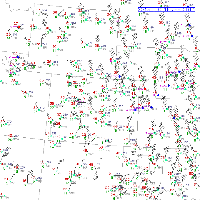
Below is a surface plot from early afternoon on the 16th showing sustained wind speeds of 30 to 40 knots with gusts as high as 55 knots.
In this blog entry we will take a look at how the dust appeared in standard GOES visible imagery and compare this to different imagery from the SUOMI NPP VIIRS instrument Polar satellite. Some of the images we will show demonstrate the capabilities that will be available when GOES-R is launched.
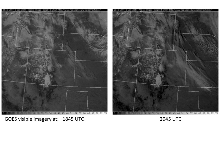
We start with a look at “standard” GOES visible imagery during the event, shown for two times below. In the visible images the plains of eastern Colorado and surrounding areas have a collection of clouds at different levels in addition to some areas of old snow cover as well as the blowing dust. From this imagery alone it is difficult to distinguish between these.
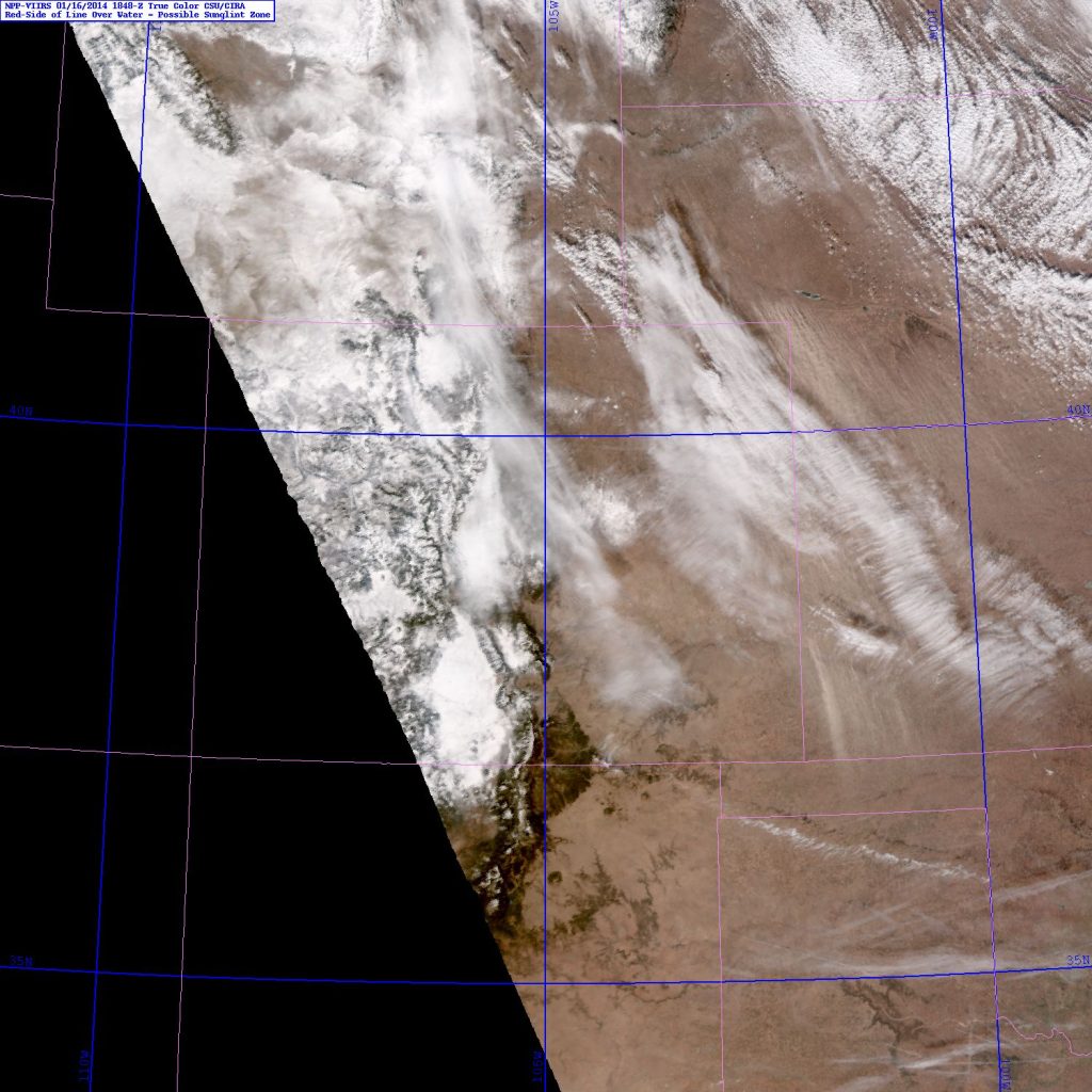
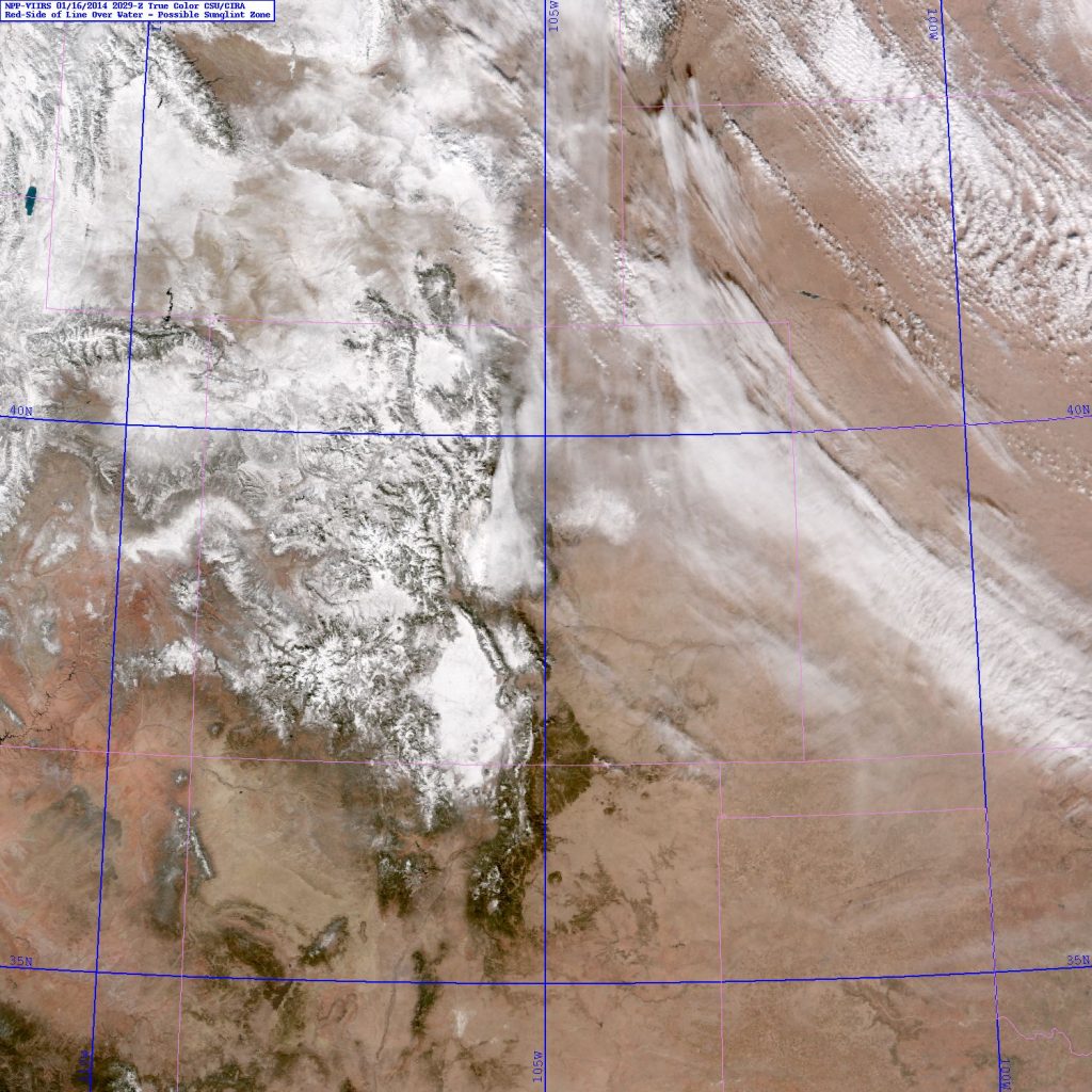
Shown below is similar type of visible satellite imagery but using VIIRS with a natural color background and of course higher spatial resolution (~0.5 km vs 1.o km from the current GOES). Right away we can see that the improved contrast and resolution allows one to see dust plumes in the first image below from 1848 UTC, but things are not so apparent in the second image from 2029 UTC.
Using different bands from VIIRS a specialized type of imagery can be created which isolates the dust, making it stand out far more clearly. CIRA creates two types of dust discrimination imagery, one with the dust highlighted in yellow and the other where the dust has a pinkish color, as shown below. The purpose of these products is to clearly isolate dust from other surrounding clouds and general background.
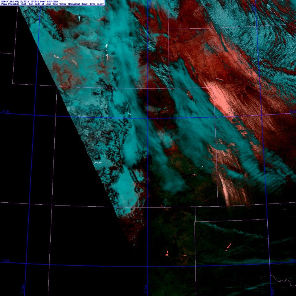
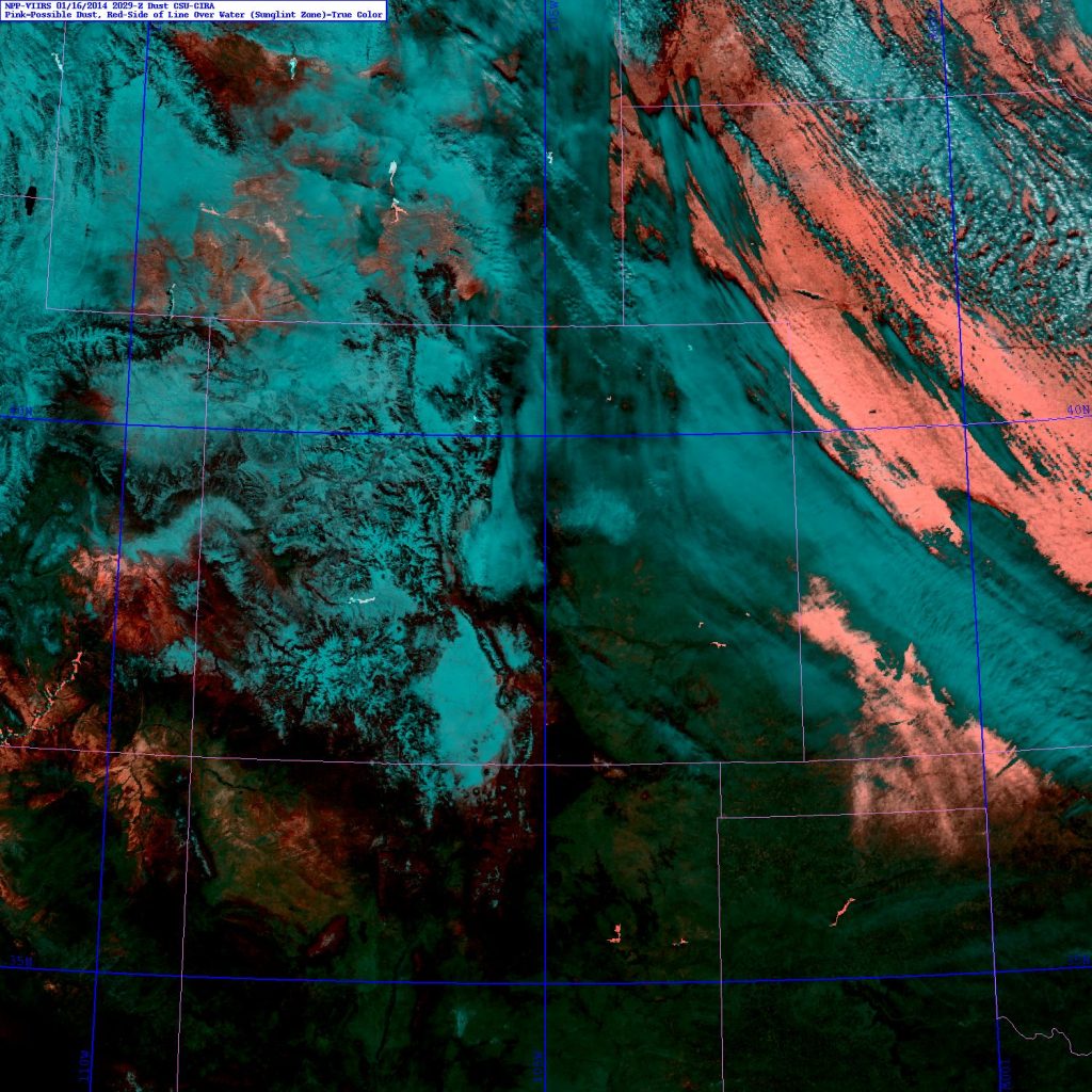
The above imagery is especially useful for the 2029 UTC time, when the earlier visible satellite image showed a more complex mix of dust and clouds. Similar imagery is also made using MODIS Polar orbiting satellites. Shown below are the pink and yellow dust products using the MODIS Aqua satellite imagery at 2020 UTC.


We noted earlier that there was also snow in the background in some spots across the Plains, as well of course in the mountains. The next set of imagery shows the CIRA snow/cloud (discriminates snow from clouds) and snow/cloud layer (further discrimination of the type of clouds, pinkish for generally higher ice clouds and yellow for generally lower water clouds).
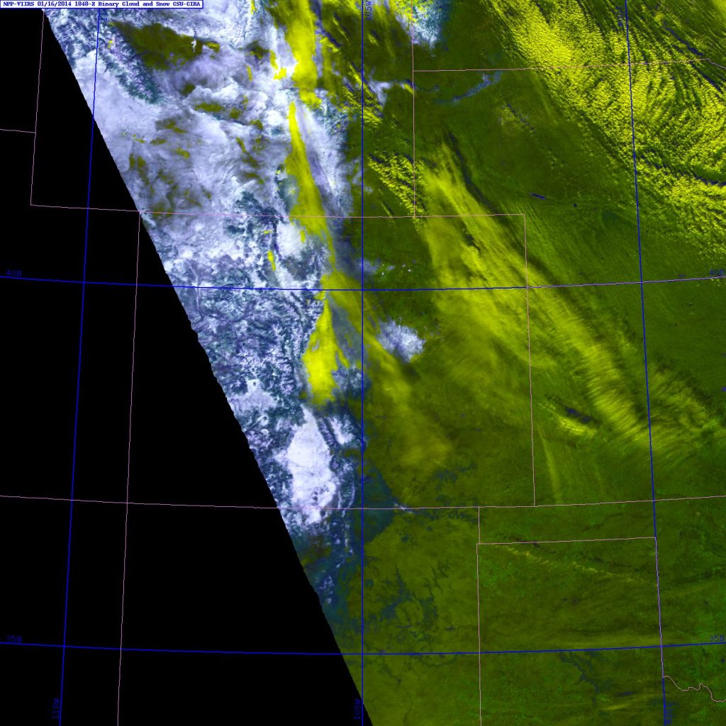
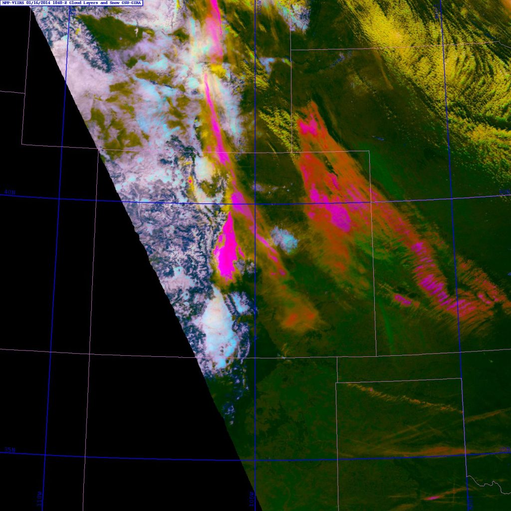
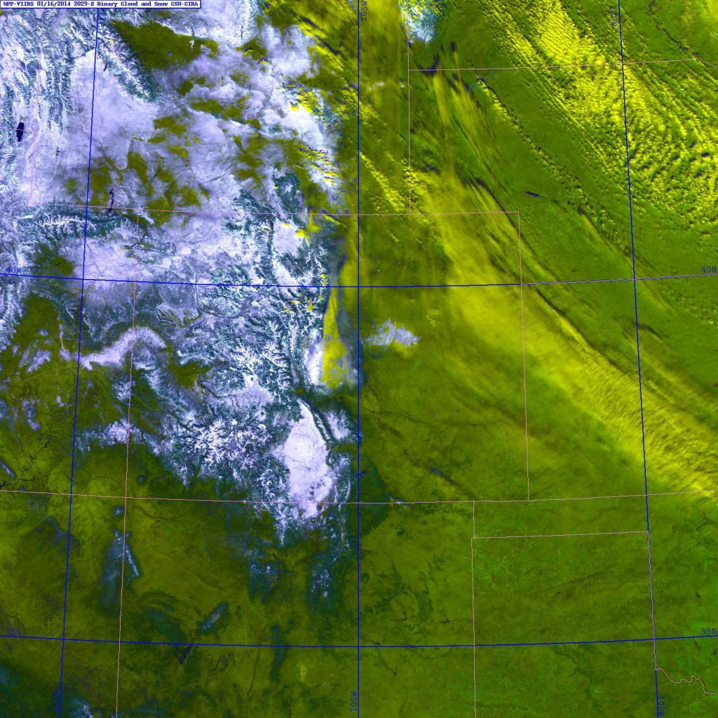
The snow/cloud layer discriminator product uses the 1.38 micron “cirrus” band to isolate higher level ice clouds (an added step from the binary snow/cloud discriminator product). An example of the cirrus imagery by itself is shown below for the 2020 UTC time.


Comments
One response to “A look at the 16 Jan 2014 dust storm in eastern Colorado using VIIRS imagery”
People are concerned about snowboarding when they should be worried about the water supply in general. We’re using it an unsustainable rate especially after last years winter and the current non existent winter that we’re having. People need to be more conscious about their water usage. I just hope that we have some late storms that dump some snow and rain otherwise the whole state will be on dry and on fire by August