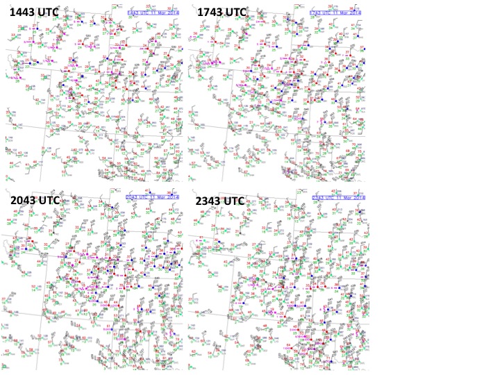
A strong cold front moved south across the High Plains on Tuesday afternoon and evening, bringing an episode of blowing dust with it. Here we look at what happened and how it appeared with some GOES-R Proving Ground products that highlight blowing dust. The sequence of surface maps displayed below in Figure 1 show the southward plunge across the plains east of the Front Range, with very strong northerly winds pushing the cold air rapidly southward. It appears that the strongest northerly winds (20 to 30 knots sustained with gusts over 40 knots) occur behind the initial frontal surge.
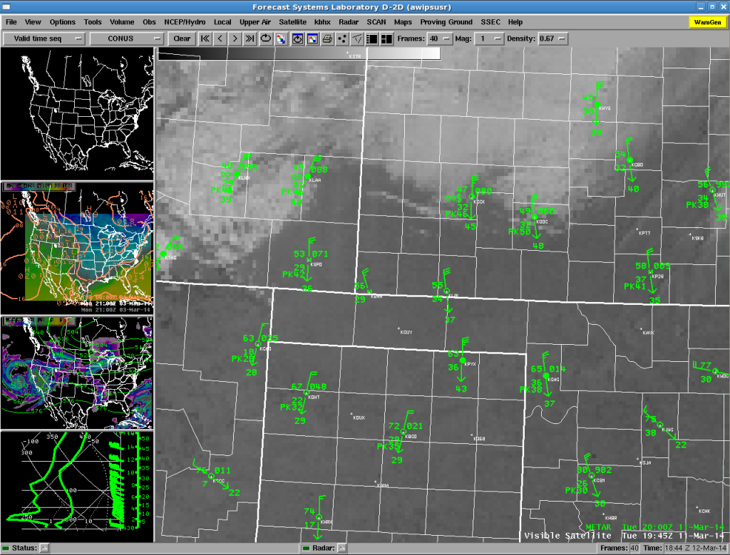
One of the problems that operational meteorologists have when it comes to blowing dust is that it can be hard to see in conventional visible satellite imagery. We demonstrate this with the GOES visible image below taken from AWIPS.
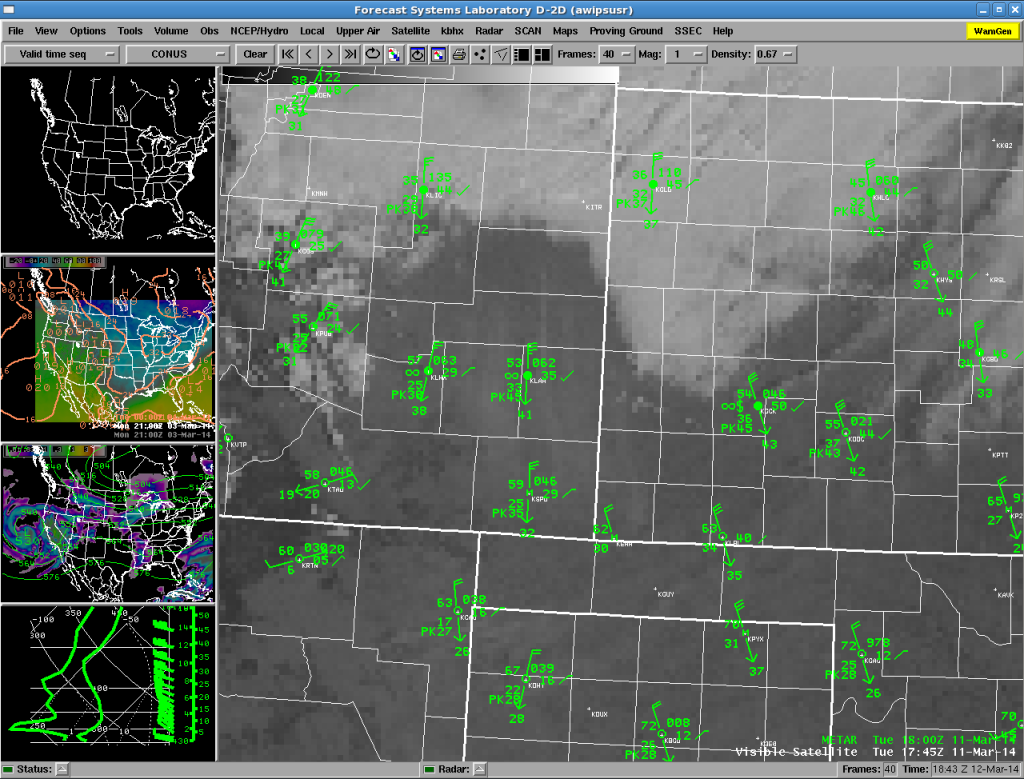
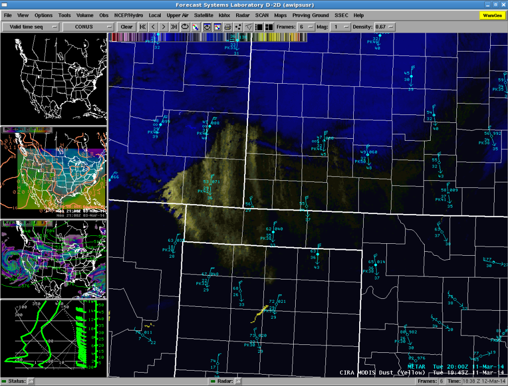
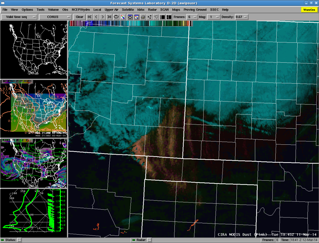
A number of stations report visibility restrictions due to haze (in southeastern Colorado) or haze and blowing dust (for example, KGCK in southwestern Kansas). But it is difficult to see this dust in the image. The CIRA MODIS dust products use the 11 and 12 micrometer thermal IR bands form the Moderate Resolution Imaging Spectroradiometer (MODIS) instruments which fly on the polar-orbiting NASA Terra and Aqua satellites to highlight dust in either yellow or pink. Because the satellites are Polar orbiters we only get one pass each during the daytime over the area of interest. An example of each product is shown below for the pass closest to the time of the image shown in Figure 2.
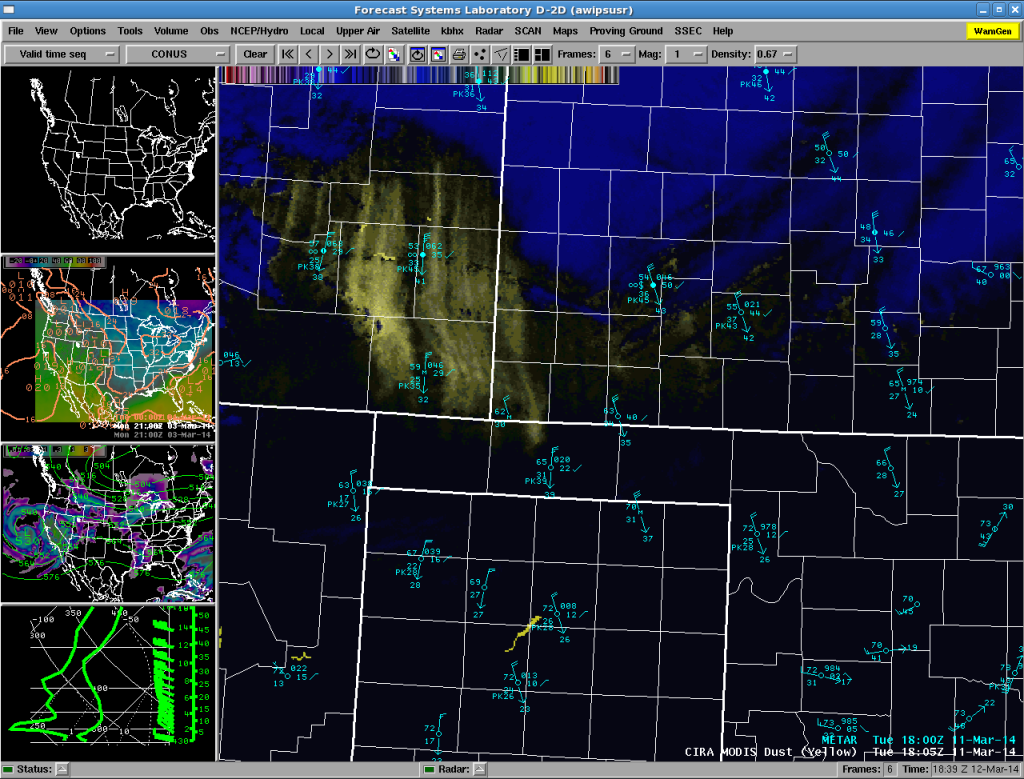
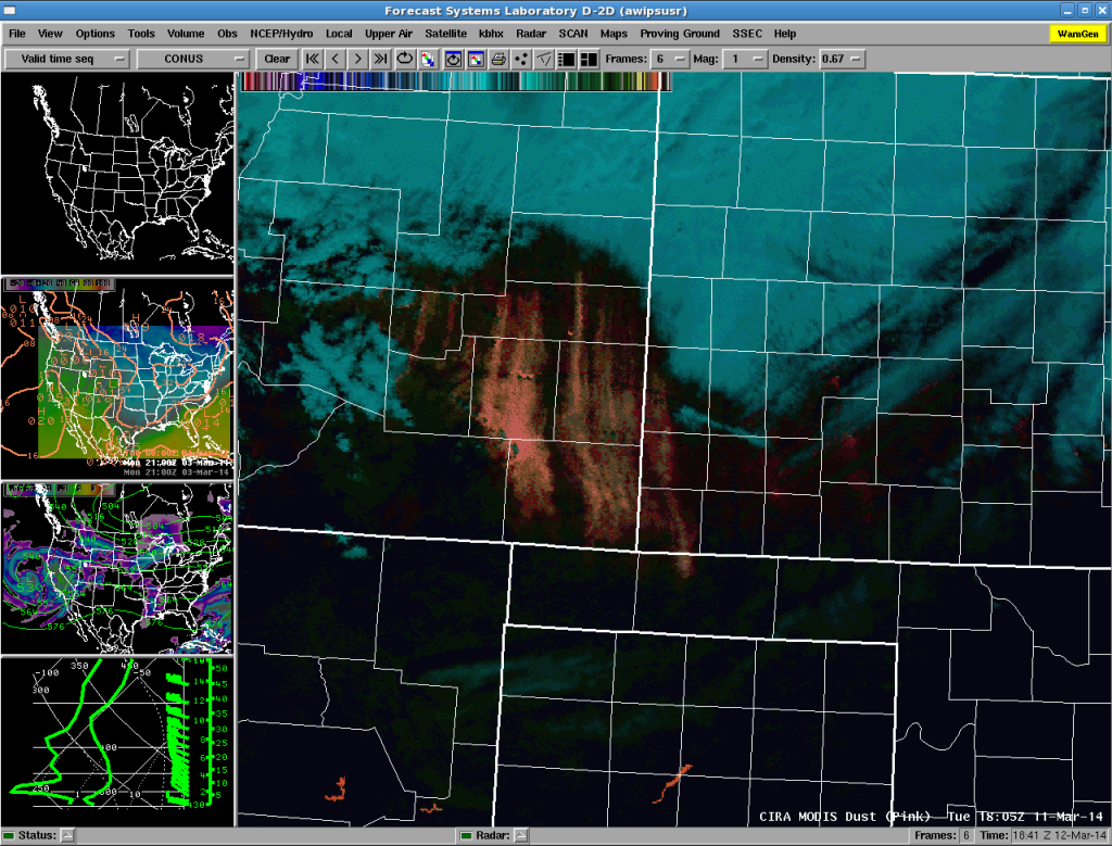
Both dust products clearly highlight the most intense areas of blowing dust, which are found in southeastern Colorado at 1805 UTC. A similar comparison is made below for the time of the next pass at 1945 UTC, in Figures 5-7 below (note that for this time we have a visible image at the same time).
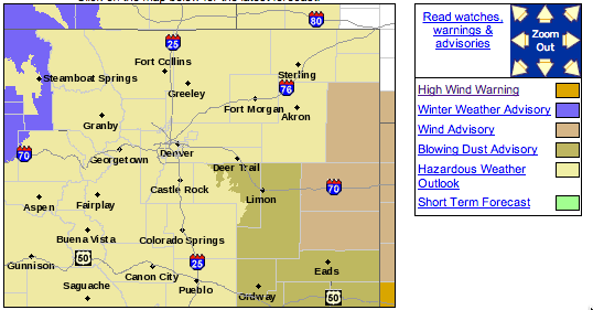
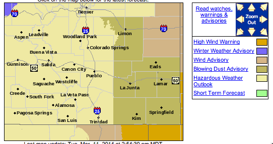
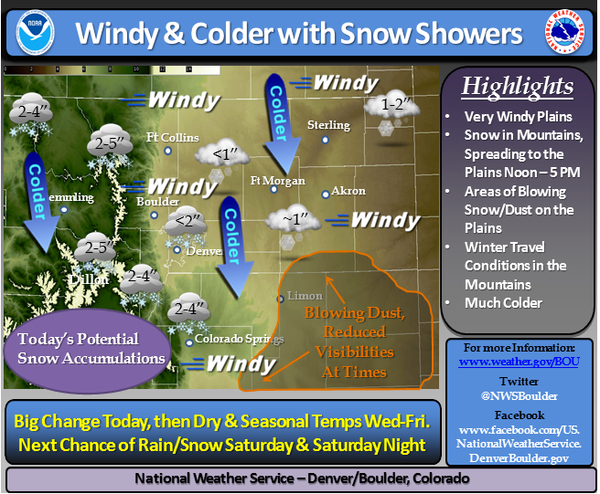
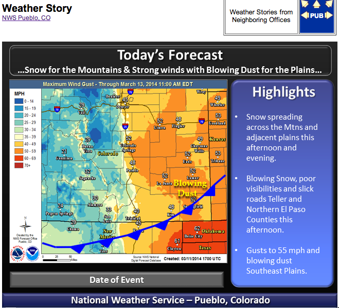
Blowing dust can be a significant hazard to all modes of travel, and in an earlier blog we documented traffic accidents that occurred during a dust storm earlier this winter in eastern Colorado. The National Weather Service (NWS) Weather Forecast Offices (WFOs) at Boulder and Pueblo issued Dust Advisories for this event (shown below in Figures 8 and 9) and included discussion of the dust in their “Weather Stories” (Figures 10 and 11).
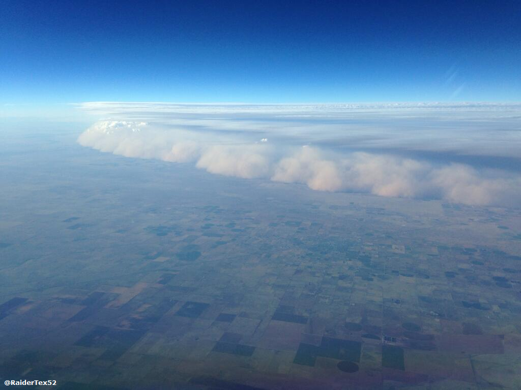
The strong winds and dust moved south into the Texas Panhandle during the late afternoon and evening hours of Tuesday (after 0000 UTC on 12 March). An extraordinary photo taken from a low flying aircraft was posted on the WFO Amarillo Facebook Page and is shown below.
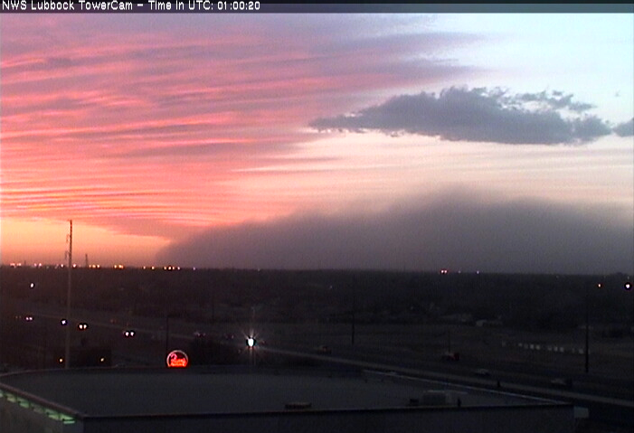
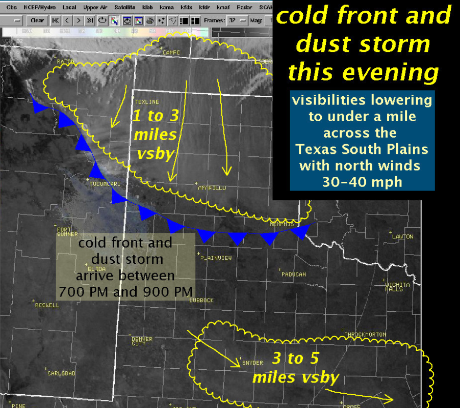
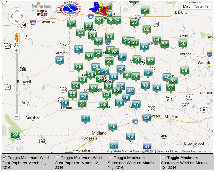
The dust then moved further south into the Lubbock (LBB) WFO forecast area. WFO LBB made an excellent post on this event (see http://www.srh.noaa.gov/lub/?n=events-2014-20140311-wind) and images below are taken from this summary. The first one is a view of the dust at sunset (about 8 PM Local Time) approaching Lubbock (Figure 13). Their graphic summary of the event follows in Figure 14, then in Figure 15 is a summary of wind gusts in the WFO LBB forecast area.
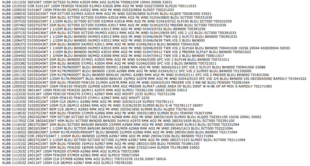
The METAR observations from LBB nicely show a period of blowing dust that continued for several hours, as shown below in the last figure.
