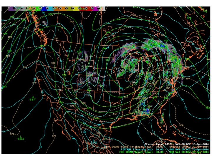
A recent post took a look at the CIRA dust products for the widespread blowing dust event across the Southern Plains behind a strong cold front on 27 April. The associated upper-level trough moved into the middle of the nation and became a giant closed low that stalled for days. Figure 1 shows the position of the closed 500 mb low along with an analysis of sea level pressure and NOWRAD radar reflectivity for midweek (0000 UTC on 30 April). The giant upper-level low affected the weather across much of the nation; here we focus on the strong northerly winds on its backside across the plains of eastern Colorado and the Texas and Oklahoma Panhandles.
We will take a closer look at the 2000 UTC time, which is when the Suomi/NPP satellite passed over the area of interest. The surface plot near this time is shown in Figure 2.
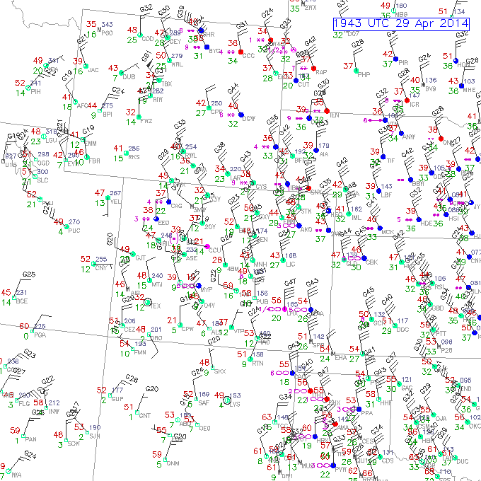
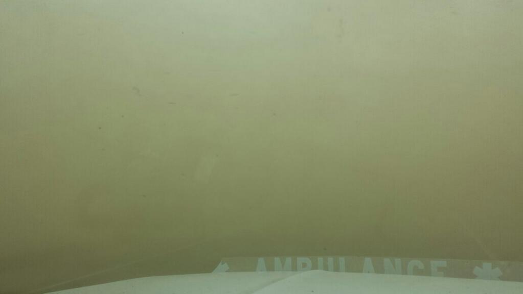
The very strong northerly winds, with gusts as high as 70 mph in eastern Colorado, produced intense areas of blowing dust that created very hazardous driving conditions, forcing a number of roads to close during the day (including for a time Interstate 70 in eastern Colorado). A picture taken in the late morning near the intersection of Highway 40 and 287, in eastern Colorado south of I-70, shows the near zero visibility (Figure 3).
What was particularly interesting about this case, and challenging for forecasters, was the blowing dust being present amidst lots of clouds and even rain (and some snow) showers, as seen in the next two figures showing conditions near 2000 UTC.
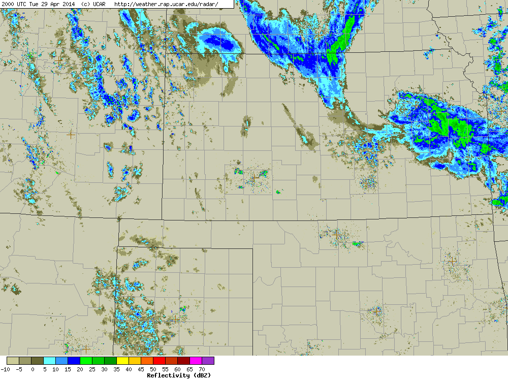
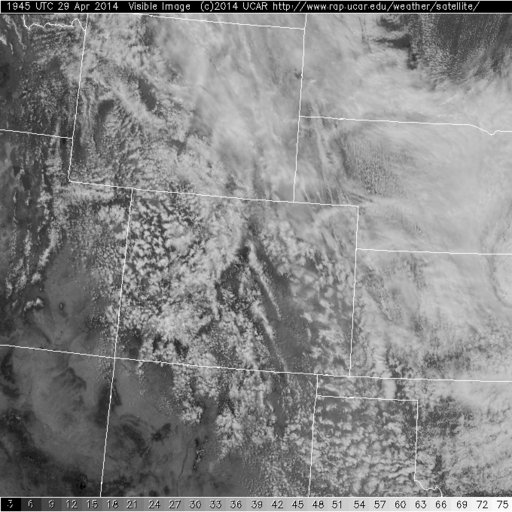
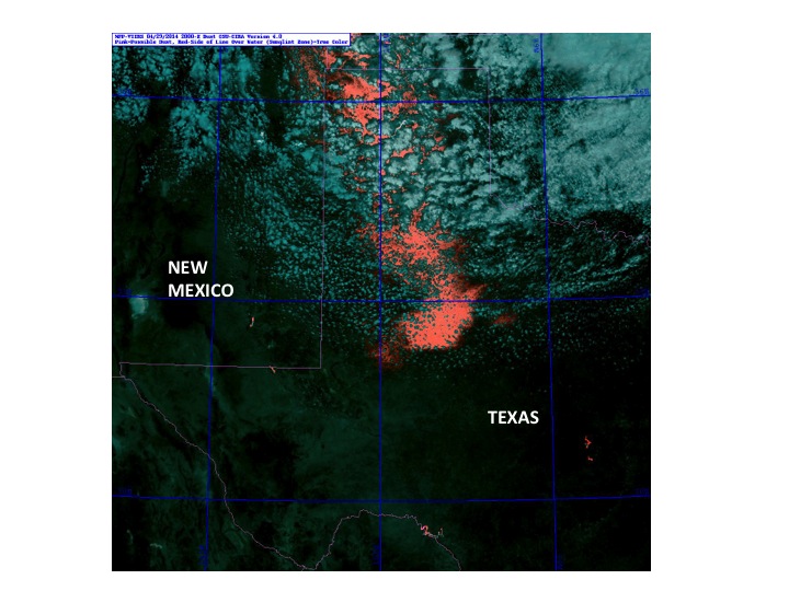
Often blowing dust events occur without many clouds present, since the associated airmass is often quite dry (see for example the blog from 27 April). In this case it is certainly difficult to see dust plumes across the eastern Plains of Colorado amidst all the cloudiness, or farther to the south, given all the cloudiness. Did the CIRA dust products help in this regard? First we will focus on eastern Colorado, then shift farther to the south centering on the Texas Panhandle, all for the 2000 UTC Suomi/NPP pass. As noted in previous blogs, Polar orbiting satellites have higher spatial resolution but limited time resolution, but are useful to replicate products that will be available at both high spatial and time resolution in the GOES-R era. In Figure 6 a True Color visible image is shown, followed by the CIRA Pink Dust product in Figure 7.
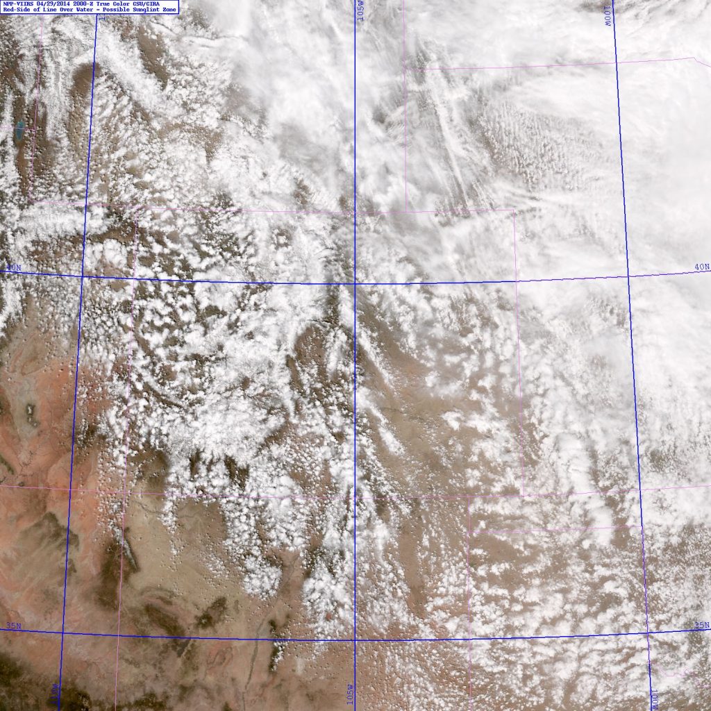
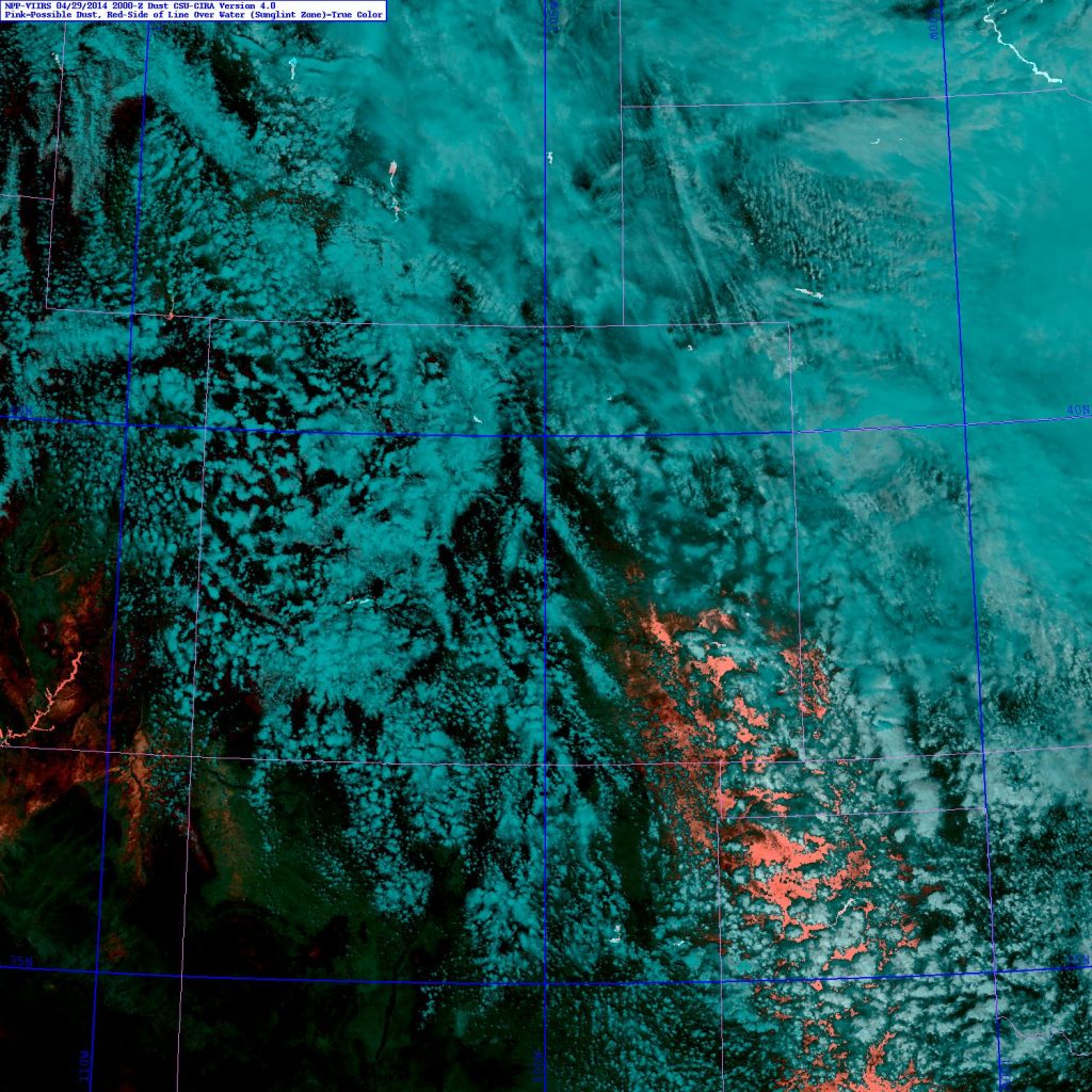
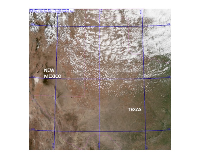
The True Color visible image is striking, but the dust is difficult to see, whereas it is much more obvious in the CIRA Pink Dust product in Figure 7. The same is true for the blowing dust farther to the south at this time across the Texas Panhandle, with the dust not so easy to see in the visible True Color image in Figure 8 but very obvious with the CIRA Pink Dust product in Figure 9.
CIRA also has a dust discrimination product using GOES, which allows for much better time resolution than from the Polar satellites, but considerably lower spatial resolution (10 km using a split window technique from GOES sounder data). This type of image for this case at 1945 UTC is shown in Figure 10.
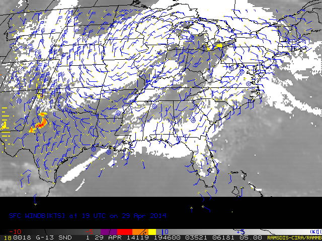
With the lower resolution it is not so easy to see the dust amidst the clouds in Figure 10, but the technique does a nice job of showing the dust farther to the south.
You can find more information on this (and other CIRA GOES-R Proving Ground products) product at http://rammb.cira.colostate.edu/research/goes-r/proving_ground/cira_product_list/ The products are available for display in AWIPS I or II; contact CIRA if interested in receiving them.
