By Ed Szoke and Dan Bikos
A rapidly intensifying cyclone developed in southeast Colorado late on April 10 as a strong upper-level wave moved out of the Rockies, not quite the “bomb cyclone” of 13 March 2019 but a very intense storm that brought blizzard conditions and widespread snow from the Central Plains to the Upper Midwest. On the southern end of the storm, very strong winds across the Southwest US resulted in a large area of blowing dust from northern Mexico / southern New Mexico into west Texas. We can see the blowing dust quite clearly as shades of yellow on a loop of the experimental GOES-16 CIRA DEBRA (Dynamic Enhancement with Background Reduction Algorithm) Dust product:
 click here or on the image for the animation
The intensity of the yellow color is related to the confidence of dust detection. This product is currently available in real-time on the CIRA SLIDER site and is also being developed for AWIPS display. The blowing dust caused significant travel problems in west Texas, as documented in this video taken near Midland, TX from April 10.
There are other ways to view dust currently on AWIPS, for example:
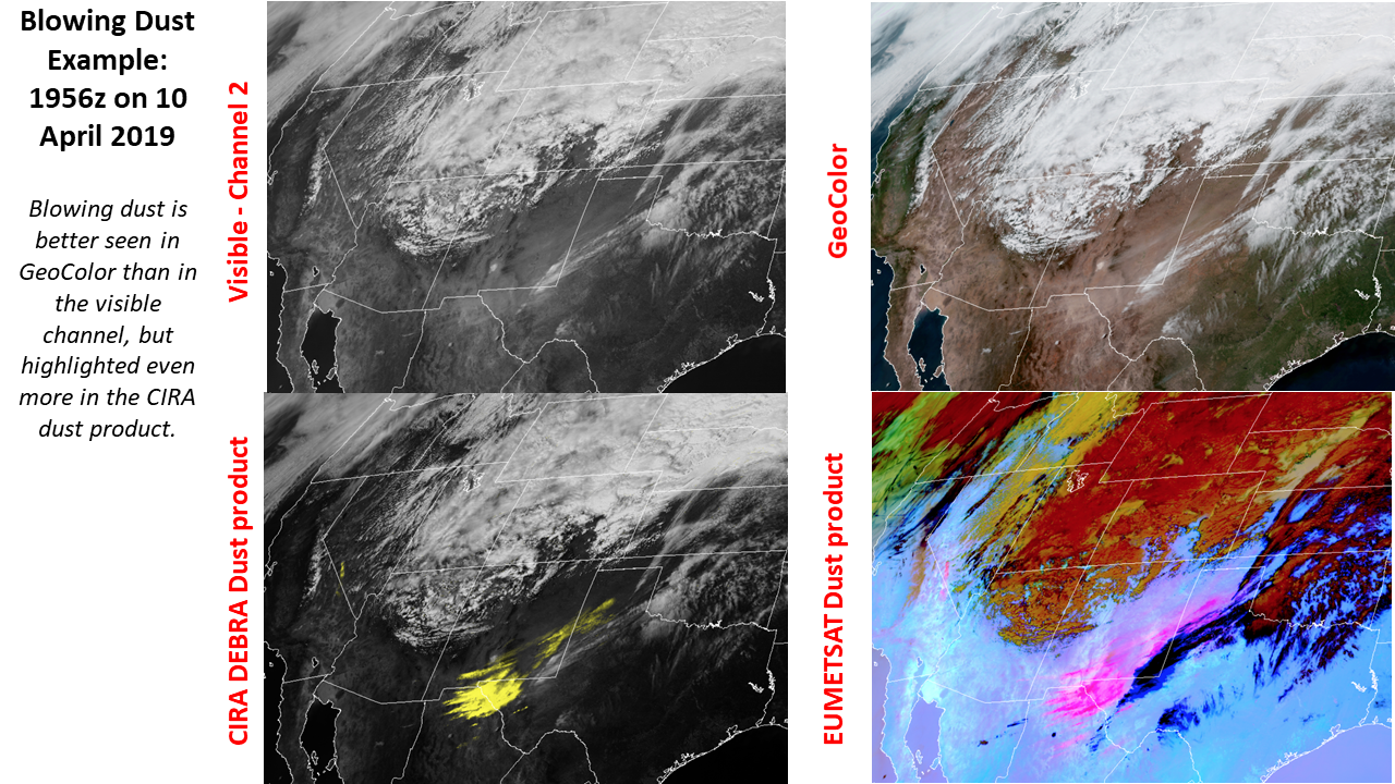
Notice that the GeoColor imagery shows the dust better than visible channel 2. The Dust RGB product (developed by EUMETSAT) is on AWIPS and depicts dust in magenta / pink with other features denoted by various colors. The CIRA DEBRA Dust product is designed to just highlight dust with clouds appearing as in visible imagery during the day and a simple gray scale for IR at night.
A mesoscale sector was in place centered over New Mexico and the western half of Texas on April 10. Loops of GeoColor, the DEBRA dust product and EUMETSAT dust product are shown below:
 click here or on the image for the GeoColor animation
 click here or on the image for the DEBRA dust animation
 click here or on the image for the EUMETSAT dust animation
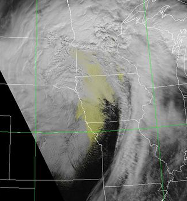
The dust plume advected towards the northeast on 11 April as the cyclone tracked in the same direction, depositing dust onto the new fallen snow as far north as Minnesota and Wisconsin, as shown in the hourly animation of the DEBRA dust product below:
 click here or on the image for the animation
It becomes more difficult to see the dust as it goes further north due to extensive cloudiness. We speculate that we can still faintly see the dust because of some breaks in the clouds. The same DEBRA dust product from SNPP VIIRS shows this more northern dust even better due to improved resolution compared to GOES-16:
There were numerous social media postings from different NWS WFOs in the affected region, for example see this post from NWS LaCrosse, WI WFO.
More extensive coverage of the dust can be found in this article from the BBC


