As winter continues to settle in across the nation and snow cover increases, an issue that arises is trying to see cloud cover over a snow pack during the daytime with visible satellite imagery, since both appear white. Certainly looping the imagery can help although issues can still remain. Snow cover can have a significant effect on the local weather, including influencing both maximum and minimum temperatures, so it is important to determine the status of snow on the ground.
There are various methods that can be used to help discriminate clouds from snow cover, requiring information from different channels that are not available on the current GOES satellites. These channels are found on some of the Polar-orbiting satellites, and similar channels will be available when GOES-R is launched. Here we show an example of the type of satellite imagery that will be available during the GOES-R era by utilizing channels from the MODIS sensors on board the Terra and Aqua Polar-orbiting satellites, and from the VIIRS sensors on the new Suomi NPP satellite.
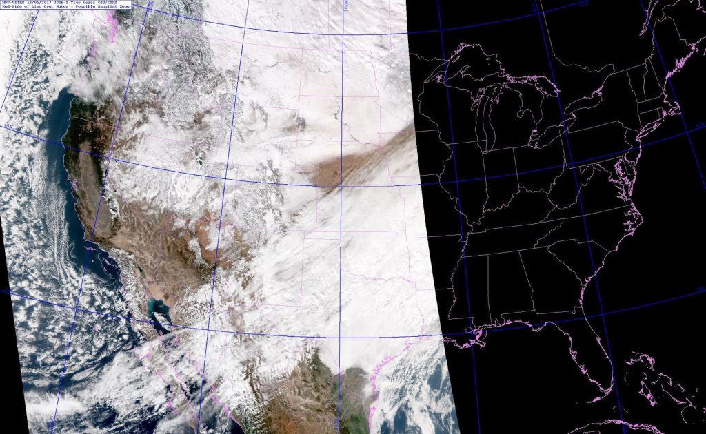
The first image shown below is a visible image from the Suomi NPP satellite, in this case True Color Imagery where the background is natural color. A mix of snow and clouds exists from the Rockies eastward across the Central and Northern Plains, but it is difficult to distinguish one from the other.
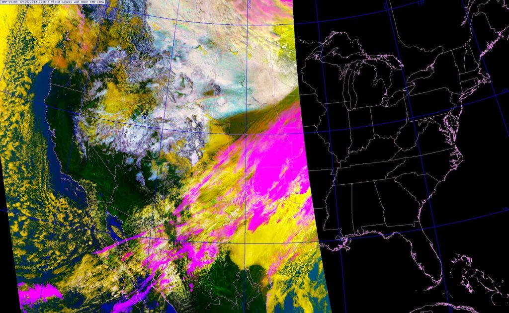
Next is a CIRA product known as Snow/Cloud Layer Discriminator imagery, in this case from the Suomi NPP satellite utilizing various channels from the VIIRS sensors (details on how this imagery is constructed can be found here.
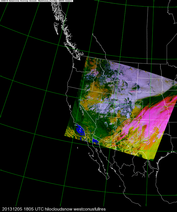
In the image above the colors are defined as follows: green = land (clear sky, devoid of snow cover), white/bluish-white = snow cover, yellow = low-level liquid-phase clouds, and orange/magenta = mid/high level ice phase clouds. There is a significant amount of tuning that is required for the various colors to match the phenomenon, and in the image above in some areas the snow appears with an excessively bluish tone. The next image shows the same CIRA snow/cloud layer discriminator product but from the MODIS sensors on the Terra Polar-orbiting satellite.
Although the channels used are similar in the two images, there are some slight variations between the two satellites. For the snow/cloud layer discriminator product the MODIS imagery has been well tuned so that the colors show the desired contrast. The slight color differences for the snow between the MODIS and VIIRS images reflect that more fine tuning is needed for the newer VIIRS imagery. When GOES-R is launched similar tuning may be necessary.


