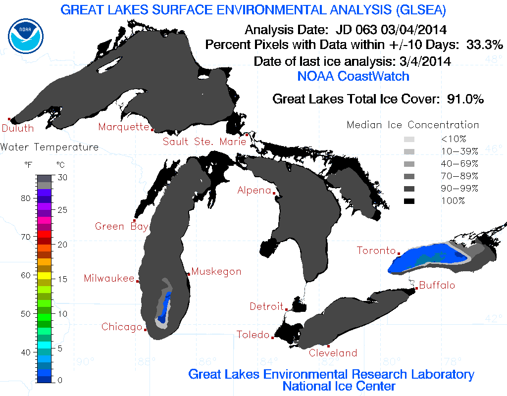
The exceptionally cold winter over the Great Lakes region has led to relatively high ice coverage across the Great Lakes. The GLERL analysis of ice cover percentage across the Great Lakes is 91% as of March 4:
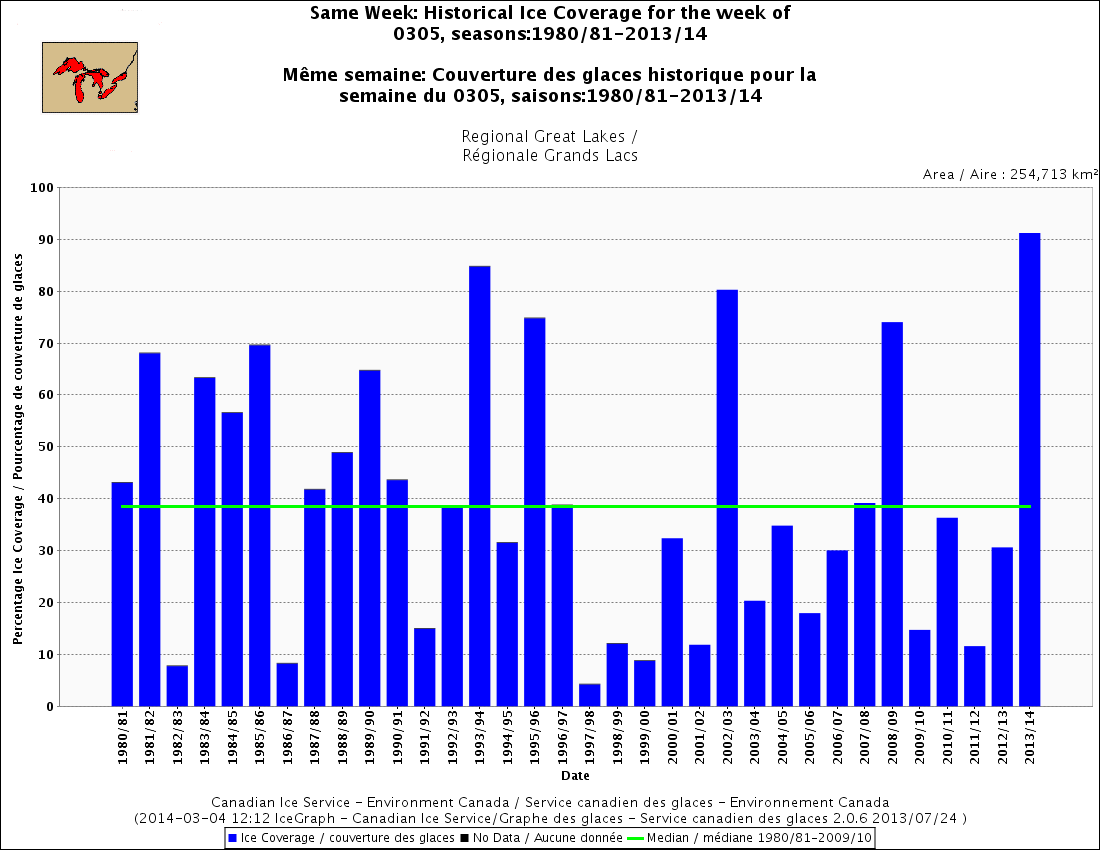
To put this into a historical perspective, the ice coverage across the Great Lakes is highest since 1980 according to this image from the Canadian Ice Service (Environment Canada):
The highest Great Lakes ice coverage is just prior to the above graph at 95% set in 1979.
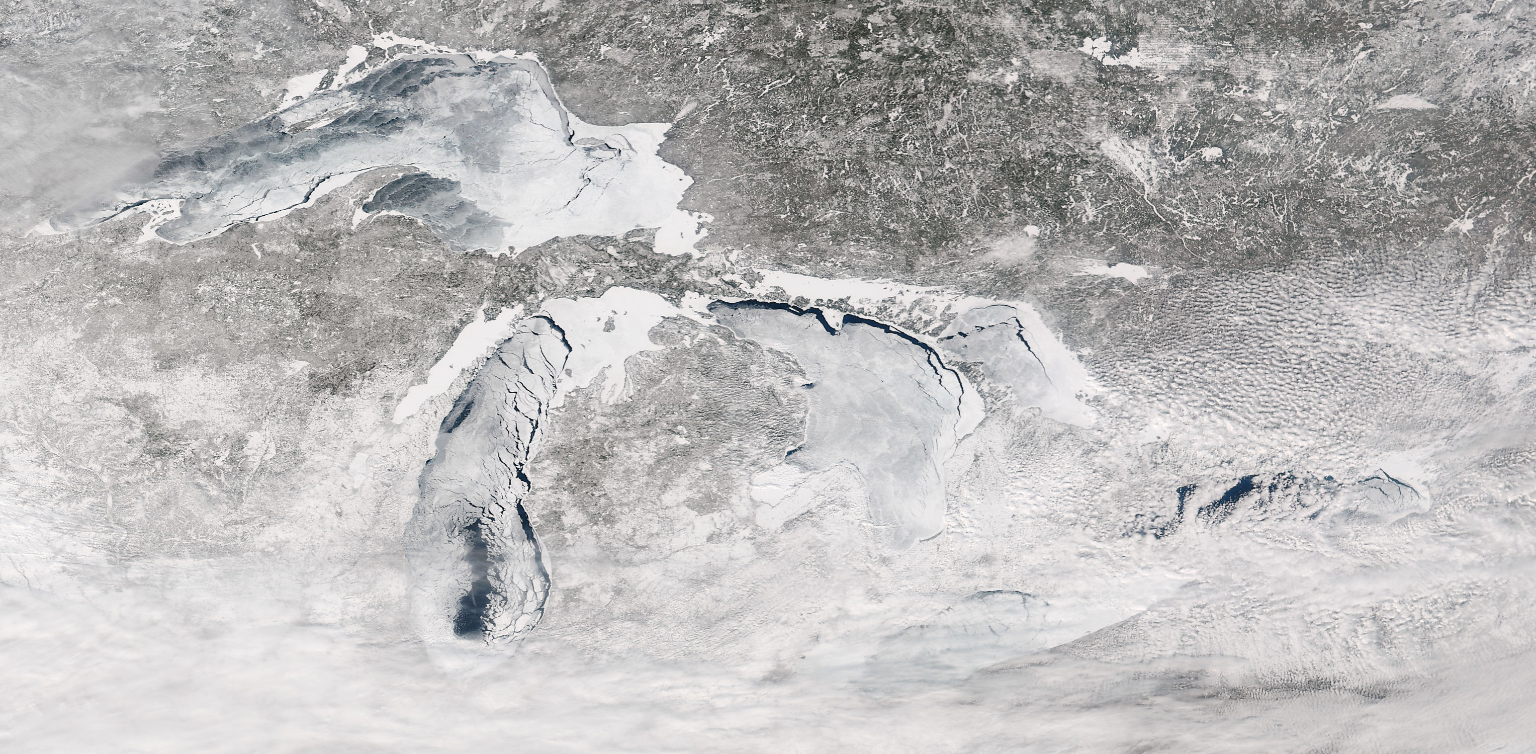
Given the historical level of ice coverage across the Great Lakes, it is of interest to look at satellite imagery of the ice cover on the Great Lakes. First we will look at a VIIRS image (courtesy CIMSS at University of Wisconsin – Madison):
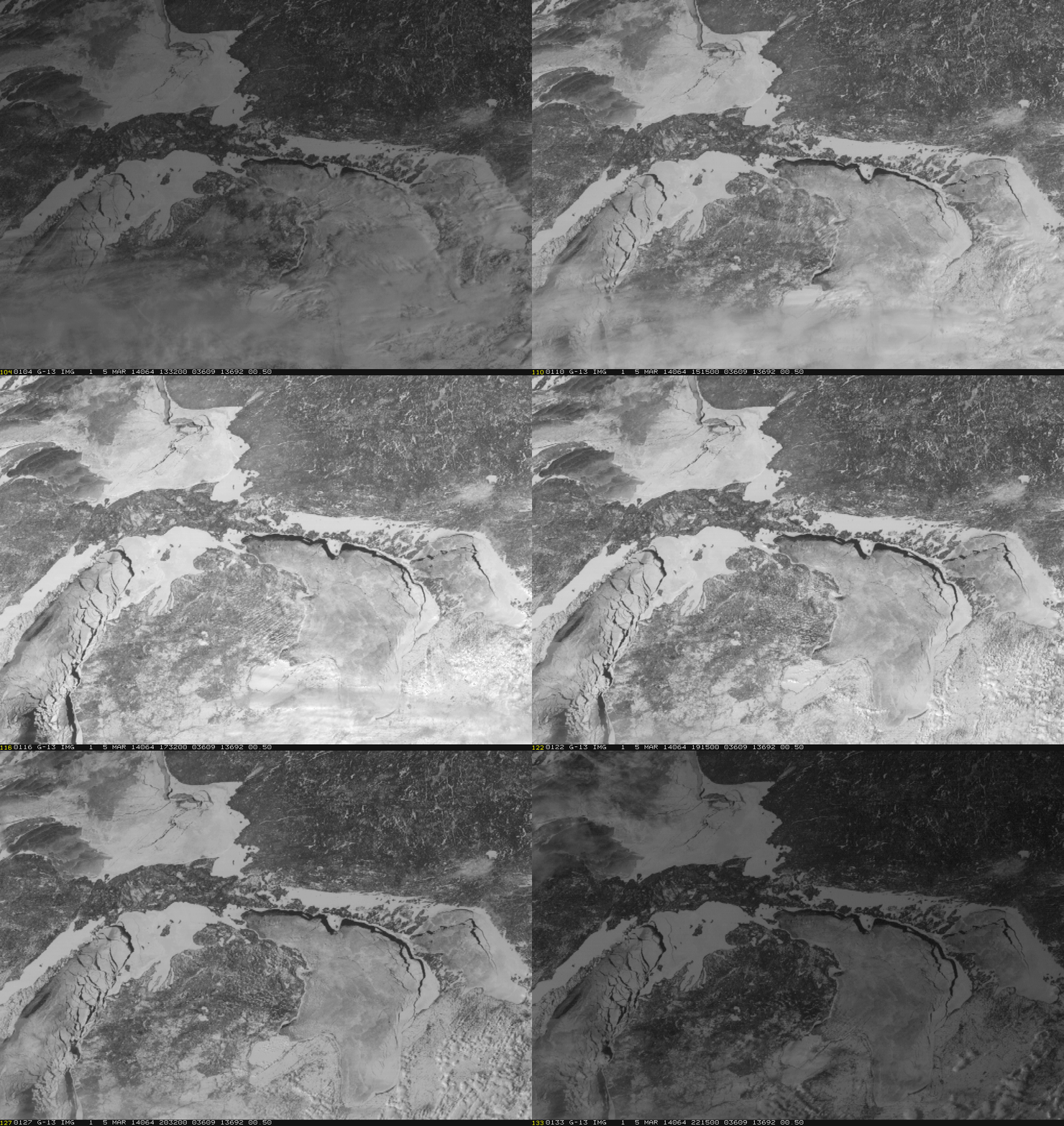
Click on the image then click “full size is 3055 x 1499” to see the image at highest resolution. One of the noteworthy aspects of the image are the cracks evident in the ice evident on the Great Lakes. These cracks can be seen to move in animated geostationary satellite imagery from the GOES satellite (imagery provided by Dan Lindsey):
The winds at low-levels play a key role in the distribution of cracks along the ice.


