In a recent post we showed a dust storm that moved through southeast Colorado and into the Texas Panhandle on 11 March with a strong cold front. Another cold front, even a bit stronger than the one last week, pushed southward through the same area almost exactly one week later as a deepening surface low emerged from the Rockies into the South-Central Plains (see Figure 1 below). Here we will again take a look at the CIRA Proving Ground Pink and Yellow Dust Products from MODIS.
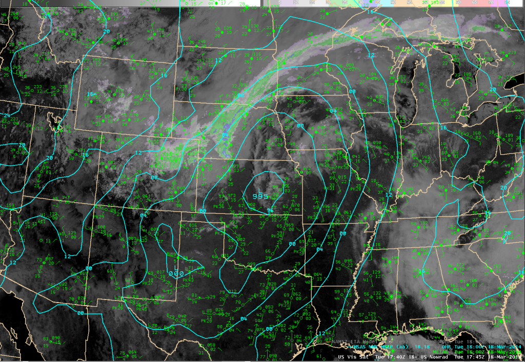
Figure 1. Visible image combined with radar reflectivity at 1745 UTC on 18 March, overlaid with 1800 UTC METAR observations and a pressure (MSLP) analysis.
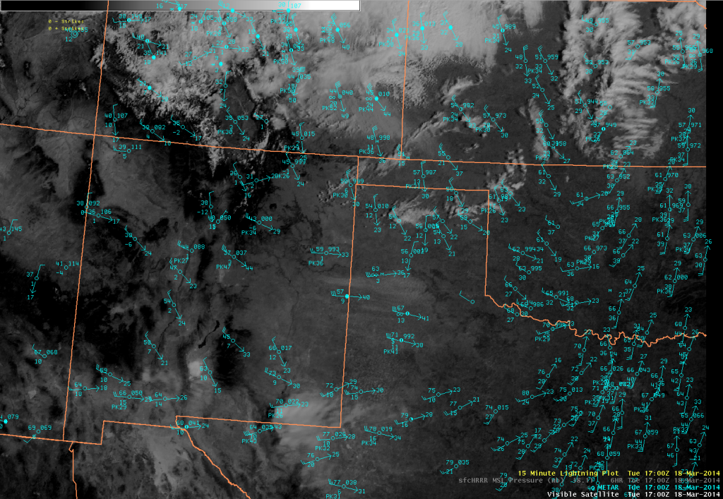
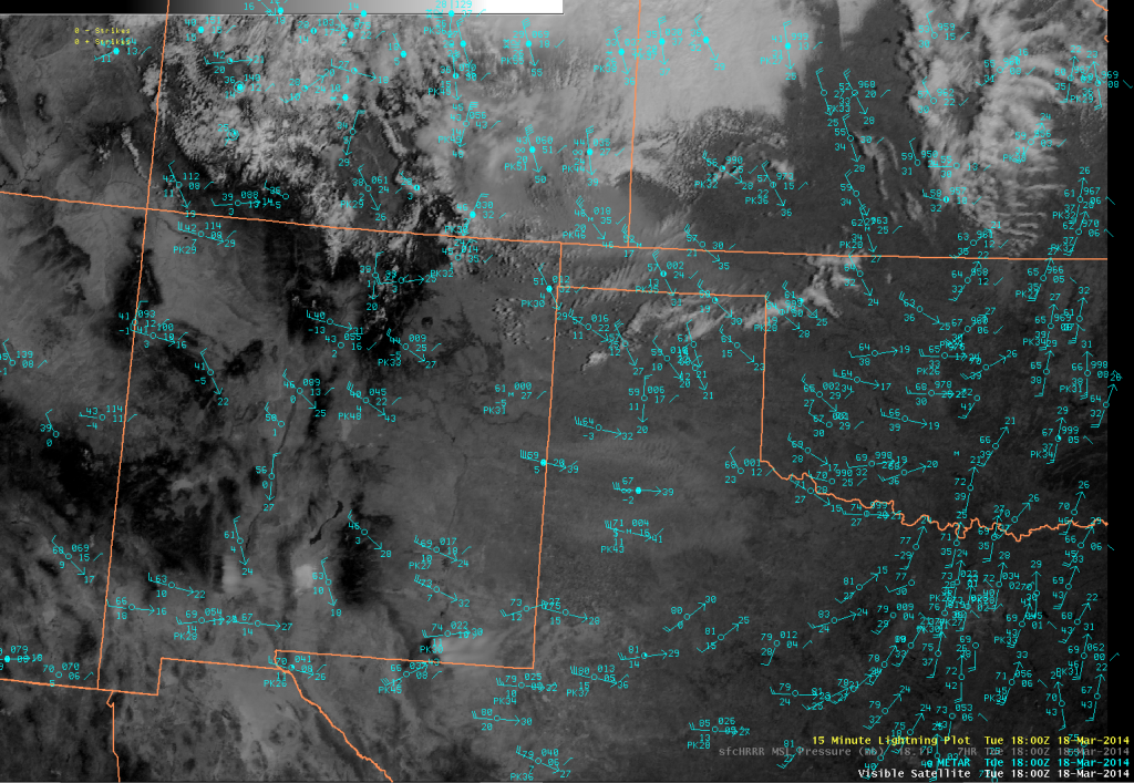
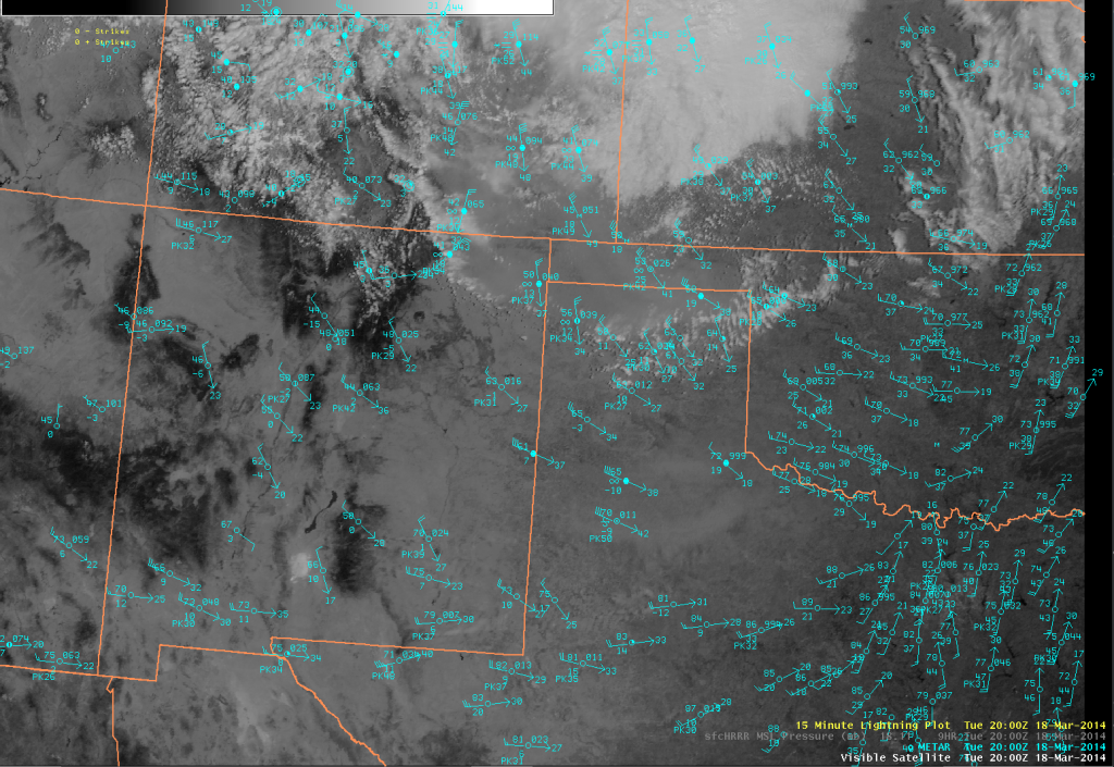
A closer look at the area of interest is shown in Figures 2 and 3, where we also get a feel for how well the dust showed up in this case with GOES visible satellite imagery.
In the image about the cold front has moved into the Texas Panhandle with a distinct wind shift. Stronger wind gusts exceeding 50 mph are found just to the north in southeastern Colorado, where temperatures have dropped into the 40s. Even colder air lies just to the north, with Limon (at the northern edge of the image) reporting heavy snow. One area of blowing dust is in southeastern Colorado with the stronger winds, although it is not obviously dust from the image above. Another area of dust is seen blowing from west to east ahead of the cold front in the warmer air and dry westerly flow, and this dust is more apparent in the image, as it is in the next image (below) from 30 minutes later.
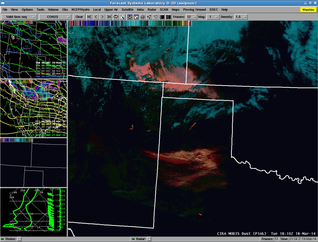
The next visible image (Figure 4) is from one hour later, and at this time we also have a MODIS pass so we can compare how the dust looks with the two CIRA dust products.
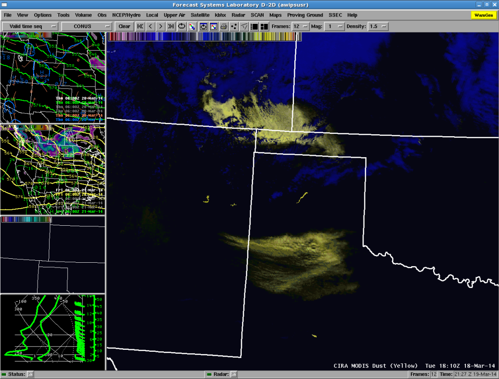
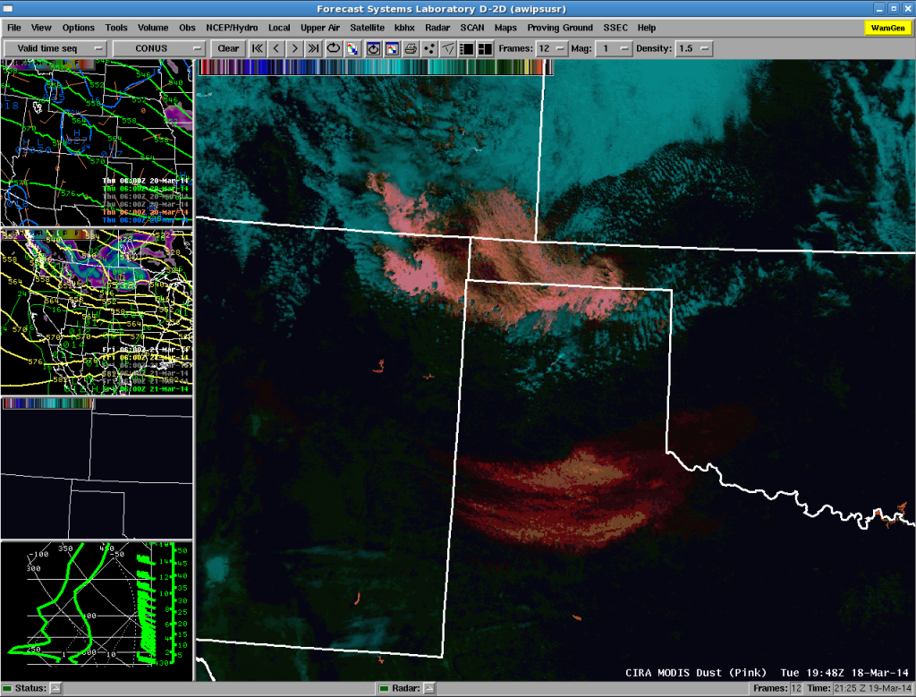
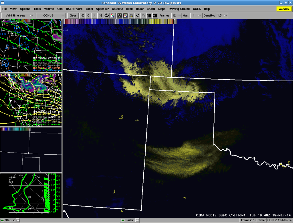
Here are the two dust products for near this time; the “pink” dust product (Figure 5) and the “yellow” dust product (Figure 6).
In both CIRA products the dust is clearly distinguished from the background clouds (which are bluish in the Yellow Dust Product and more cyan colored in the Pink Dust Product). It is especially easy to see the large amount of dust in far southeastern Colorado into the Oklahoma Panhandle with the stronger winds behind the cold front. This particular area of dust continued to consolidate during the afternoon as it pushed southward. A lot of wave structure is seen in the dust, given the horizontal resolution of 1 km in the MODIS-based imagery. Figure 7 shows the visible image at 1900 UTC again with a METAR plot at the same time. The image in Figure 8 is the same for 2000 UTC. We can compare these images with the CIRA dust products from the next MODIS pass at 1948 UTC, in Figures 9 and 10.
The CIRA Dust product images again reveal two areas of blowing dust, a dense area just moving into the Texas Panhandle associated with the stronger northerly winds and sharp cooling behind the cold front. The southern area of dust is still in the same general area as before (near Lubbock, TX (LBB), similar to what occurred a week earlier when they experienced a pre-frontal dust event before a second one behind the cold front). There likely is more blowing dust in southeastern Colorado than is shown in the imagery, but it is obscured by low cloudiness in the colder air well behind the front.
A more recent addition to the Polar orbiting satellites is the Suomi/NPP satellite with the VIIRS instrumentation, which also has the channels needed to make an image similar to the one shown in Figure 10. The pass on this day was at 1946 UTC, and the CIRA pink dust image is shown in Figure 11 below.
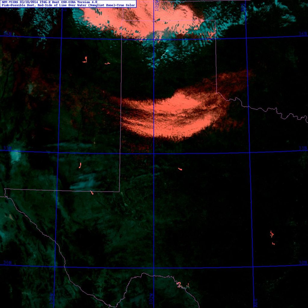
Figure 11. CIRA pink dust image at 1946 UTC from the VIIRS instrument aboard the Suomi/NPP satellite.
The area of dense dust well behind the cold front continued to expand as it moved southward across the Texas Panhandle, becoming a larger scale Haboob that spread through Amarillo (AMA) and LBB, again almost exactly a week after the previous event. Some METAR observations are shown below (Figure 12, from La Junta (LHX) and Figure 13, from Lamar (LAA), both in southeastern Colorado and equally far south, from AMA in Figure 14 (located in the central Texas Panhandle) and then farther south from LBB, in Figure 15).

Figure 12. METAR observations from La Junta (LHX), Colorado from 0853 UTC (bottom) to 2003 UTC (top) on 18 March.

Figure 13. METAR observations from Lamar (LAA), Colorado from 0853 UTC (bottom) to 2003 UTC (top) on 18 March.

Figure 14. METAR observations from Amarillo (AMA), Texas from 1153 UTC/18 March (bottom) to 1153 UTC/19 March (top).
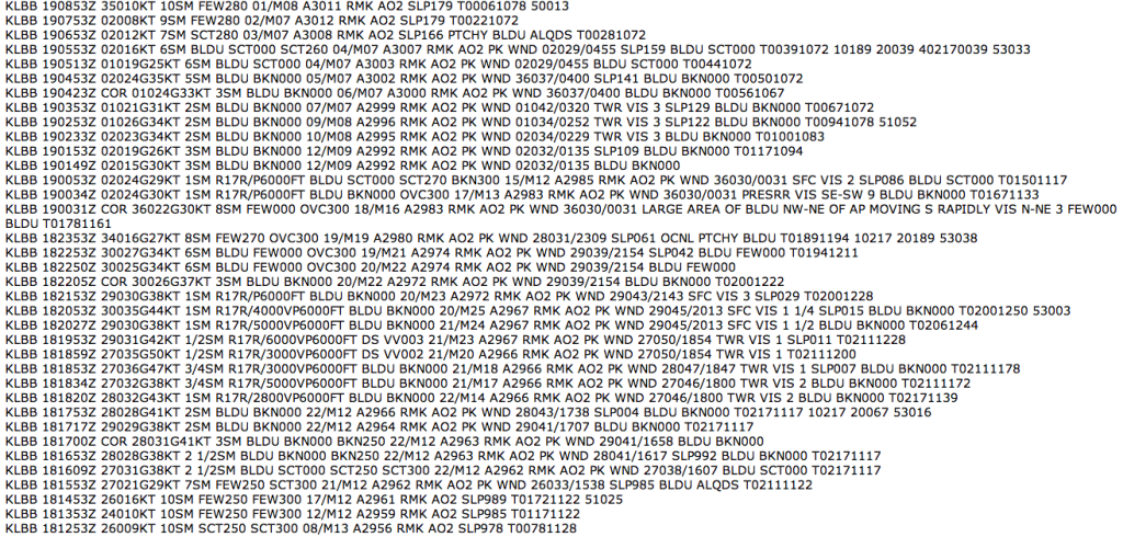
Figure 15. METAR observations from Lubbock (LBB), Texas from 1253 UTC/18 March (bottom) to 0853 UTC/19 March (top).
The various NWS Weather Forecast Offices (WFOs) issued numerous statements, warnings and other graphical products to convey information about the blowing dust, which can be very hazardous to travel when visibilities are suddenly reduced. Below we show a sample of these from north to south. First is a look at the “Weather Story” from the Boulder (BOU) WFO issued on the morning of 18 March, in Figure 16, then moving farther south the same product from the Pueblo (PUB) Colorado WFO in Figure 17.
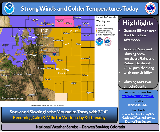
Figure 16. BOU WFO Weather Story graphic conveying information on the blowing dust. Note the snow also in the forecast area.
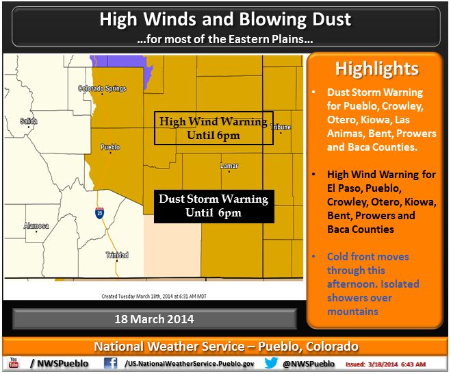
Figure 17. The Pueblo WFO Weather Story graphic shows the area where both a Dust Storm and a High Wind Warning had been issued.
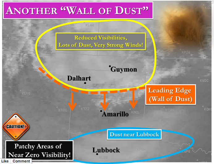
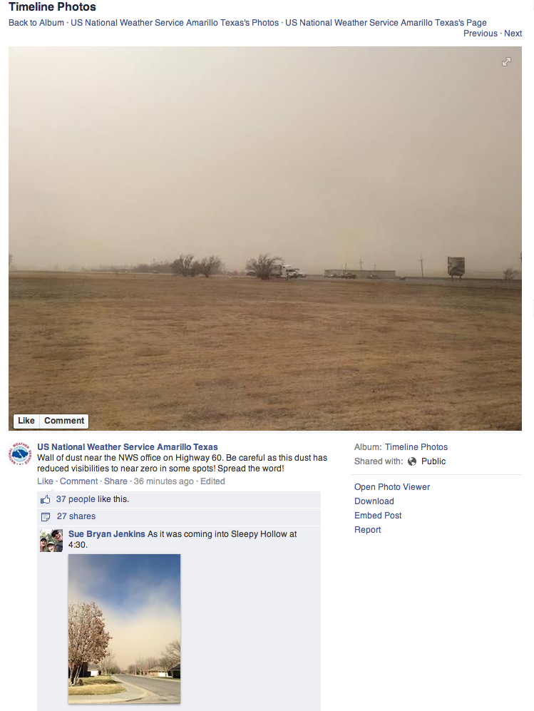
Social media is also used to help convey warnings and other information from a WFO. In Figure 18 is an example of such a product from the AMA WFO, highlighting the area of dust near LBB and the “Wall of dust” approaching from the north. An image posted by NWS personnel from the WFO, along with another image as the dust entered a neighborhood, both from the WFO Facebook page, are shown in Figure 19.
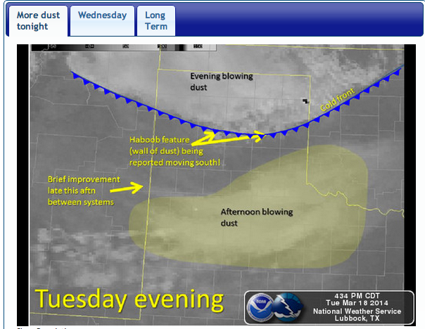
The Weather Story issued by the LBB WFO late in the afternoon on 18 March also nicely describes in graphical form the two areas of dust (Figure 20).
A picture posted on their Facebook page shows the dusty scene in the afternoon in the area of dust that persisted ahead of the cold front (Figure 21).




One Response to An even stronger cold front and even more blowing dust – 18 March 2014