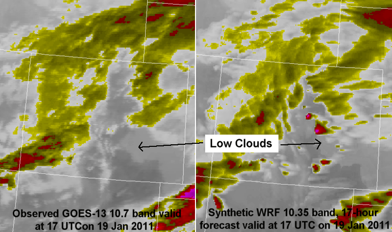
On the morning of 19 Jan. 2011, a nice example of using the simulated WRF imagery to forecast low clouds presented itself. The image on the right is the 17-hour forecast from the 00Z WRF run, and low clouds are evident in the Arkansas River Valley in southeast Colorado, as denoted with the arrow. The left image is the corresponding GOES-13 IR image at 17 UTC, showing that these clouds were indeed observed. A forecaster might then look at the forecast images over the next several hours to see whether the model dissipates the clouds.
Recent Posts
- Different ways to see snow with GOES-16 imagery & RGBs – by Ed Szoke & Dan Bikos
- Can GLM Total Lightning help with warning for non-supercell (landspout) tornadoes? A case from Iowa on 29 May 2019.
- Blowing Dust associated with 10-11 April 2019 Central US Strong Cyclone
- Rapid ice cover development over the eastern Great Lakes in late January 2019
- Daytime fog over snow in Wyoming on 21 November 2018
Recent Comments

