The GOES-16 data posted on this page are preliminary, non-operational data and are undergoing testing. Users bear all responsibility for inspecting the data prior to use and for the manner in which the data are utilized.
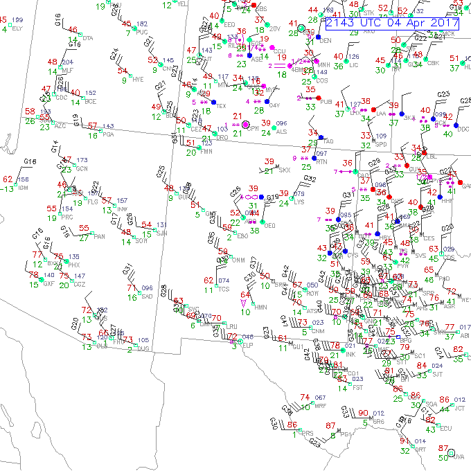
During the afternoon of 4 April 2017, strong westerly winds and low relative humidity was observed in west Texas, southern New Mexico and northern Mexico as seen in the surface observations at 2100 UTC:
The winds were in response to a deepening low near the Texas Panhandle. Although none of the observations in the plot above show blowing dust, METAR sites such as ELP (El Paso, TX) included some periods of blowing dust in the late morning and afternoon hours. Here we explore how well the areas of blowing dust were seen in GOES-16 satellite imagery, using 3 different loops during the afternoon hours of 4 April.
The first loop (below) goes from 1827 to 2157 UTC and displays GOES-16 visible imagery (0.64 microns/Channel 2).
Do you see any evidence of blowing dust in this loop?
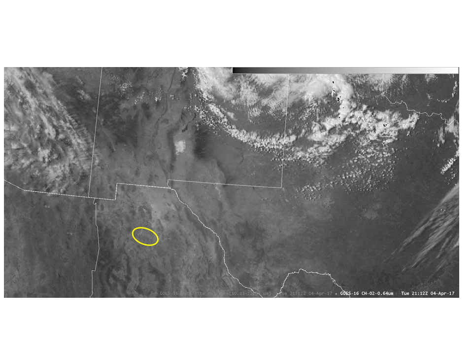
Refer to the static image below which contains a yellow circle, refer to the visible loop above and look in the region of this yellow circle.
The blowing dust is extremely subtle in the static image and even in the animation, no other areas of dust are obvious in the loop.
Sometimes features such as blowing dust show quite well in the CIRA True Color product. True Color imagery approximates the response of normal human vision, providing a depiction of the satellite-observed scene. The natural color of the background often makes it easier to see certain features when compared to the standard 0.64 micron visible imagery. Since there is no green channel on GOES-16, CIRA creates a “synthetic” green band to make this product, more information is provided at:
The GOES-16 True Color product:
Does the True Color product improve our ability to see dust in this case?
If we return to the same region (yellow circle), this dust plume appears a little more obvious relative to the visible band only. North of this plume you may be able to discern additional plumes of dust, however they are still fairly subtle.
Certain products have been developed that are designed to highlight features such as dust plumes. One example is the band difference product between the 10.3 micron and 12.3 micron bands. The difference product would show a negative value in the presence of dust, which is shown as purple in the color table shown in the loop below:
With this in mind, do you see any additional dust plumes in this product?
You should now be able to discern multiple east-west oriented dust plumes (purple color). Some of the plumes have a distinct source region associated with them. This product helps us to see dust plumes that was not obvious in the other imagery. Even in the GOES-16 era with 0.5 km visible band, dust may not be discernible without the help of a product designed to highlight dust. Examples of other dust products that are under development include one by CIRA known as the DEBRA dust product with real-time data available at:
http://rammb.cira.colostate.edu/ramsdis/online/msg-3.asp


