RAMMB: GOES-R Proving Ground Blog
Category:
MODIS Snow/Cloud Discriminator
A look at the 16 Jan 2014 dust storm in eastern Colorado using VIIRS imagery
January 22, 2014
Determining clouds from snow – an example from 5 Dec 2013
December 10, 2013
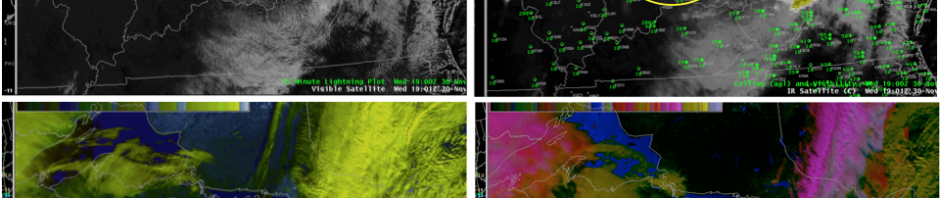
Cloud over snow example on 30 November 2011 from Buffalo WFO using MODIS imagery
January 6, 2012
MODIS Snow/Cloud Discriminator Example
October 14, 2011