For this blog entry, we’ll consider applications of the NSSL 4-km WRF-ARW model synthetic imagery towards a severe weather event that occurred on June 22, 2010. The synthetic imagery is one of the GOES-R proving ground real-time products. Synthetic imagery is model output that is displayed as though it is satellite imagery. Analyzing synthetic imagery has an advantage over model output fields in that the feature of interest appears similar to the way it would appear in satellite imagery. The primary motivation for looking at synthetic imagery is that you can see many processes in an integrated way compared with looking at numerous model fields and integrating them mentally.
Figure 1 shows the WRF-ARW synthetic imagery for the 6.95 um (water vapor) band. The forecast times are indicated at the bottom middle portion of the image, they are from 1200 UTC to 0300 UTC so we are looking at the 12 to 27 hour forecast from the 0000 June 22, 2010 model run. The model shows an upper-level low over Montana and Wyoming moving eastward. South of this feature, we can see a region of relatively fast moving warmer brightness temperatures (the red colors moving from Arizona and Utah towards Colorado). This appears to be associated with an upper-level jet streak. Another example of a region of warmer brightness temperatures would be across Michigan moving towards Ohio, Pennsylvania and New York. With both features in the east and the west, there appears to be convection developing during the late afternoon hours. Remember, we’re looking at mid to upper level features in the water vapor imagery. The main role of the synthetic water vapor imagery is identifying shortwaves and jet streaks that may play a role in the initiation, maintenance and intensity of convection. It’s important to understand what you’re looking at in the water vapor imagery when you see a region of warmer brightness temperatures, we’ll discuss this more in future blog entries and in VISIT training sessions that address this topic. Next, let’s look at lower levels, so we turn to the synthetic IR imagery.
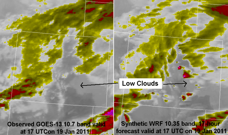
Figure 2 shows the WRF-ARW synthetic imagery for the 10.35 um IR band. We’re looking at the same time period as the water vapor loop we just looked at. The advantage to this channel is that low-level features will show up. This is useful when analyzing cloud cover, to see if clouds will dissipate and allow for sufficient insolation to warm up the surface. At 1400 UTC we can see low-level clouds showing up as the colder brightness temperatures across western Nebraska and northeast Colorado, these are forecast to dissipate by afternoon hours, however note the higher level clouds forecast across eastern Colorado. A morning MCS exists across eastern Nebraska moving eastward towards Iowa. We see the early afternoon convection just ahead of the upper low in Wyoming and Montana by 2000 UTC, while isolated storms develop in eastern Colorado and the Nebraska panhandle shortly thereafter, in the region of strong southwest flow aloft. Additional convection develops further south in Texas later. Upscale growth occurs during the late afternoon and evening hours, particularly over Nebraska where there is stronger flow aloft then further south in Texas. It appears to be an MCS over Nebraska by 0300 UTC. The best use of the synthetic imagery is to look at the forecast in the morning hours, follow the trends in GOES and other observational data during the day to gauge how much confidence you should have in the model forecast.
Figure 3 shows the GOES 10.7 um IR band over the same time period as the forecast imagery we just looked at. Notice the low-level clouds in western Nebraska and northeast Colorado dissipated, as was forecast. The high level clouds in Colorado were well forecast, and looked to be covering a greater area than forecast. The early thunderstorm activity in Wyoming near the upper low is forecast well. Notice the later storms in western Nebraska and Kansas, they have much large anvil cirrus canopies than forecast by the synthetic imagery, this is a known bias in the model so that storms in the model will typically appear smaller than observed in GOES. Upscale growth into an MCS late in the loop in Nebraska seems to be handled well also, and keep in mind that the anvil cirrus canopy will always appear larger in GOES than in the synthetic imagery.
Figure 4 shows the GOES 6.5 um water vapor imagery over the same time period. The brightness temperatures will generally appear warmer in the synthetic imagery compared to GOES imagery. The main role of the synthetic water vapor imagery is identifying shortwaves and jet streaks that may play a role in the initiation, maintenance and intensity of convection. Keep this in mind as you examine the synthetic water vapor imagery, then look at GOES visible imagery and surface observations to see where the key low-level convergence boundaries exist.
The synthetic imagery has exciting potential as an additional tool in forecasting severe thunderstorms, just keep in mind we are looking at model output with its familiar limitations.
For more information on severe weather applications of the synthetic imagery from the NSSL 4-km WRF-ARW model, you may take to this VISIT training session:

