17-22 January Significant Precipitation for the West Coast
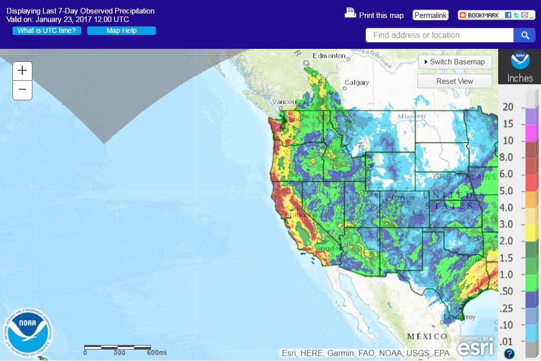
The West Coast of the US experienced multiple storms between 17-22 January 2017 that resulted in substantial precipitation:
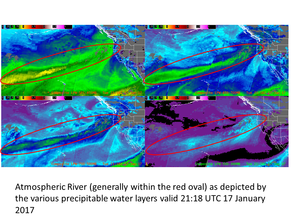
Early in the period, an Atmospheric River with origins from the central tropical Pacific Ocean advected towards Washington, Oregon and northern California:
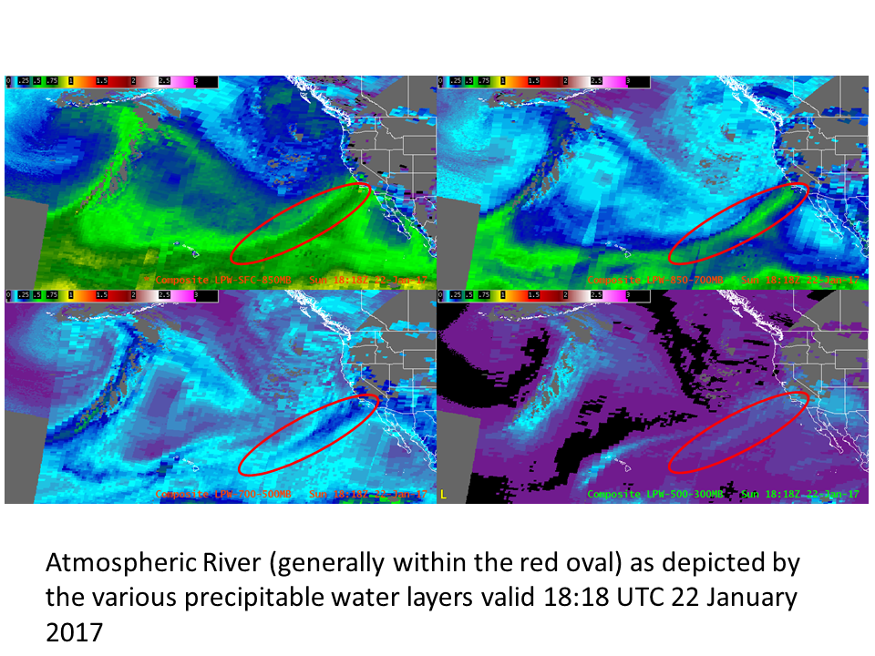
This product is the CIRA Layer Precipitable Water (LPW) product (displayed here in inches) which denotes water vapor distribution in various layers. Upper left is the surface to 850 mb layer, upper right is 850 to 700 mb layer, lower left is 700 to 500 mb layer and lower right is 500 to 300 mb layer. The red oval generally indicates the position of the atmospheric river of interest. This product not only indicates the position of the atmospheric river, but also the magnitude of the moisture between the various layers. The vertical distribution of moisture can be compared between different storms to assess relative impact. Generally speaking, higher PW amounts at higher levels in the vertical promote a higher likelihood of warm-rain processes and higher precipitation efficiency. These factors are important in evaluating flood potential.
A loop of the LPW product for the period 17-23 January:
Depicts the evolution of the various atmospheric rivers throughout the week, leading to multiple heavy precipitation events along the West Coast. By the end of the loop, we note an atmospheric river affecting southern California:


