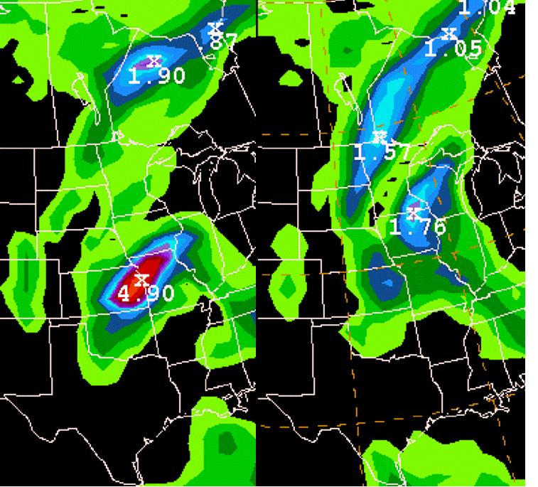
QPF Bombs and Getting the Most Out of Your Model

J. Braun
Above is an example of two model forecast runs (12 hours apart). The main difference comes when looking at the QPF amounts generated over ERN ND and NWRN MN between the two model runs. The later model run on the right is able to transport more moisture to the north as opposed to the earlier run with the large QPF Bomb over ERN KS and WRN MS. To learn more about NWP model’s ability to discern these bombs and what useful information you can still glean from “contaminated” output, please see this helpful web module put together by Pete Manousos a few years ago, by clicking here. �
