Synthetic imagery for model evaluation in the Proving Ground
Louie Grasso, Dan Lindsey, J. Braun
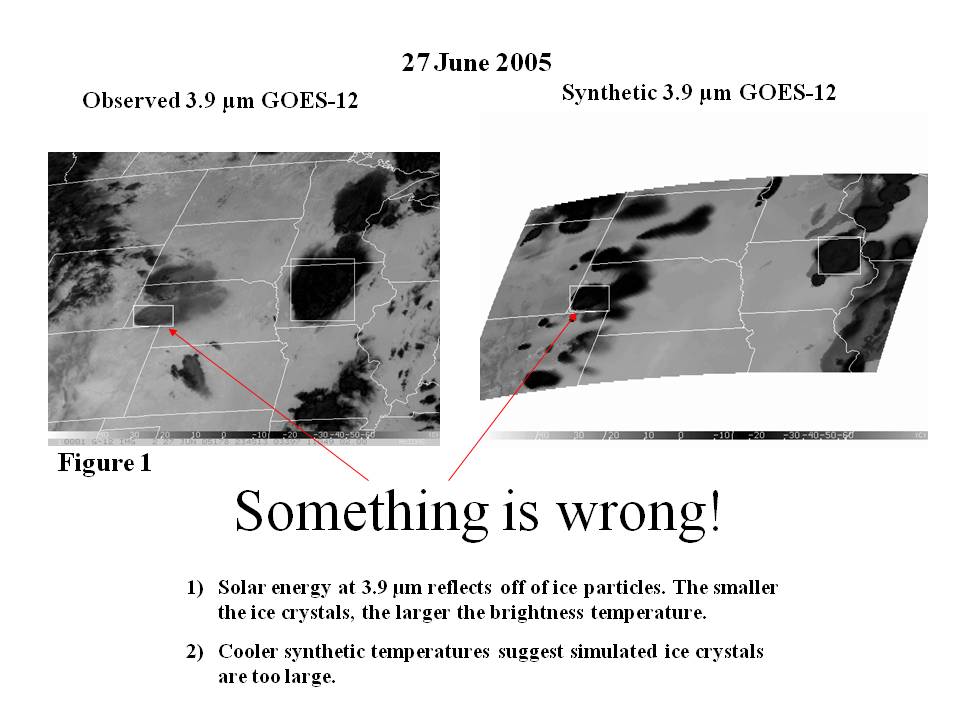
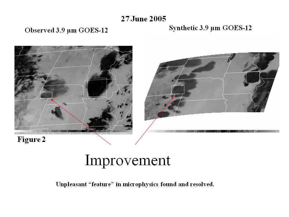
Synthetic GOES-12 satellite imagery at 3.9 µm has been produced for a thunderstorm simulation. This event occurred on 27 June 2005 over the upper Midwest of the United States. Observations (Figure 1 – click image for larger format) shows warmer cloud tops (light grey) for storms over western Nebraska compared to the colder cloud tops (black) for the storms over Iowa. In contrast, synthetic imagery produced from a numerical model output shows cold cloud tops for the storm over western Nebraska and Iowa. This is an example of how synthetic satellite imagery can be used to evaluate the performance of a numerical model. Compared to observations, the synthetic imagery suggested a problem with the microphysics: Ice crystals were too large in the anvil of the storm over western Nebraska. After some time, the problem was identified and solved. Synthetic imagery from a new simulation (Figure 2 – click image for larger format) shows that the cloud top temperatures warmed for the storm over western Nebraska. This resulted in a better match with observations.


