Thunderstorm features through channel differencing in the GOES-R Proving Ground
J. Braun
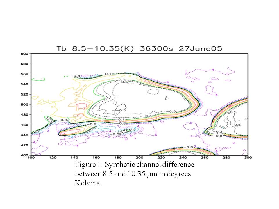
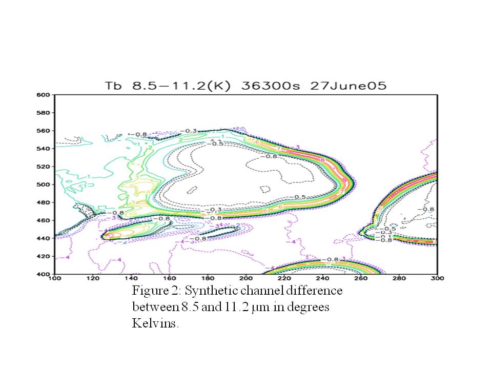
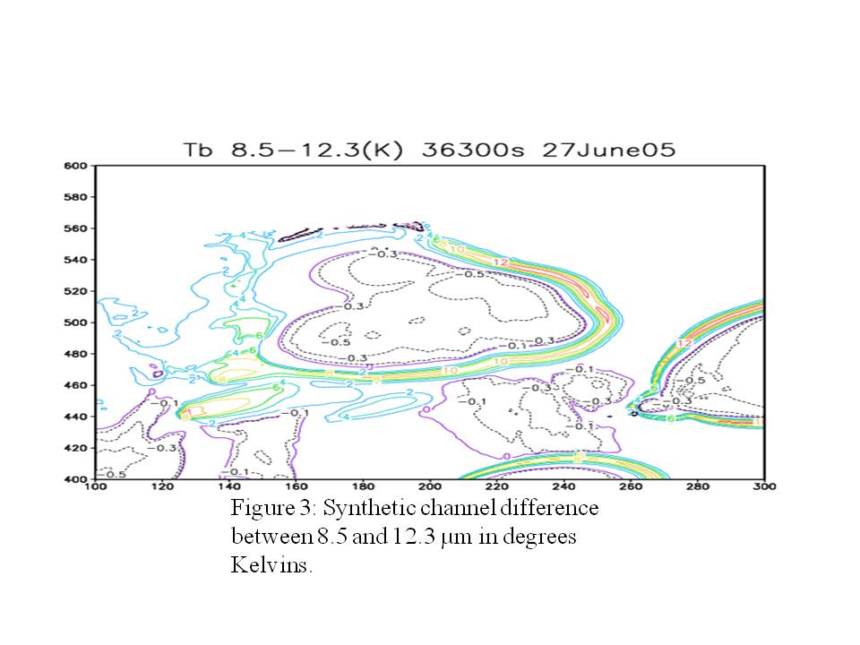
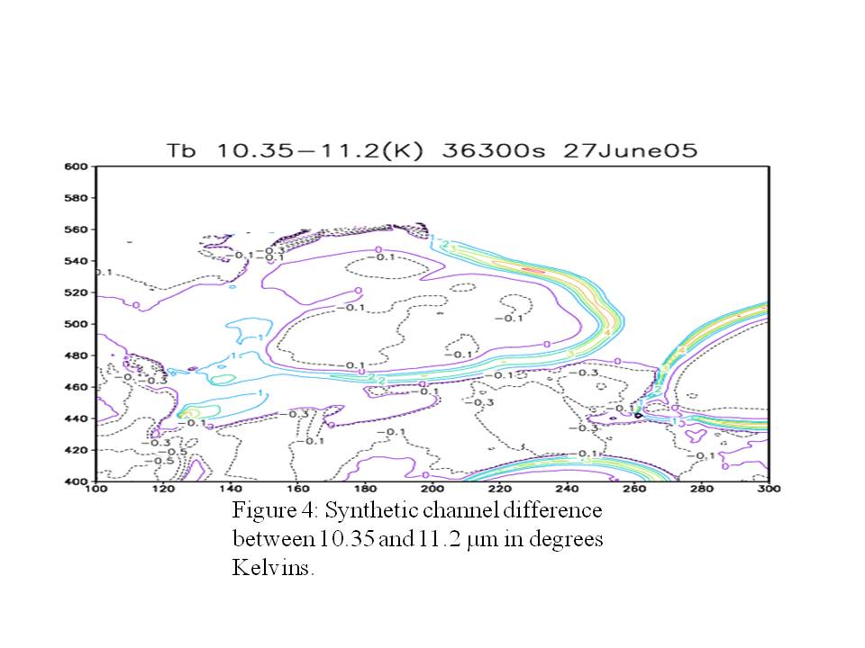
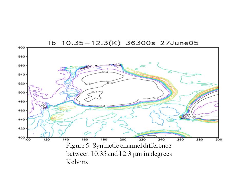
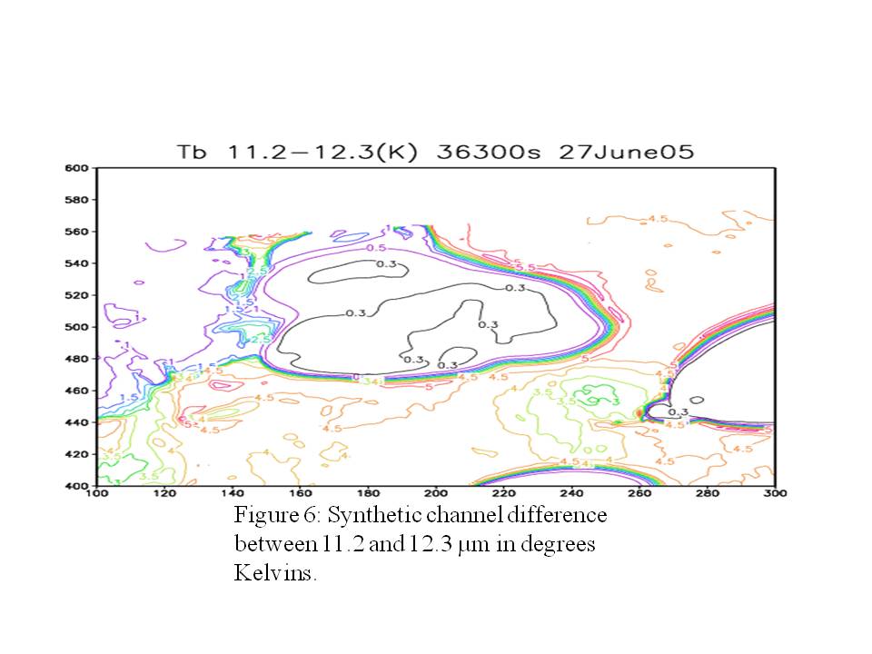
GOES-R ABI will have several channels in the window region from which channel difference products can be produced. Four channels, 8.5, 10.35, 11.2, and 12.3 µm can be differenced to produce a total of six difference images. In this example, differences were produced from a numerical simulation of the 27 June 2007 thunderstorm event over Wyoming. Satellite imagery of numerical model output is termed “Synthetic” imagery. Shown in Figures 1-6 are the six possible synthetic channel differences that can be produced from the above four GOES-R ABI channels (click each image for a larger view). All figures feature a thunderstorm anvil (160 < X < 260 ; 460 < Y < 560) that exhibits a small negative difference (Figure 1) that increases—as one views the figures in numerical order–to small positive values (Figure 6). In contrast, the edge of the thunderstorm anvil exhibits relatively large positive values in all figures. In regions of no clouds (X=280; y=540), differences change from negative values to positive values as one views the figures in numerical order. In summary, channel differencing can be used to identify the thick ice clouds composing the interior of the thunderstorm anvil; thin ice clouds along the edge of the thunderstorm anvil; and water vapor in the clear sky region.

