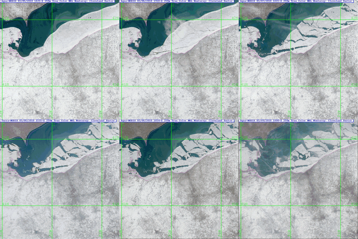
MODIS Images: Lake Erie Ice Break-up and Ice Floe
Figure 1: March 3rd through March 8th 2010 (NexSat Project/Naval Research Laboratory)
J. Braun
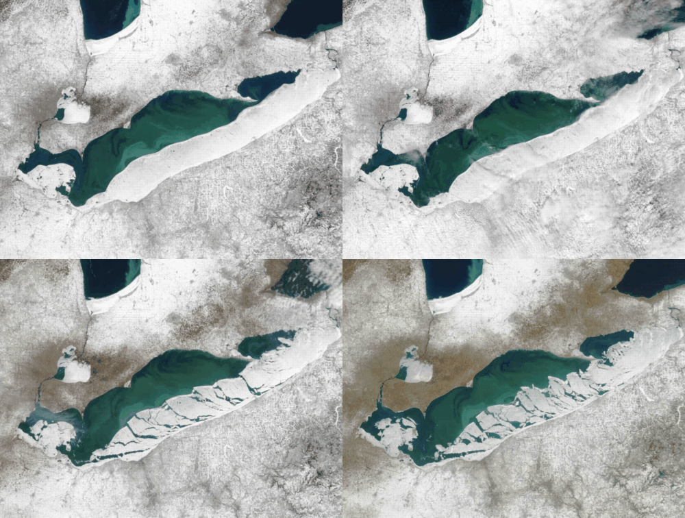
Whew! Hints at spring may finally be around the corner. Cold Arctic winter temperatures through most of the beginning of this new year have kept much of the Great Lakes in frozen repair through early March. However, a hopefull proxy for spring is showing itself in the figure 1 (18Z) loop (above) and figure 2 (close-up below) with the ongoing break-up ice ofver the last week or so. Winds finally shifted from northerly to southwesterly, helping to lift temperatures from the region’s icy continental grip with the mercury climbing into the lower 40s. Although the signal is welcome, there can be problems. The combination of shifting winds and warmer temperatures can bring hazardous conditions to the lake in the form of ice floes. For those who venture too far out when the break-up begins, there is a distinct change at becoming trapped and adrift on the ice…and headed towards Canada. �

Figure 2: March 5th through March 9th 2010 (Steve Miller and NexSat Project/Naval Research Laboratory)
In the past, hundreds of ice fishermen have been stranded on huge ice floes when the shifting winds caused a floe to break away from the main ice. Some have even perished trying to escape (e.g. cold water and heart attacts, drownings, and being crushed by the ice itself). Many also lose expensive equipment to this phenomenon – such as snowmobiles, trailers and fishing equipment. Most of those who are rescued are taken off by either helicopter or hovercraft…and a lot of dollars. Ice fishermen often try to get as far out on the ice as they can for the best fishing…breaking many ice safety rules and put themselves in danger in the process. Timely imagery from remote sensing sources (like this MODIS group of images) can keep (some) fishermen from becoming trapped, by visually supporting (direct observation) the forecast process that may indicate the the beginning of the ice break-up. Although this MODIS imagerey has great resolution (250m), it’s temporal resolution could be better. When GOES-R finally arrive in the latter half of the decade, some of the resolution will be lost (500m), but the images will arrive every 5 minutes instead of once a day…so take your pick.

