Oil and Water Really Don’t Mix
By J. Braun
Additional information/images from – Steven Miller, Bernie Connell, Dan Lindsey, and NASA
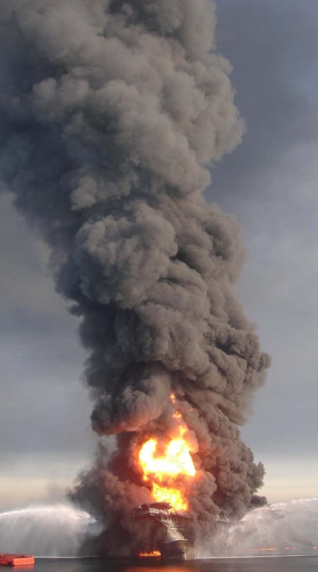
Figure 1(above).
Eleven crew members of the state of the art floating oil rig “Deepwater Horizon” are now presumed dead following an explosion on the rig which then caught fire, burned for two days, then sank in 5,000 ft of water in the Gulf of Mexico. Our deepest condolences go out to their families.
The rig, located roughly 50 miles southeast of the coast of Louisiana, was contracted by BP Oil Company through its owners Transocean (the world’s largest offshore drilling contractor). The rig is state of the art becauseit is not moored (i.e. it does not use anchors) but instead uses a triply-redundant computer system together with global satellite positioning (gps) to control the location of the rig within a few feet of its intended location, at all times (called Dynamic Positioning System). It may take quite some time to figure out just how/why a rig of this advanced state of technology caught fire in the first place, much less sank, with all the “fail safe” hardware, software and equipment on board. Up to 5000 barrels of oil are currently leaking into the gulf every day. Efforts to cap the well have so far been unsuccessful.
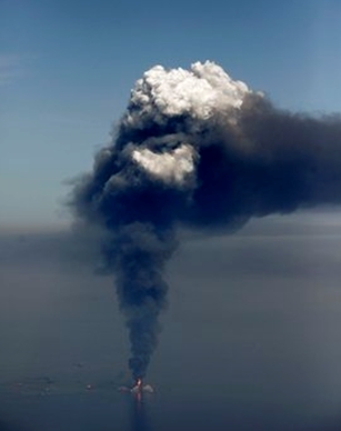
Figure 2.
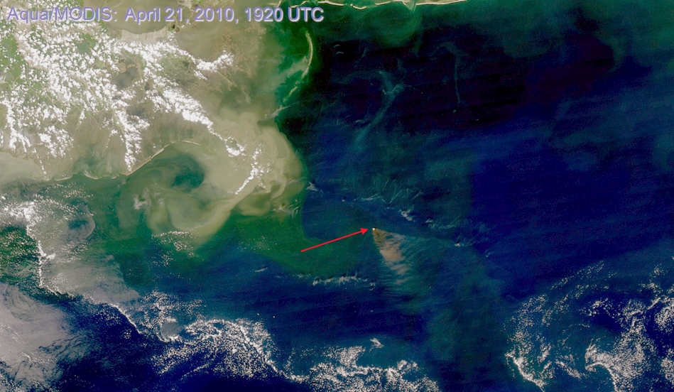
Figure 3 – NASA’s Aqua/MODIS RGB image.
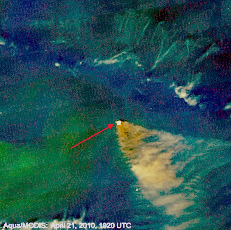
Figure 4 – Same as above only close-up.
However, after Deepwater Horizon did catch fire – flames were often visible up to about 35 miles away as they were often 200 – 300 ft high! There were also some very white portions of the plume which is believed to be pyrocumulus – and can actually be seen in the April 21 MODIS image as a white spot directly over the rig(Figures 2, 3 and 4.).
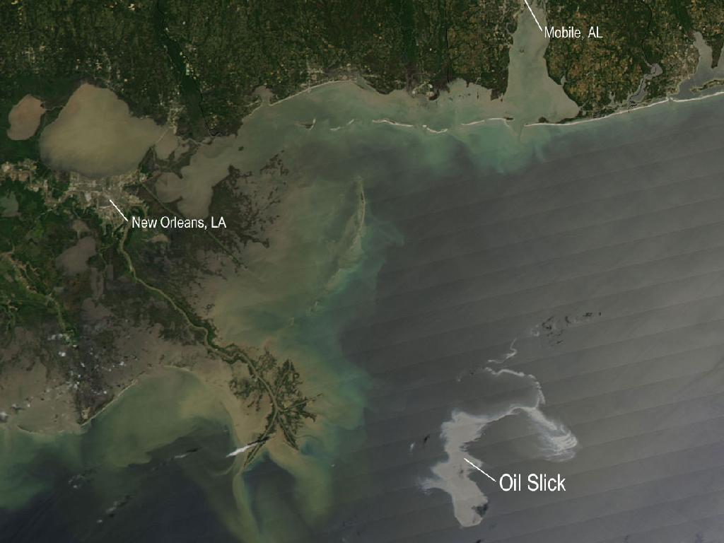
Figure 5 – NASA’s Aqua/MODIS – April 25, 2010 three channel RGB image.
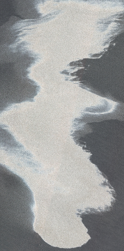
Figure 6 Same as above only close up view.
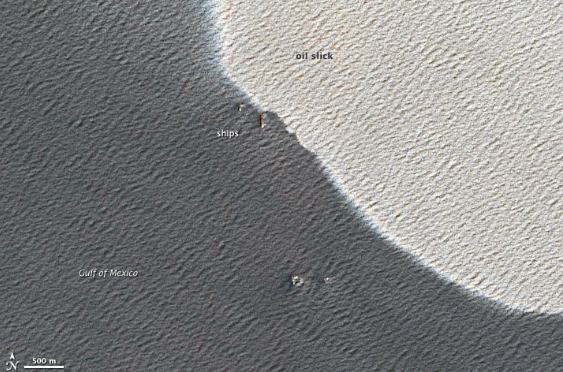
Figure 7 – Same as previous two images only very close up.
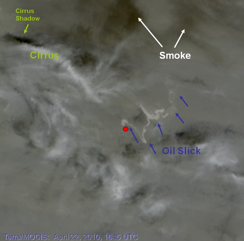
Figure 8 – NASA’s Terra/MODIS April 22, 2010 – three channel RGB image.
Other satellite views (figures 5, 6, 7, 8) use sunglint to identify the oil/fuel slick…in this case appearing as a bright swirly region owing to mirror reflection of the solar disk off the waters whose capillary waves (a wave traveling along the phase boundary of a fluid, whose dynamics are dominated by the effects of surface tension) have been suppressed by the slick making it appear “smoother.” It also depends strongly on the sun/satellite sensor geometry relationship in terms of how these features will appear in the imagery. That is, if the feature had been located in another part of the “glint zone” it may have appeared as dark against lighter surrounding waters.
Oil slicks are often notoriously difficult to spot in natural-color satellite imagery because a thin sheen of oil only slightly darkens the already dark blue background of the ocean. However, under unique viewing conditions (such as with the help of sunglint), oil slicks can become visible. For the following images (figures 9 and 10 and 12), sun glint was also the major reason that the slick could be observed (not temperature variations – even in the 11.0 or 3.9 micron imagery). The 3.9 shortwave IR imagery is able to pick up the slick because of the differences in the reflective component between water and oil. The longwave IR (figure 11) is not able to separate these differences…and the apparent temperatures across the two surfaces is being sampled as being virtually the same. Note, however, the variation that different enhancements make to the shortwave IR (3.9 um) imagery.
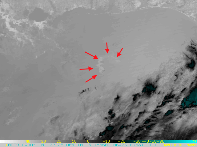
Figure 9 NASA’s Aqua/MODIS 3.9um image April 25, 2010 “normally” enhanced.
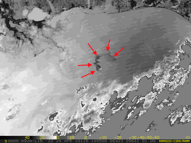
Figure 10 – Same as above only further enhanced (effective temperature range reduced).
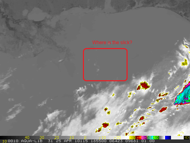
Figure 11 – Same as previous two images only taken at 11.0um longwave IR.
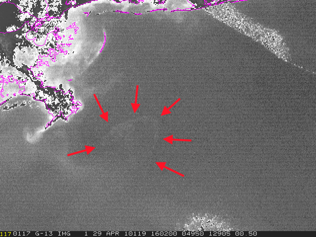
Figure 12 – GOES-13 visible April 29, 2010
