Synthetic Cloud Top Heights
by Louie Grasso, Dan Lindsey, Jeff Braun
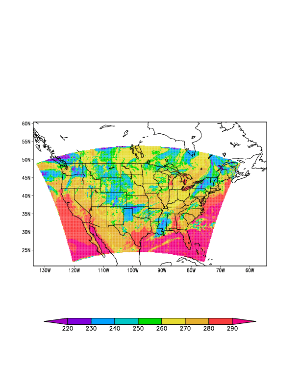
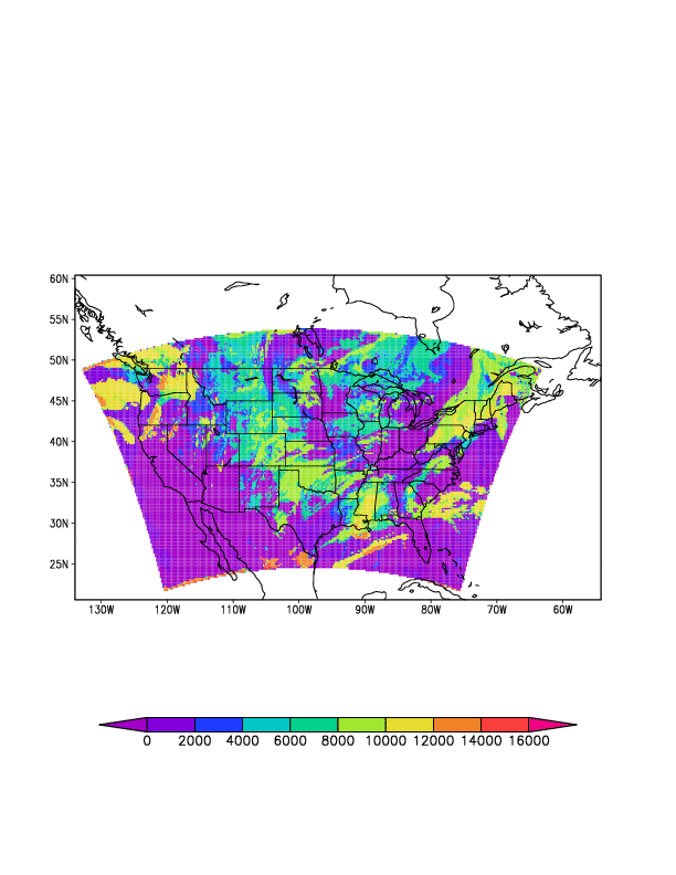
Cloud tops heights, an important forecast parameter, is being generated from the NSSL 4km WRF-ARW real-time run. At CIRA we have been generating synthetic GOES-R imagery from this real-time model since spring 2010. Based on information and contact at the 14th Great Divide Workshop in Billings, MT, we have begun to generate cloud top height products from the real-time model. The two images below indicate the initial step in this direction. Figure 1 shows a 12 hour forecasted synthetic GOES-R brightness temperature image at 10.35 um. Similarly, figure 2 shows the corresponding cloud top heights. These images are valid at 12Z 11/15/2010. The next step (to come later) is to get this product into an AWIPS friendly format and then follow this with forecast cloud base height and cloud layer information.
We encourage readers to give us feedback. This will allow us to improve these products before they are put into AWIPS.
Figure 1 – Synthetic GOES-R 10.35 um image (temperatures – deg K) valid at 12Z 11/15/2010
Figure 2 – Synthetic GOES-R 10.35 um image (heights – meters MSL) valid at 12Z 11/15/2010


