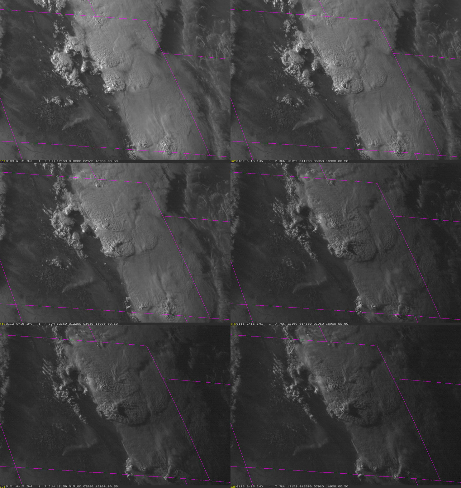
1-Minute GOES Imagery over Colorado Severe Storms
On 6 June 2012, GOES-15 SRSO was called, meaning intermittent 1-minute scans would be collected over a mesoscale sector centered in eastern Colorado. The Storm Prediction Center had a slight risk of severe storms over the region, and by late afternoon convective initiation occurred along the Denver Convergence Zone north and east of Denver. The loop below shows a sample of the 1-minute Visible Imagery just before sunset.
To view a longer animation with loop controls (stop, step through, etc.), go here http://rammb.cira.colostate.edu/templates/loop_directory.asp?data_folder=dev/lindsey/loops/6jun12_goes15_vis&image_width=1020&image_height=720
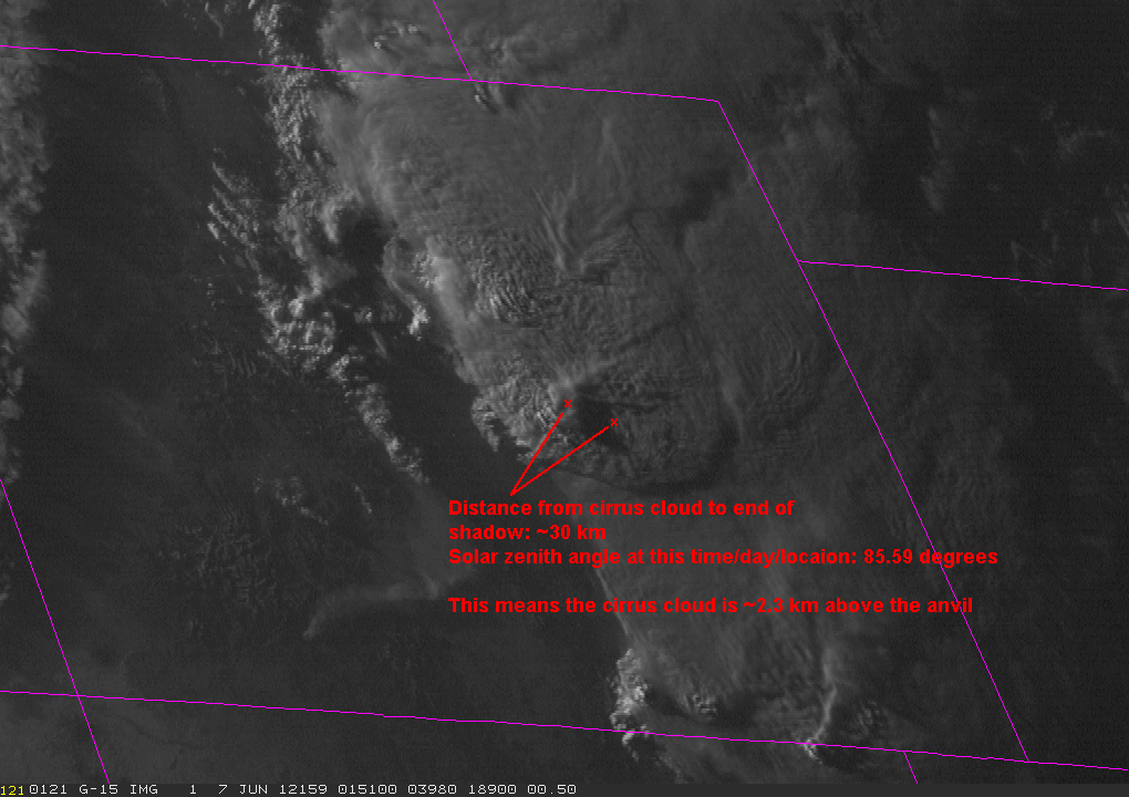
The frequent scans allow the movement of storm-top gravity waves to be resolved. By the end of the loop near sunset, the steep sun angle helps elongate shadows cast by above-anvil cirrus clouds on top of the remaining anvil clouds. This gives the correct impression that these clouds are indeed well above the rest of the convective anvil.
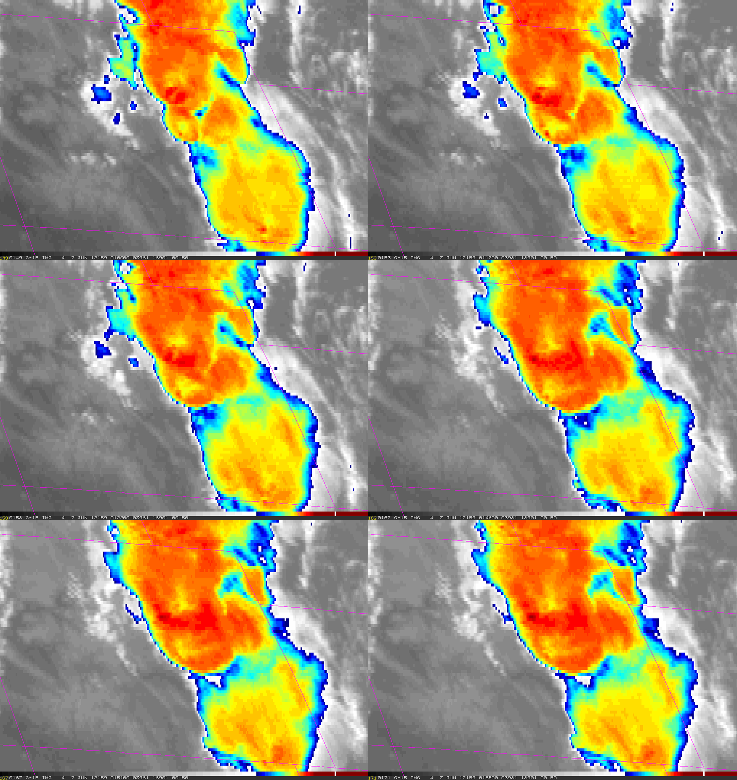
The corresponding color-enhanced Infrared loop is below.
For a longer loop with controls, go here: http://rammb.cira.colostate.edu/templates/loop_directory.asp?data_folder=dev/lindsey/loops/6jun12_goes15_ir&image_width=1020&image_height=720
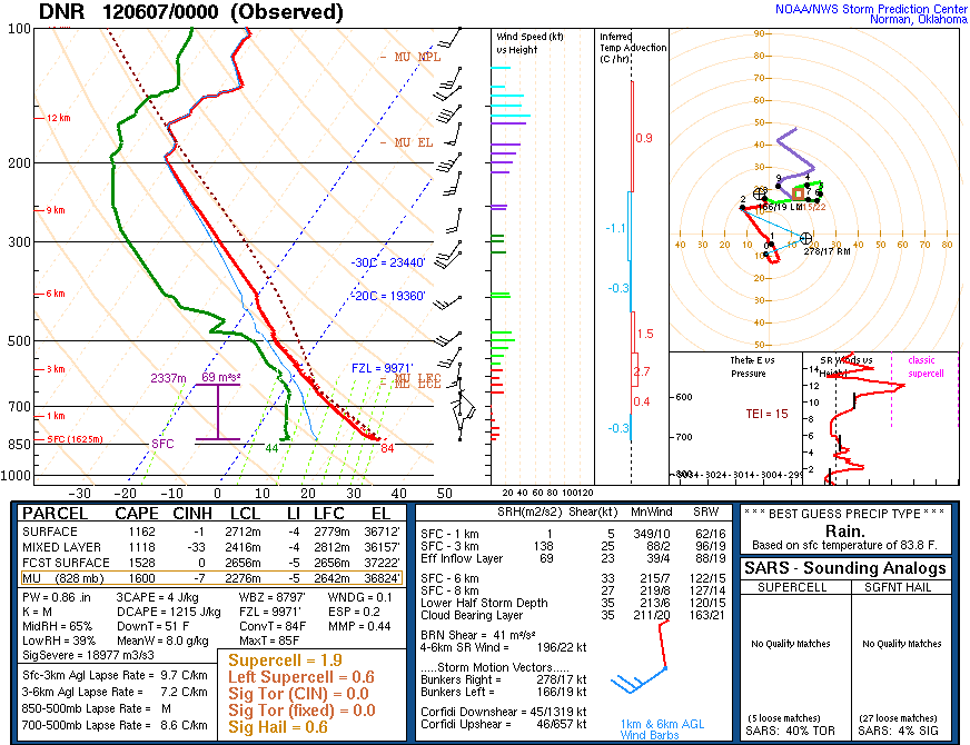
Note that the overshooting tops most evident in the Visible loop correspond to relative cold (red) colors in the IR loop. It’s also quite interesting that most (or maybe all) of the above-anvil cirrus have relatively warm brightness temperatures compared to anvil cloud below. This suggests that this cirrus resides in the lower stratosphere and has been warmed by the environmental temperatures there (see the sounding below from Denver at 00 UTC and note the temperature inversion above the tropopause). The resulting IR presentation resembles “cold-ring-shaped storms” as documented by Martin Setvak et al. (Atmospheric Research, 2010).
 Finally, a technique introduced by Dr. Setvak is to overlay a transparent color-enhanced IR image onto a Visible image – the result is often referred to as a “sandwich” image. An example from 6 June is below. The advantage of this presentation is the ability to easily co-locate features in the Visible image with their corresponding IR brightness temperatures.
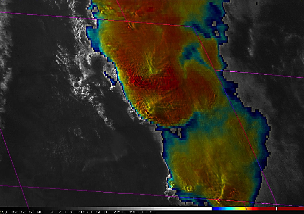 Finally, one of the VIS images near sunset can be used to do a rough calculation of how high the cirrus sits above the ambient anvil cloud (see below). At 0151 UTC, based on the shadow length and solar zenith angle, we estimate the cirrus cloud to be about 2.3 km (+/- 0.75 km) above the anvil cloud on which it’s casting a shadow.

