Mesoscale vortex development over Lake Ontario on January 23, 2013
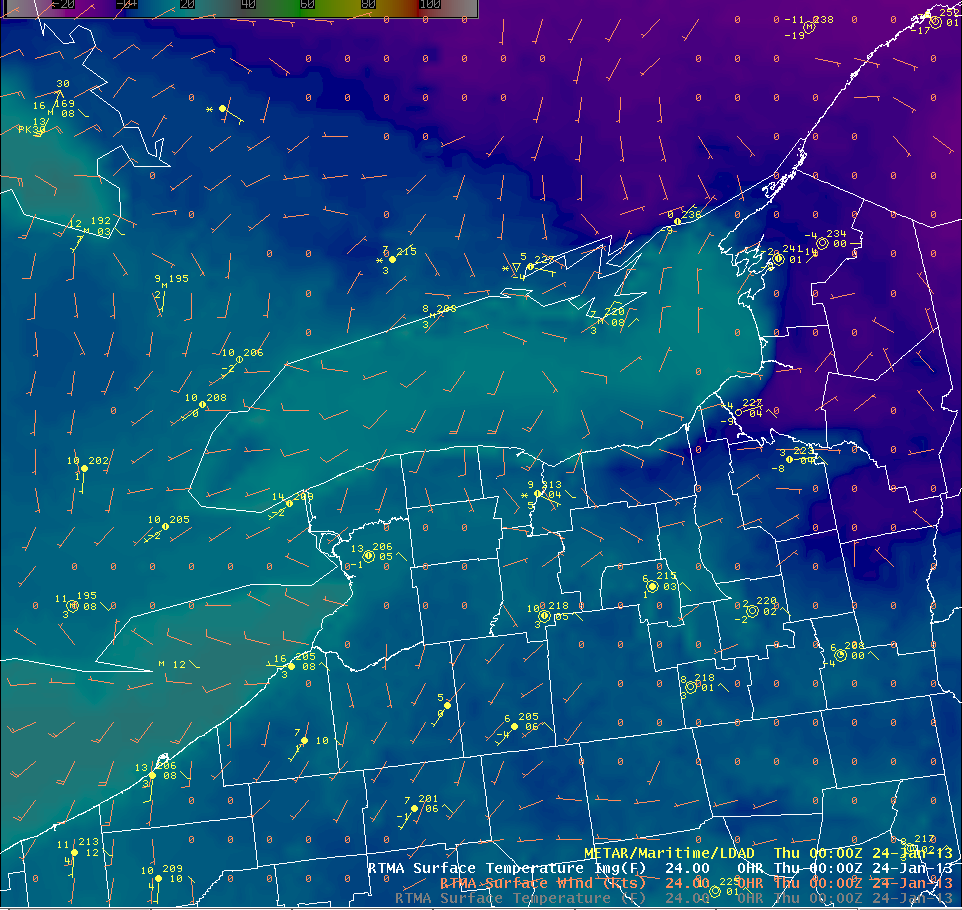
An Arctic airmass over the Great Lakes provided for a significant lake-effect snow event off Lake Ontario leading up to January 23, 2013 (maximum snowfall reports 3 feet near the southeast shoreline). Near the end of this lake-effect snow event, low-level wind speeds decreased as shown in this plot of RTMA surface winds/temperatures along with METARs at 0000 UTC 24 January:

Around this time period, the 0.5 degree reflectivity from the Buffalo, NY WSR-88D showed the development of a mesoscale vortex over Lake Ontario:
The convergence over Lake Ontario is driven by the temperature difference between the relatively warm lake surface and the relatively cold air over the land. When conditions are favorable, mesoscale vortices may develop along convergence boundaries.
Conditions favorable for mesoscale vortex development include:
1) weak synoptic pressure gradient and low wind speeds.
2) large lake-air temperature differences.
3) low atmospheric stability.
4) organized convergence over the lake.
These conditions existed during the time period shown in the radar loop above.
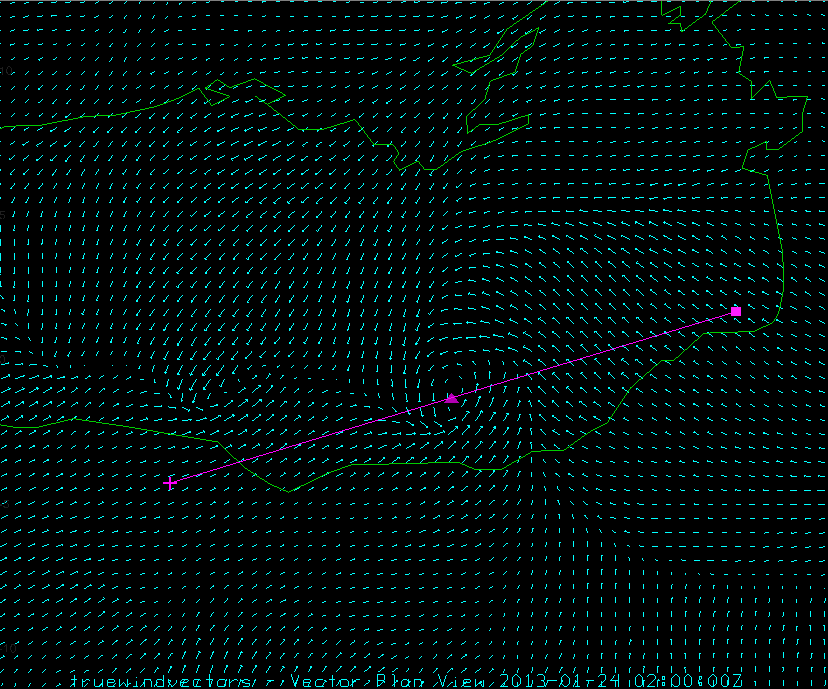
In order to better understand the genesis of the mesoscale vortex shown in the radar loop, the WRF-ARW model was employed to simulate the conditions. The model configuration included a 9-km domain over the eastern Great Lakes region and a nested domain with horizontal grid spacing of 3-km. The NAM218 was used as initial conditions for a model simulation that begins at 1800 UTC 23 January and ends at 0600 UTC 24 January. The following is a loop of the WRF-ARW MSLP (hPa, shaded) and surface winds:
The thermally induced convergence zone over Lake Ontario takes some time to spin up during the early portion of the simulation. Soon after seeing the increase in convergence over the lake, you can see regions of cyclonic vorticity develop along these convergence boundaries. Also note the lower MSLP values over Lake Ontario, with localized regions of lower pressures where cyclonic vorticity develops over the various convergence boundaries.
The mesoscale vortex of interest that we observed in the Buffalo radar reflectivity field seems to be fairly well represented in the model with movement onshore by later in the loop which resulted in a heavier burst of snow.
Note that there are other other mesoscale vortices further east over Lake Ontario, these vortices are quite shallow so that at this range from the Buffalo radar, the beam would overshoot any mesoscale vortices that existed there. Since the cyclonic vorticity signature in the model field is so pronounced with this mesoscale vortex over the southeast portion of Lake Ontario:

It’s interesting to construct a cross section (denoted by the purple line) through this mesoscale vortex that was forecast by the model.
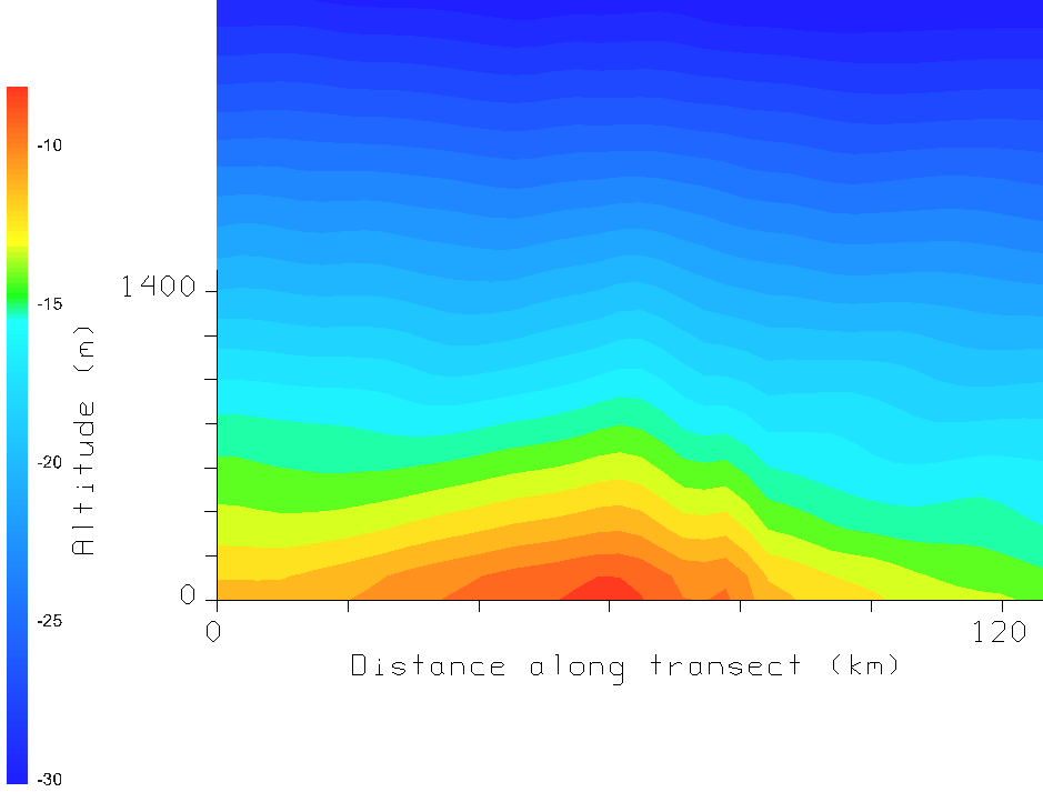
Here is a cross section that depicts the temperature across the mesoscale vortex:

Note the warm core at the middle of the transect which corresponds to the mesoscale vortex. The warm core signature is most evident at low levels and decreases with height.
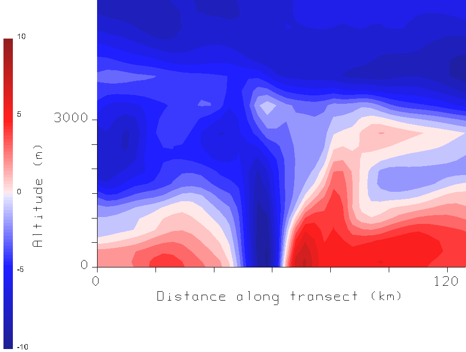
A cross section of the v-component of the wind across the mesoscale vortex:

Shows the cyclonic circulation extending up to about 2.6 km AGL.
The warm core structure and wind field is consistent with that shown in Laird et al. (2001).
For additional (daytime) examples of mesoscale vortices in visible satellite imagery, see:
http://rammb.cira.colostate.edu/case_studies/20051214/
References / further reading:
Grim, J.A., N.F. Laird, and D.A.R. Kristovich, 2004: Mesoscale vortices embedded within a lake-effect shoreline band. Mon. Wea. Rev., 132, 2269-2274.
Laird, N.F., L.J. Miller, and D.A.R. Kristovich, 2001: Synthetic dual-Doppler analysis of a winter mesoscale vortex. Mon. Wea. Rev., 129, 312-331.
Schoenberger, L.M., 1986b: Mesoscale features of the Michigan land breeze using PAM II temperature data. Wea. Forecasting, 1, 127-135.
