2 April 2015 severe thunderstorm event
On 2 April 2015, severe thunderstorms were forecast by the SPC as summarized in their Day 1 convective outlook graphic:

We will focus on the western edge of the enhanced outlook area which is roughly southeast Kansas, northwest Oklahoma, southwest Missouri and northwest Arkansas.
One of the key ingredients for this severe weather setup was an upper-level jet. The GOES water vapor imagery overlaid with the RAP 250 mb isotachs for the late afternoon / early evening hours depicts this upper-level jet:
The core of the jet is across southern Colorado, and quickly moves eastward across Kansas towards the threat area in southeast Kansas / northeast Oklahoma. There appears to be a good correlation between the arrival of the upper-level jet streak and the timing of convective initiation in southeast Kansas.
GOES visible imagery along with RAP 250 mb isotachs:
Shows considerable cirrus at the leading edge of the jet streak across Kansas and in fact convective initiation occurs along a low-level convergence boundary around that time. The low-level convergence boundary can be seen in southeast Kansas extending eastwards into southwest Missouri where convection occurred earlier and moved off to the east.
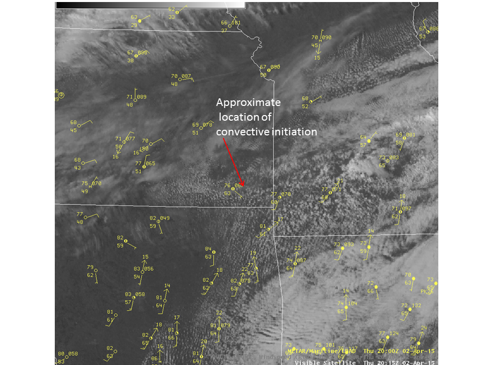
A closer inspection of the visible imagery at 20:15 UTC:
 shows the different boundaries and air-masses. Unstable cloud streets can be seen along and south of the segment where convective initiation occurs. Stable cloud streets exist further north and northeast of the boundary where cooler temperatures exist. The thunderstorms developed at the northern edge of the lid associated with an elevated mixed layer profile.
