1-minute GOES-14 SRSO for 9 August 2016 Montana storm
On 9 August 2016, GOES-14 Super Rapid Scan Operations for GOES-R (SRSOR) collected 1-minute imagery of a severe thunderstorm in southeast Montana:
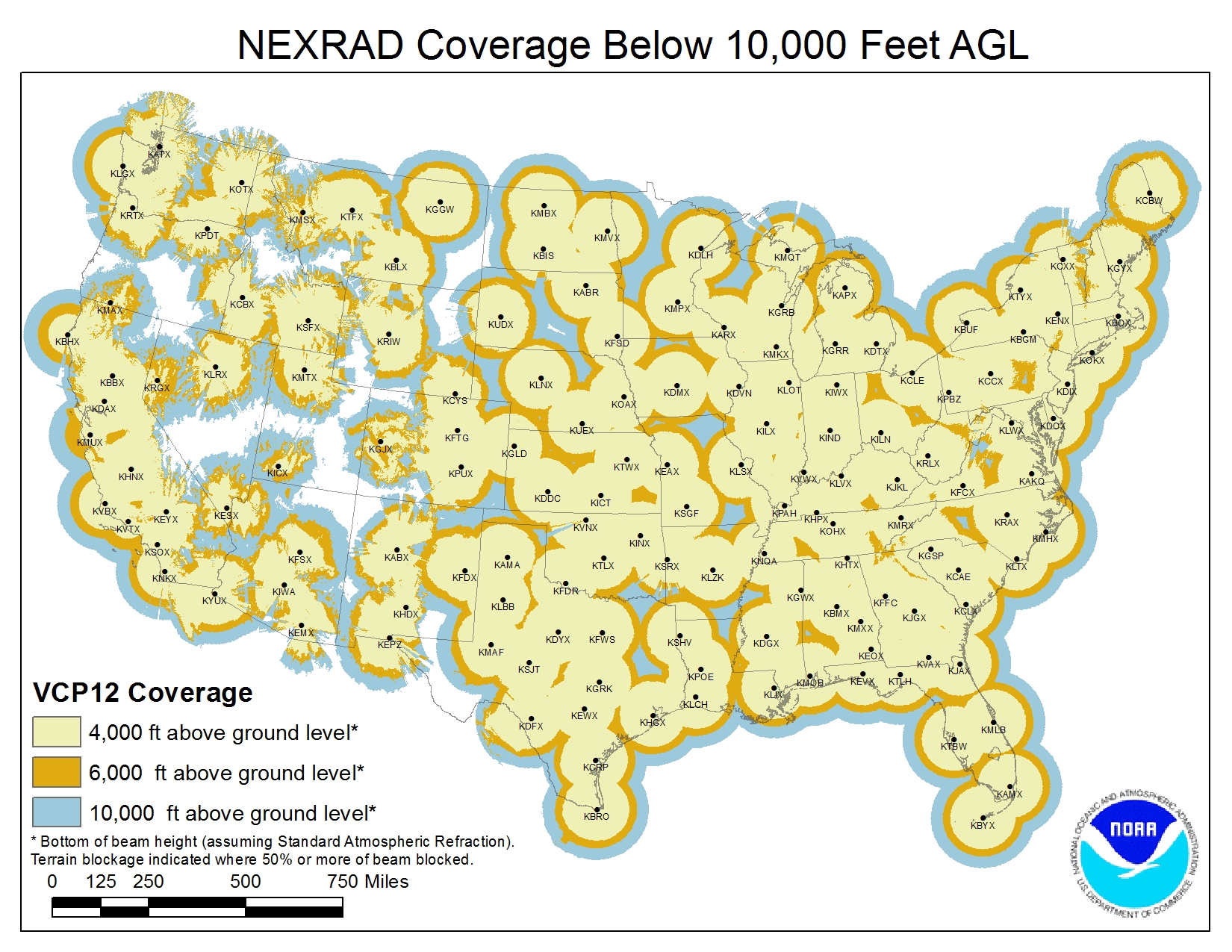
The 1-minute visible satellite imagery is particularly important for this case, since the storm is in southeast Montana where WSR-88D coverage is limited due to the large distance from the nearest radars:
If one were looking at the closest radar in analyzing this storm, they would be sampling very high up into the storm, limiting the utility of the available radar data.
A meteorologist with experience in utilizing satellite imagery in assessing severe thunderstorms would immediately be able to recognize this storm as severe, particularly due to the high temporal resolution of the visible satellite imagery.
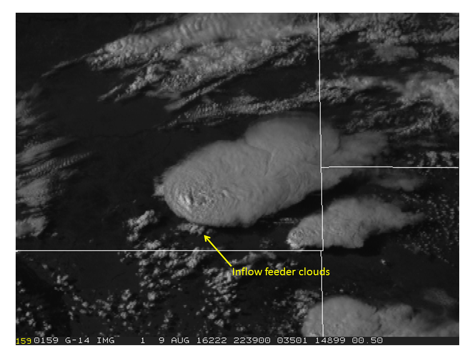
The storm has an overshooting top that is rapidly changing. The upshear (southwest) edge of the anvil cirrus is crisp and well defined. There are inflow feeder clouds east of the flanking line, such as observed at this time:
these were long lasting as well.
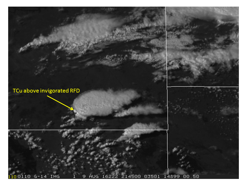
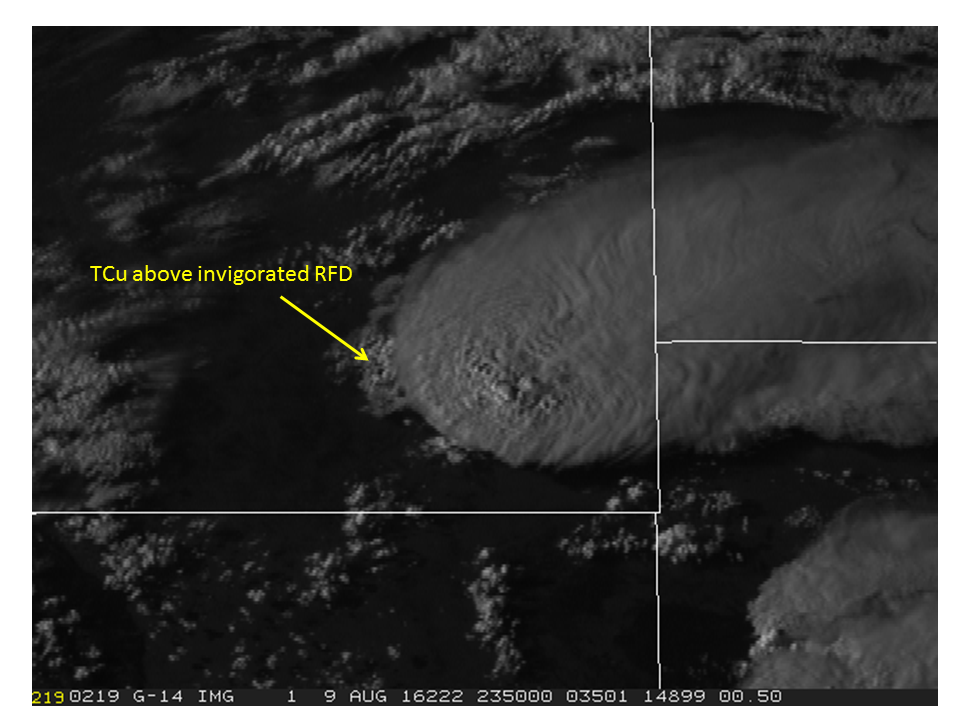
There were also times of invigorated cumulus above the RFD, another sign of a severe storm that is undergoing intensification or near peak intensity, here are some examples from two different times:
This storm was associated with hail reports up to 4 inches in diameter. For additional imagery/discussion on this event, see this link on the CIMSS satellite blog.
The main point of this discussion is that GOES satellite imagery may provide useful information in assessing for a potential severe thunderstorm. This is particularly the case with higher temporal resolution data such as the 1-minute imagery we see in this loop and for regions where radar coverage is sparse or potentially when the closest WSR-88D is down. We look forward to GOES-R when 1-minute imagery will be available much more often than currently available, and of course the higher spatial resolution will also assist in identification.


