VIIRS Flood Detection Product: Gulf Coast Flooding, August 2016
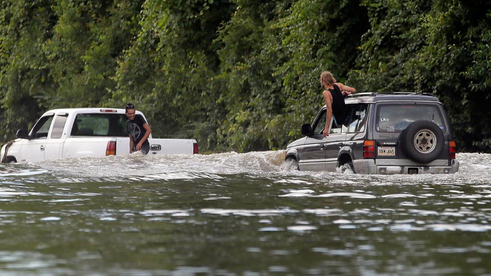
The Gulf Coast has taken a major hit lately with intense rainfall and flooding across the area (Figure 1, below). This past weekend (12 August 2016 through today) there has been a Federal Flood emergency declared in the state of Louisiana. The areas that has been hit the most is south-central and southeastern Louisiana. A summary of the flooding with images across the state can be seen through the link here.
Figure 1: Two people stranded in high flood waters in Louisiana over the past weekend (Source: The Weather Channel).
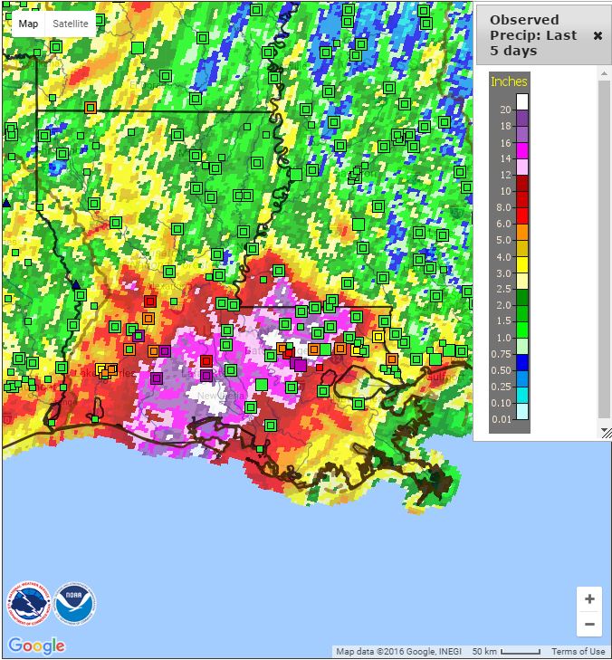
From the lower mississippi River Forecast Center (RFC), Figure 2 highlights the observed precipitation (cumulative) for the last five days (not including today) along the Gulf Coast states.
Figure 2: The observed precipitation for the state of Louisiana for the last five days. One can see the south-central and southeastern parts of Louisiana have been tremendously inundated with these areas having more than 20 inches of rainfall in the short time span.
Interestingly enough, observed precipitation from events such as the one mentioned above can be compared to satellite observations. This comparison can be shown through the animated GIF below that changes from the Google Map view of south-central and southeastern Louisiana to the Visible Infrared Imaging Radiometer Suite (VIIRS) Flood Detection Product. The date of the images is for 15 August 2016 at 1930 UTC. Make sure to click the image for animation to occur.
If we take a closer look at the VIIRS Flood Detection Product (Figure 3) we first look at the legend for interpretation. The product shows the ‘floodwater fraction percentage’ from 0-100% for each pixel, where the spatial resolution is at 375 meters. In addition to the floodwater fraction percentage, are the scene types that can be present in each pixel. Scene types range from land (LD, light brown), Supra-snow/ice water (SI, magenta), snow (SN, white), ice (IC, aqua), clouds (CL, light grey), cloud shadow (CS, dark grey), and open water (WA, dark blue). From the legend and images, one can see and discern the areas of Louisiana that experienced the most flooding which coincide with observed precipitation measurements.
Figure 3: The VIIRS Flood Detection Product highlighting the areas of Louisiana that experienced the most flooding. The legend and interpretation of the color scheme is shown above.


