Low-level moisture as observed from the GOES-16 split window difference product
The GOES-16 data posted on this page are preliminary, non-operational data and are undergoing testing. Users bear all responsibility for inspecting the data prior to use and for the manner in which the data are utilized.
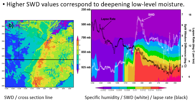
The split window difference product is the difference between GOES-16 bands 13 and 15, that is 10.35 minus 12.3 microns. The high spatial resolution of GOES-16 allows for detection of small-scale gradients in water vapor. Lindsey et al. (2014) demonstrates the utility in this product for identification of local deepening of low-level moisture in a cloud-free environment. The following schematic illustrates the concept that larger positive values of SWD correspond to deepening low-level moisture (in the absence of clouds):
In this example with simulated data, a cross section is taken across a dryline in Texas in clear sky conditions. The cross section on the right of specific humidity (shaded) illustrates the local deepening (i.e., moisture pooling) along the dryline. Split window difference values are maximized in the vicinity of the localized deeper moisture.
For an example, lets look at the GOES-16 visible (0.64 micron) animation:
Note the line of cumulus that develops oriented approximately east-west from Denver eastwards to just south of the Kansas / Nebraska border. Before the line of cumulus develops, skies were clear. Now let’s consider the split window difference product during the same time period:
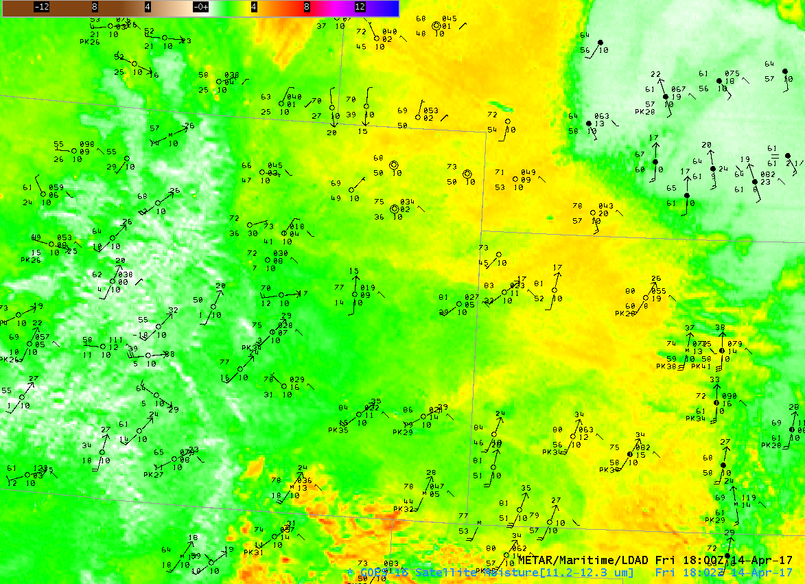
In this color table, positive brightness temperature difference values are green, followed by yellow then red for increasing magnitudes. The low-level convergence boundary where the cumulus later develops is now readily identified. Also, the magnitude of the brightness temperature difference increases (becomes more positive, towards the red values) prior to the development of the cumulus. This is the signal of deepening moisture along the convergence boundary. Supporting evidence from METARs at 1800 confirm the presence of the low-level convergence boundary with higher dewpoints north of the east-west segment of the boundary:
This product can be utilized to identify regions (in clear sky conditions) where localized moisture deepening occurs prior to the development of convective clouds (and potential convective initiation). One caveat to this signal is that we tend to see this where moisture is relatively shallow, not in regions of deep low-level moisture. More research is needed to understand the limits of how deep the moisture must be to not see this signal in the split window difference product.
Note that in this example, the split window difference product is band 14 (11.2 micron) minus band 15 (12.3 micron). It should now be band 13 (10.35 microns) minus band 15 (12.3 microns), this is a small change that would not affect your interpretation of the imagery but it should make the signal a bit stronger (easier to identify).
Another example may be seen in Himawari over Bangladesh / eastern India, where the dryline commonly develops in April. First, here is the visible loop:
Initially, skies are clear which is an important prerequisite to seeing this signal in the split window difference product. Later, thunderstorms develop.
The split window difference product:
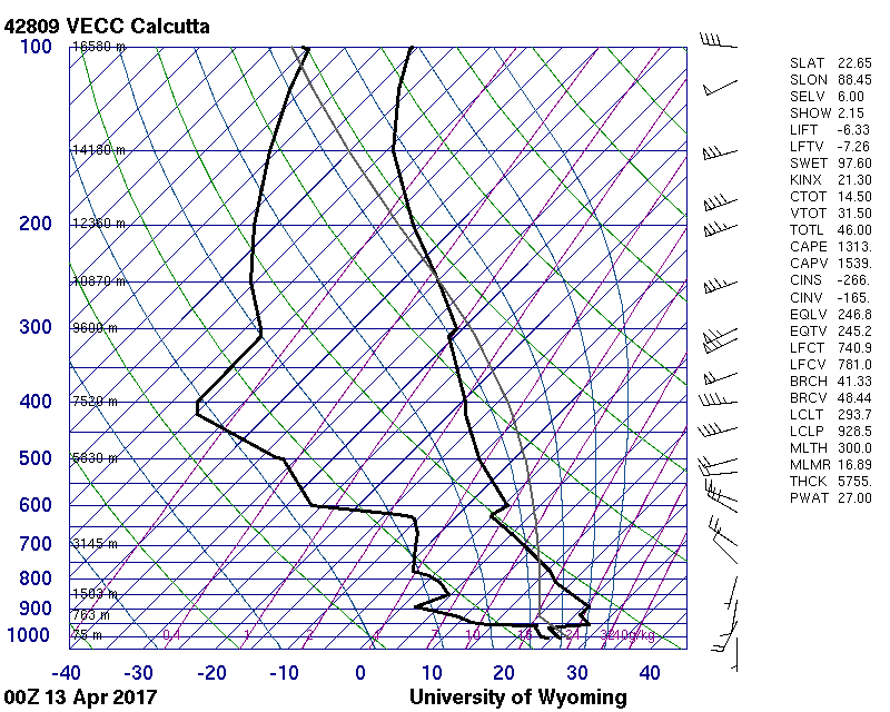
Shows increasing values of brightness temperature difference (orange/red in this color table) in clear skies before cumulus develops, followed by thunderstorms. Again, the signal is increasing depth of moisture along the convergence line (slowly eastward moving dryline in this case). Moisture depth in the pre-storm environment can be assessed with the nearest sounding from Calcutta:
like the Colorado case, the moisture depth is shallow. This seems to be one of the caveats for being able to identify this signal in the split window difference product.
References:
, 2014: Use of the GOES-R Split-Window Difference to Diagnose Deepening Low-Level Water Vapor. J. Appl. Meteor. Climatol., 53, 2005–2016, doi: 10.1175/JAMC-D-14-0010.1.


