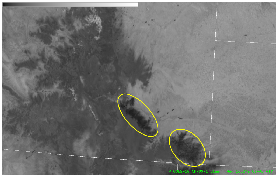
Snow on the ground as depicted in the GOES-16 1.6 micron band
The GOES-16 data posted on this page are preliminary, non-operational data and are undergoing testing. Users bear all responsibility for inspecting the data prior to use and for the manner in which the data are utilized.
The GOES-16 visible (0.64 micron) loop shows what appears to be pretty straightforward – recent snow cover melting during daytime heating in southern Colorado:
Now let’s look at the GOES-16 1.6 micron loop:
At this wavelength, snow and ice surfaces are strongly absorbing, thus darker in this imagery. However, all darker regions are not equally dark, see the highlighted region here:
Note the darker, almost black regions within the highlighted yellow ovals.
On the previous day, the highlighted regions did receive rain mixed with the snow following all snow that accumulated earlier in the day. This likely led to a more slushy type of snow in the darker regions highlighted above.
It turns out, at this wavelength, the size of the ice particles on the surface matters. Where there was rain on snow, the ice particles are larger relative to regions that received all snow. As the melting began on 5 April, the snow cover in the darker regions highlighted were relatively wetter / “slushier” compared to other regions that received just snow.
For a much more detailed explanation of this effect in the 1.6 micron band, see this blog by Curtis Seaman:
A potential application of this principle regarding the 1.6 micron band is identification of hail swaths left behind thunderstorms (assuming clear skies). The hail swath should appear relatively dark in this channel, similar to the wet / slushy snow signature shown above.

