16 April 2017: 1.37 micron band (“Cirrus band”) features other than cirrus clouds
The GOES-16 data posted on this page are preliminary, non-operational data and are undergoing testing. Users bear all responsibility for inspecting the data prior to use and for the manner in which the data are utilized.
By Dan Bikos, Louie Grasso, and Ed Szoke
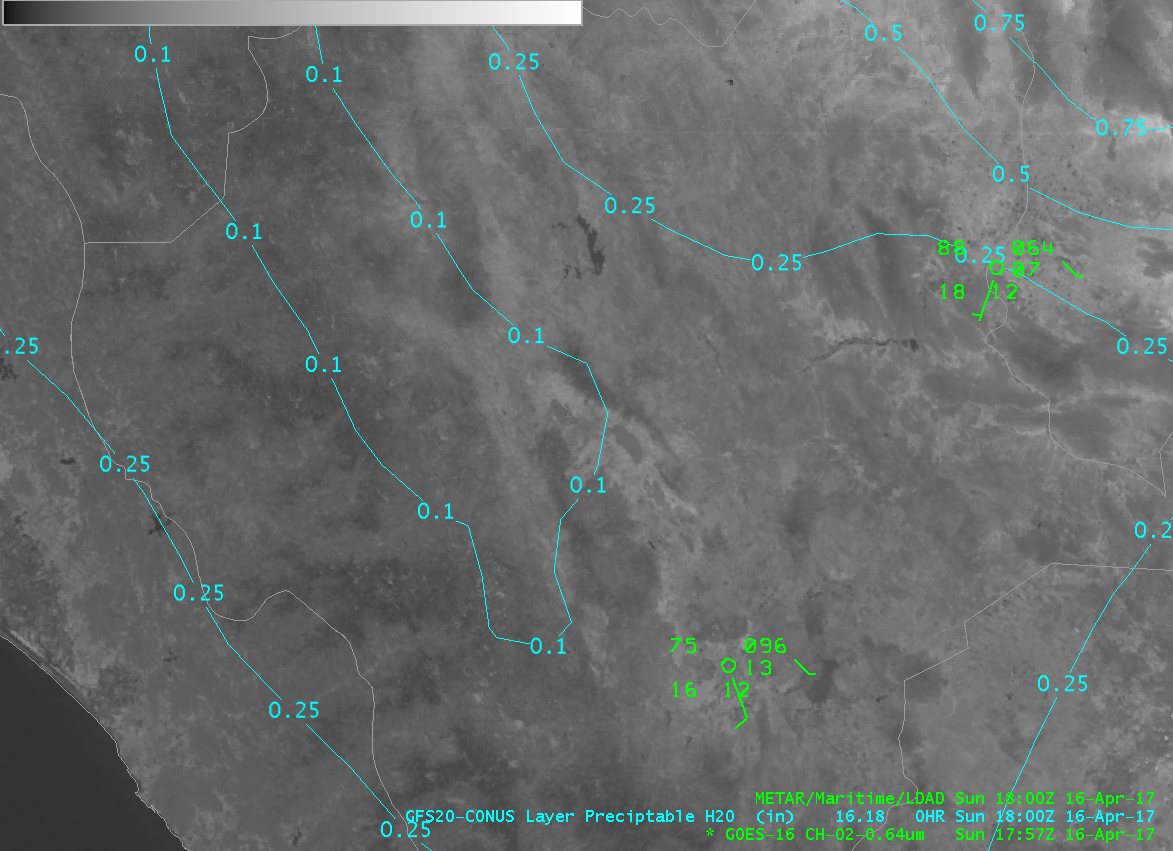
For this blog entry, we are going to focus in on the state of Durango in Mexico during the mid-day hours of 16 April 2017. Conditions during that time were warm and very dry:
The sky cover was mostly clear throughout the period of interest (mid-day hours):
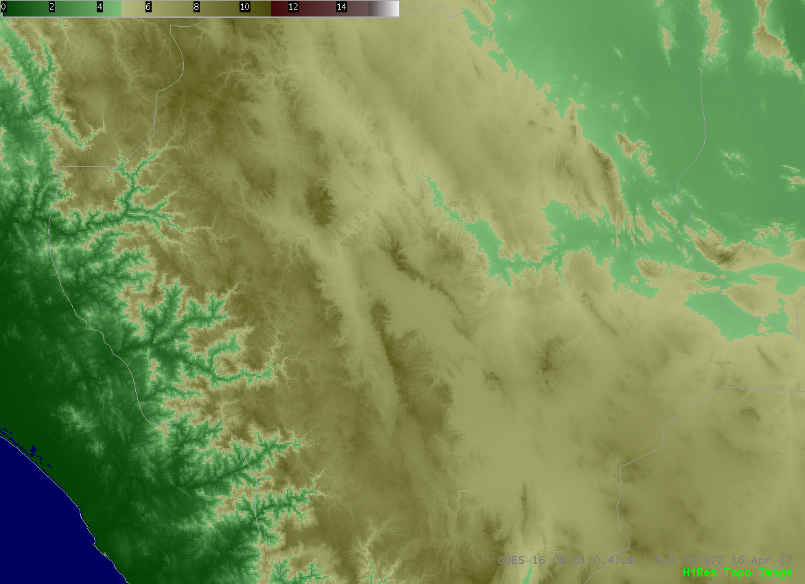
A topographic map of the region reveals that the elevation (given below in thousands of feet) is quite high:
If we analyze the GOES-16 1.38 micron (“Cirrus band”):
There are features that are moving that are approximately oriented southwest-northeast (ignoring the cirrus clouds later in the loop in the northern regions and also the low-level cumulus to the south). These features are not clouds since we did not see them in the visible channel shown above.
Let’s look at the GOES-16 7.34 micron (“low-level water vapor”) band:
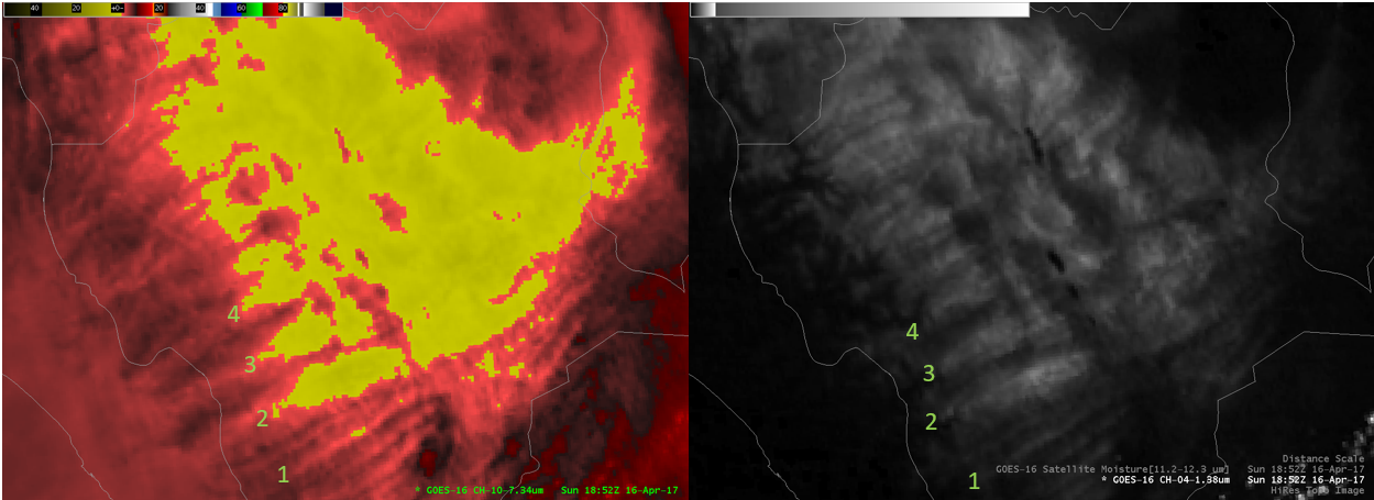
Features similar to those that were observed in the 1.38 micron band appear at 7.34 microns. The 1.38 micron band can be displayed with a different color table to increase the contrast, thus bringing more clarity to the features that we observe:
Recall at this wavelength, 1.38 microns, water vapor is the primary absorber. If there is sufficient moisture to absorb incoming radiation, cirrus clouds show up rather clearly due to the large contrast between bright cirrus clouds and a dark background, hence the band being named the “Cirrus band”. In the case discussed here, moisture is limited, particularly at higher elevations where we see the southwest-northeast oriented banded features. In fact, here is a comparison of the corresponding features at 1.38 and 7.34 micron band.
We note that each feature labeled above has the following characteristics:
1) 1.38 micron band darker corresponds to 7.34 micron band cooler brightness temperature and
2) 1.38 micron band lighter corresponds to 7.34 micron band warmer brightness temperature.
Why?
In this relatively dry, higher elevation environment, the surface is not completely obscured by the intervening (and highly absorbing) atmospheric water vapor when viewed at 1.38 microns. In this near-infrared band, regions that are darker correspond to more column-integrated water vapor (and a lower surface reflectance contribution), while regions that are brighter correspond to less column-integrated water vapor (and a higher surface reflectance contribution).
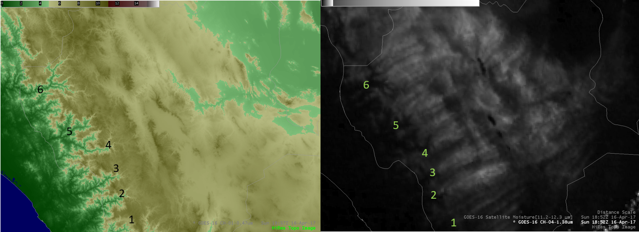
The alignment of these features most likely associated with water vapor are oriented with the terrain:
Note that the lower valleys at locations 5 and 6 can be seen as darker regions at 1.38 microns (recall, more water vapor is associated with darker regions at 1.38 microns).
Can we rule out that these features are associated with dust or smoke? This will now be investigated.
The split window difference product (11.2 micron minus 12.3 micron band difference):
would have negative values (brown in this color table) if lofted dust was present, since the values are positive, we can rule out lofted dust.
For assessing smoke, we look at the GOES-16 0.47 micron (“Blue”) visible band:
There are no obvious smoke plumes during this time period. However, if we look later in the afternoon when fires tend to be more pronounced and show up more clearly due to favorable scattering associated with the view angle:
We do observe a few smoke plumes. However, the orientation of the smoke plumes does not match with what we observed in the 1.38 or 7.34 micron bands and does not cover such a large area in bands that are oriented with the terrain.
In conclusion, the GOES-16 1.38 micron (“Cirrus”) band can observe features other than cirrus clouds and plumes of water vapor may be observed under specific circumstances.


