Tropical Activity in the East Pacific
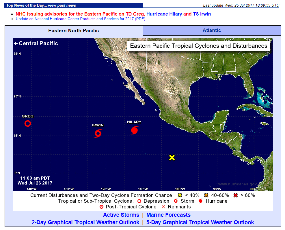
It is that time of year again! The time of year where tropical storms, hurricanes initiate and permeate through the Atlantic and the East Pacific Oceans. Currently, a few to note are tropical depression Greg, Tropical Storm Irwin and Hurricane Hilary. A screenshot of the National Hurricane Center’s (NHC) ‘Active Storm’ Map showing the relative locations of the storms is seen below as of 26 July 2017.
You can check out the CIRA GeoColor product loop of the tropical activity via the new RAMMB/CIRA Slider, a user interface where users can see and analyze satellite products over the entire globe. The loop is from 26 July 2017 between 14-17Z.
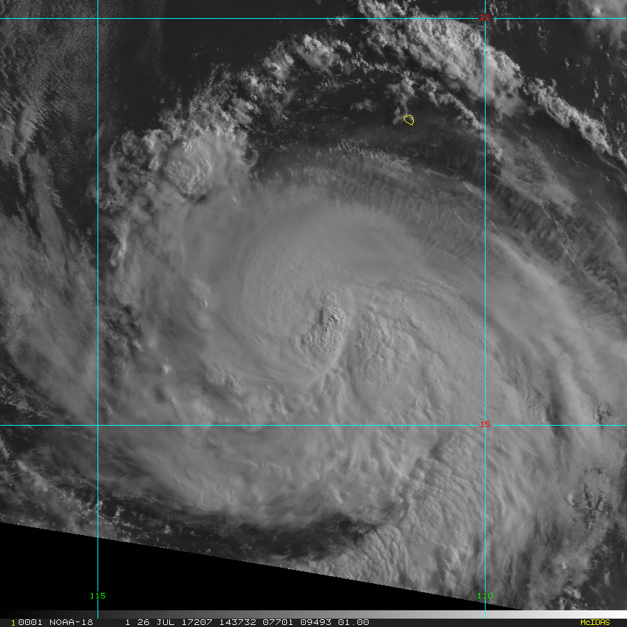
According to NHC, it is important to note that Hilary is a Category 2 Hurricane with maximum sustained winds of 105 mph and is forecast to move west/northwest at 13 mph as of 9AM MDT, 26 July 2017.
Here is the latest visible image of Hurricane Hilary seen below via MODIS and AVHRR at 1 kilometer resolution via the CIRA ‘TC Real Time’ website. MODIS and AVHRR are instruments on-board a few polar-orbiting satellites such as the NOAA-18 satellite.
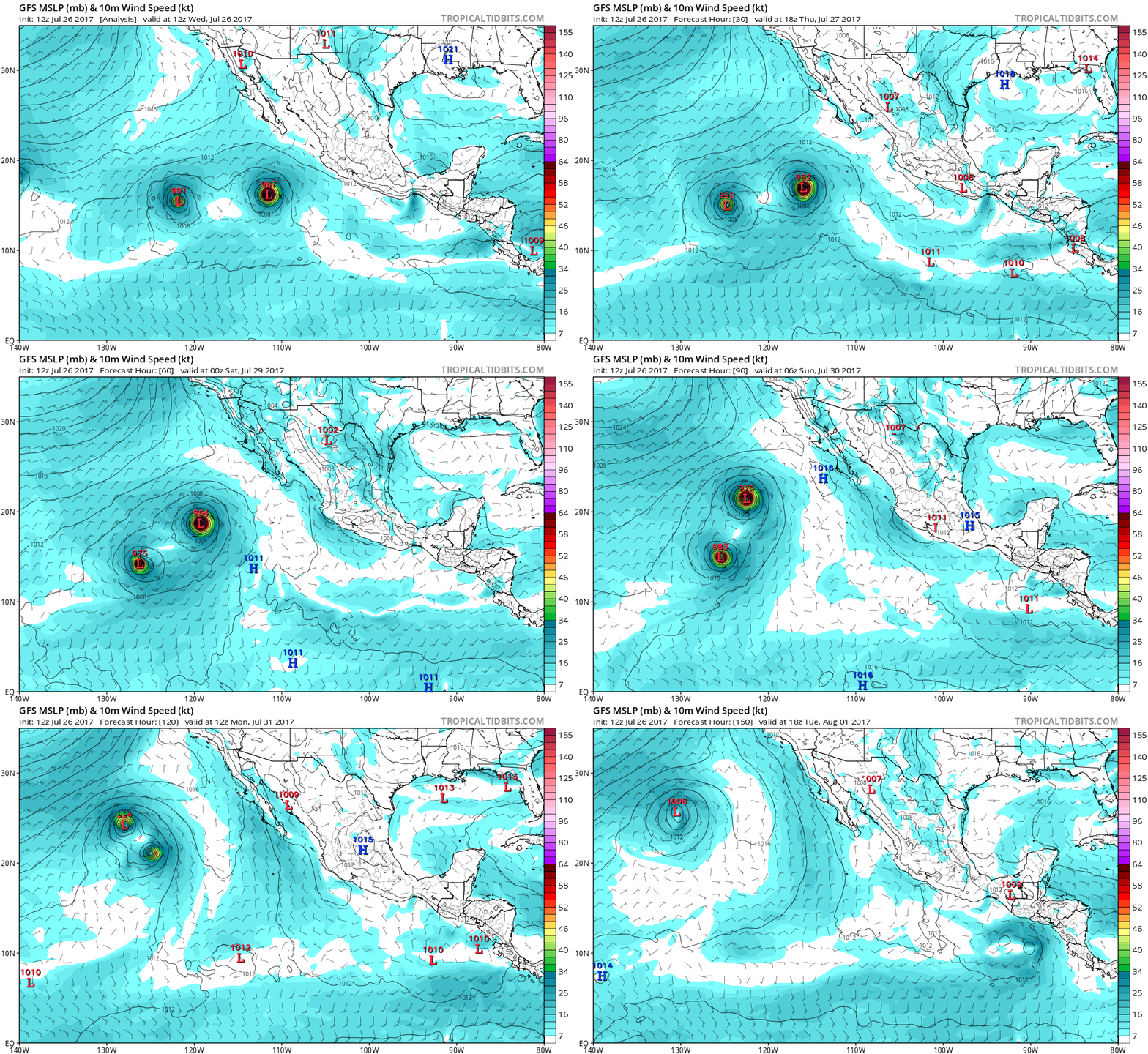
Furthermore, what is fascinating is some of the model output such as the GFS and ECMWF models have Tropical Storm Irwin and Hurricane Hilary experiencing a Fujiwhara Effect in the next few days: where both storms rotate relatively close to one another (counter-clockwise, where both storms are approximately less than 900 miles apart from each other). According to the models in this particular case, Tropical Storm Irwin will become engulfed into Hurricane Hilary in the later days. We will see what happens! Check out the GFS model run animation of this phenomena, initialized at 12Z, 26 July 2017 via the Tropical Tidbits website below.


