Quasi-Null case for lots of TPW over eastern Colorado on 29 July 2017
The GOES-16 data posted on this page are preliminary, non-operational data and are undergoing testing. Users bear all responsibility for inspecting the data prior to use and for the manner in which the data are utilized.
We’ve shown blog entries that highlight the value of the CIRA advected layer precipitable water (ALPW) product for heavy rain cases. Here we show a case of very high LPW during the monsoon circulation over western North America that affected eastern Colorado but this time failed to produce excessive rain.
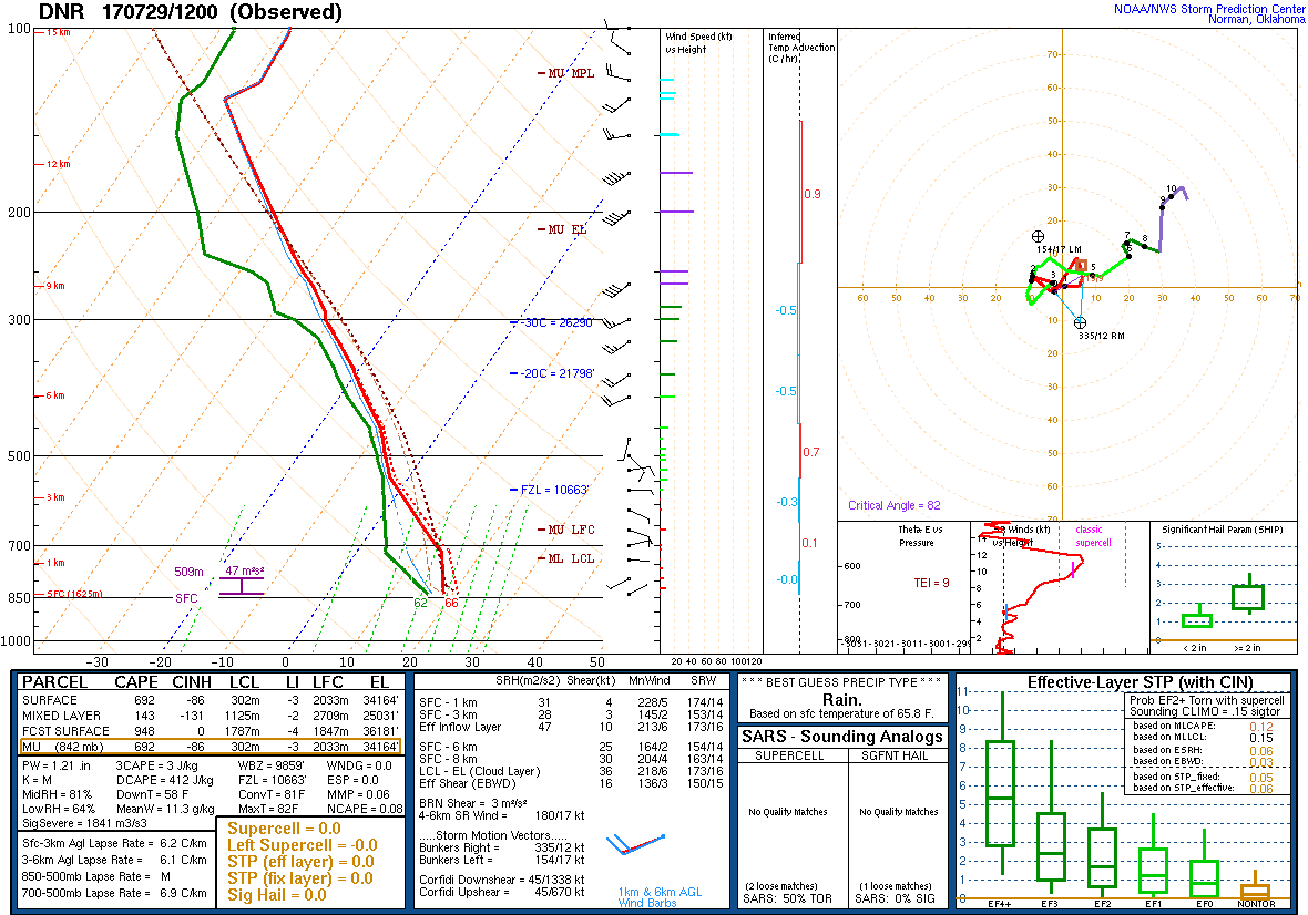
The 1200 UTC Denver sounding on 29 July 2017 was extremely moist:
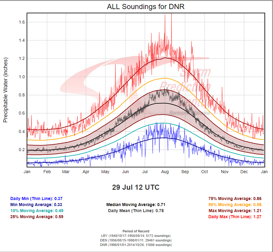
This was a near record TPW value for this day of 1.21″ as depicted on sounding climatology for Denver available from SPC:
The ALPW loop covering from near 00 UTC 28 July through 1800 UTC 30 July shows the peak of the monsoon surge of moisture over northeastern Colorado is on 29 July:
While the lower levels are too low for the elevated terrain of most of Colorado, the upper two layers show that the moisture was very deep. All of this pointed to a threat for potential flash flooding or at least heavy rain for the lower elevations of northeast Colorado on 29 July.
So what actually happened?
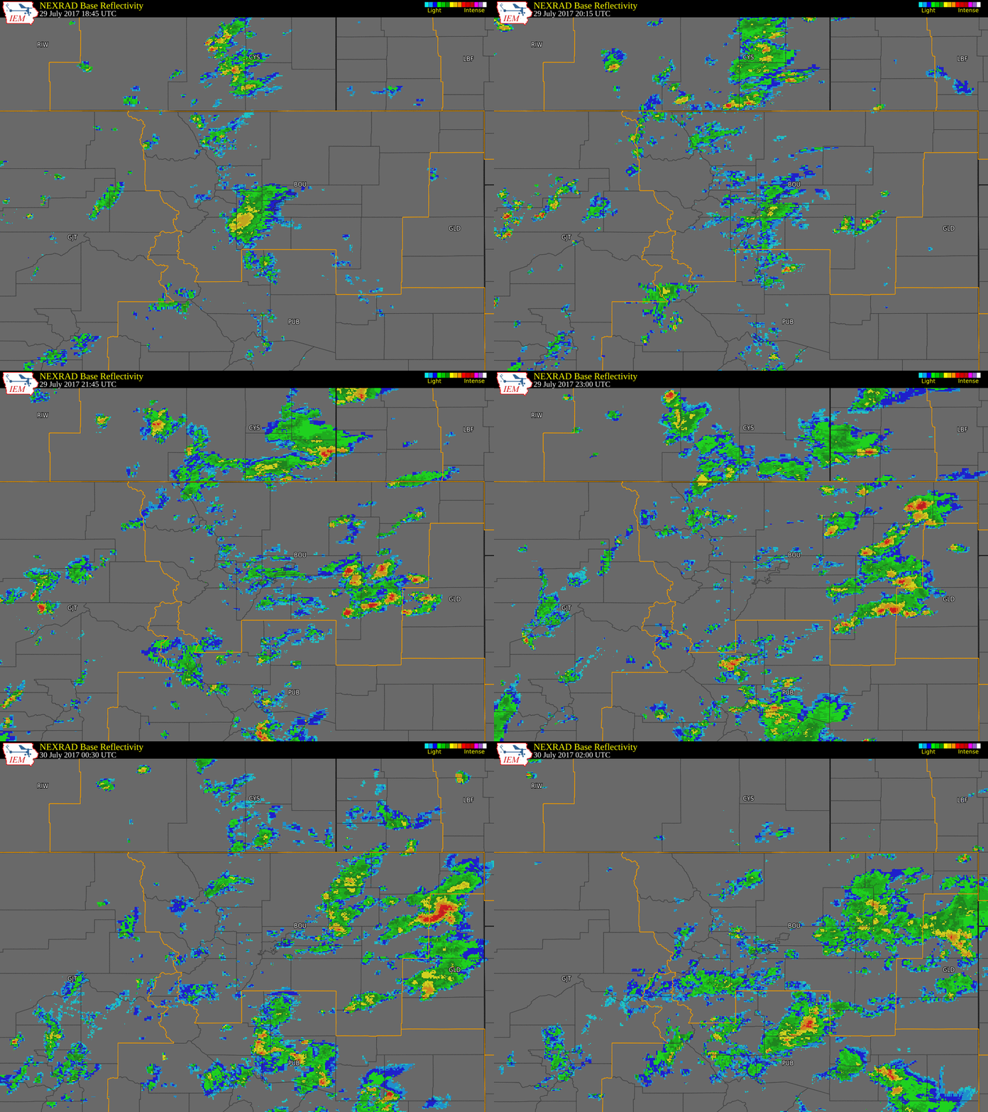
Here is a radar loop that spans the mid-day through evening hours:
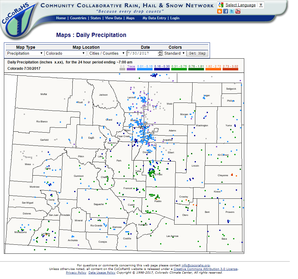
Substantial rain did occur over portions of the mountains west of the Urban Corridor of northeastern Colorado, but these moved very slowly and only light showers managed to move eastward on to the lower elevations. We can see that heavier showers did develop farther to the east but most of the populated areas along the Urban Corridor failed to receive much rain at all as seen in the CoCoRaHS rainfall reports:
Why didn’t these areas receive heavier rainfall in this abundantly moist atmosphere? One major factor is that there was so much moisture that the day began under considerable cloud cover. As the GOES-16 visible (0.64 micron) loop shows, the clouds never cleared over a large portion of northeastern Colorado:
Notice that where there was more sunshine further east and south, convection did develop with some flooding issues. Also, the convection in southeast Wyoming and far northeast Colorado produced what appear to be gravity waves on top of the lower-level cloud cover.
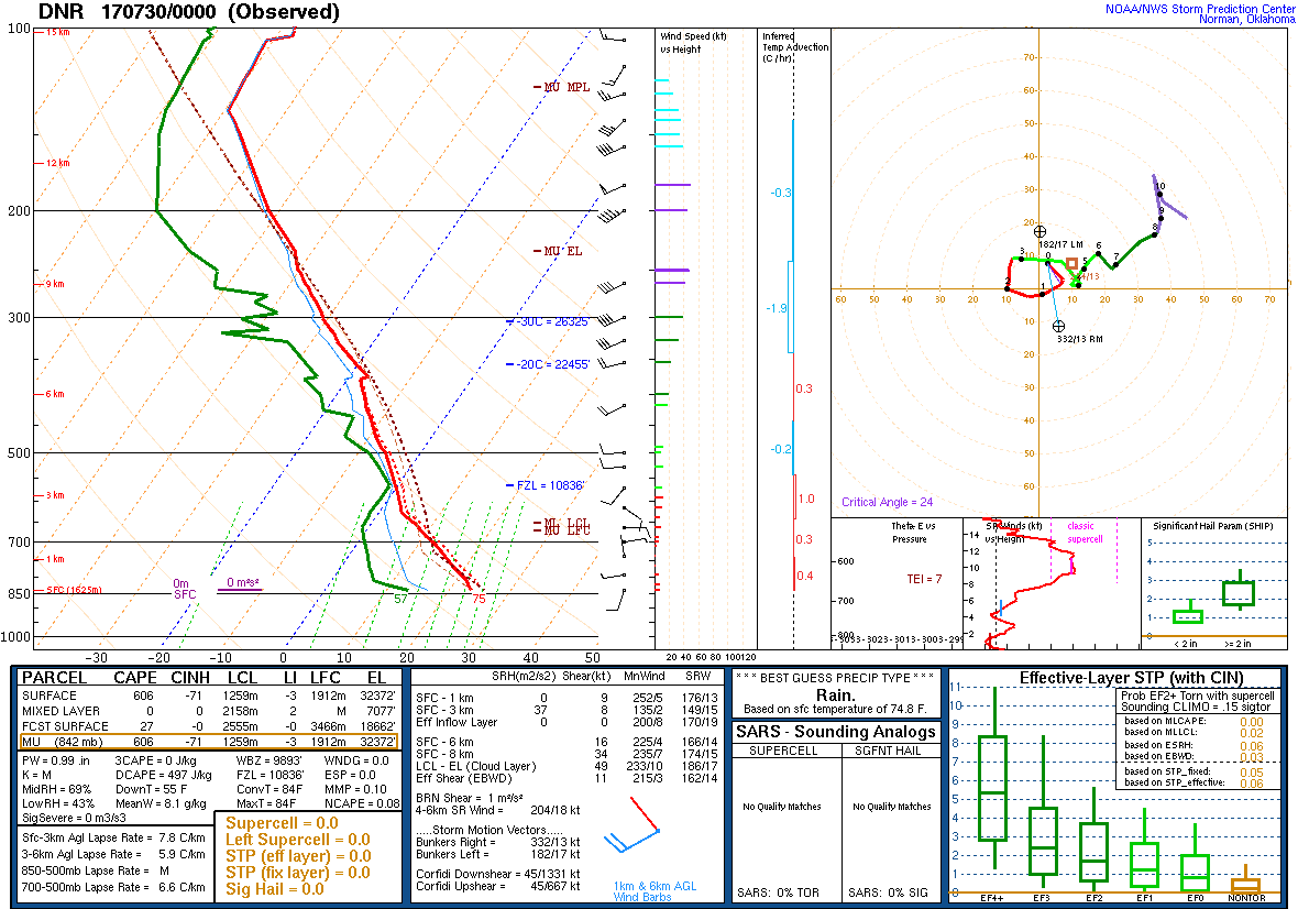
Sometimes, we can still get heavy rain along the Urban Corridor despite cloud cover if upslope is strong and deep, and/or there is a upper level shortwave. In the absence of these 2 possibilities, another scenario would be storms developing in the adjacent foothills moving eastward, but in this case it appears that the steering flow is very weak. Looking at the 00Z Denver sounding from 30 July:
There was drying in the lower levels, and we see there is one westerly wind barb. It’s possible that the weakening mountain storms sent a weak but fairly large scale outflow (perhaps just above the surface) onto the adjacent plains actually drying the lower levels, since this would be downslope flow. This stabilization along with the cool temperatures from the persistent cloud cover may have combined to prevent any heavy rains across the Urban Corridor on what appeared to be a day with high heavy rain potential.

