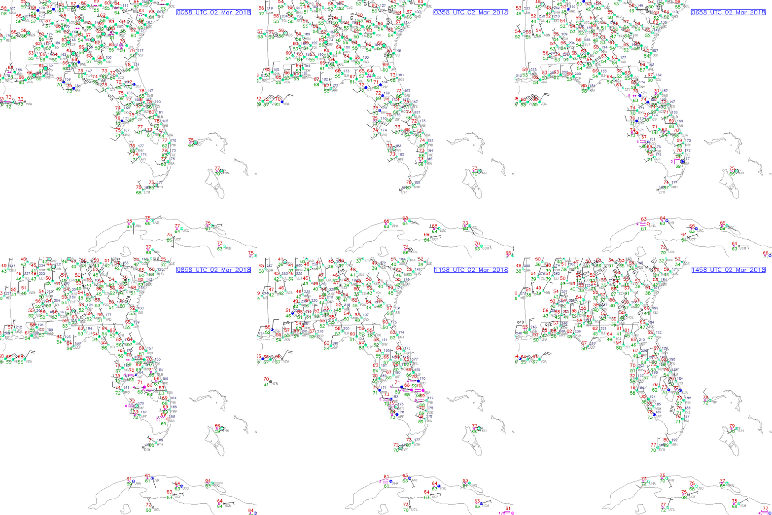
East Coast Weather….
Winter Storm Riley inundated the northeast United States with strong winds, storm surge and high amounts of rain and snow. Current snowfall totals over the northeast can be seen via the National Weather Service – Snowfall Reports web-link. The screenshot below, shows the snowfall distribution over the northeastern United States, with current snowfall observations (as of 2230 UTC, 2 March 2018) ranging from just a few inches (blue colors) to over 20 (red, maroon colors) in some areas!

A Near-Constant Contrast (NCC) image (below) taken at 0645 UTC, 2 March 2018, shows the large, areal extent of Riley, as Riley produced damaging winds and power outages across the northeast. Corresponding cloud cover (reflected light sources) and city lights (emitted light sources) can be also be seen in the imagery.

Another feature to highlight in the NCC imagery is the cold front across the state of Florida. Using the same image from above and zooming in to the state of Florida, notice the ambient cloud cover and elongated line of clouds, expressed horizontally. Although this is a static image at 0645 UTC, 2 March 2018, one can verify the elongated line of clouds is a cold front passing through the state, via surface observations.
Using surface observations at a similar time stamp (0658 UTC, 2 March 2018), there is a dramatic shift in winds, from north-northwesterly in northern Florida, to west-southwesterly winds in southern Florida (see red circle). The rapid change in wind direction is an indication of a front moving through the area, in this case, a cold front.

To see the cold front advect south, through the state of Florida, see the following animation. Notice the change in air temperatures (values in red), from low-to-mid 70’s to the upper 50’s, and lower 60’s. Animation is from 0058-1458 UTC, 2 March 2018. (Images courtesy of RAP Real Time Weather data)

