Hail swath observed by GOES-16
On 14 May 2018, a severe thunderstorm near Denver, Colorado resulted in accumulations of hail (reports of 2 to 6 inches in depth locally).
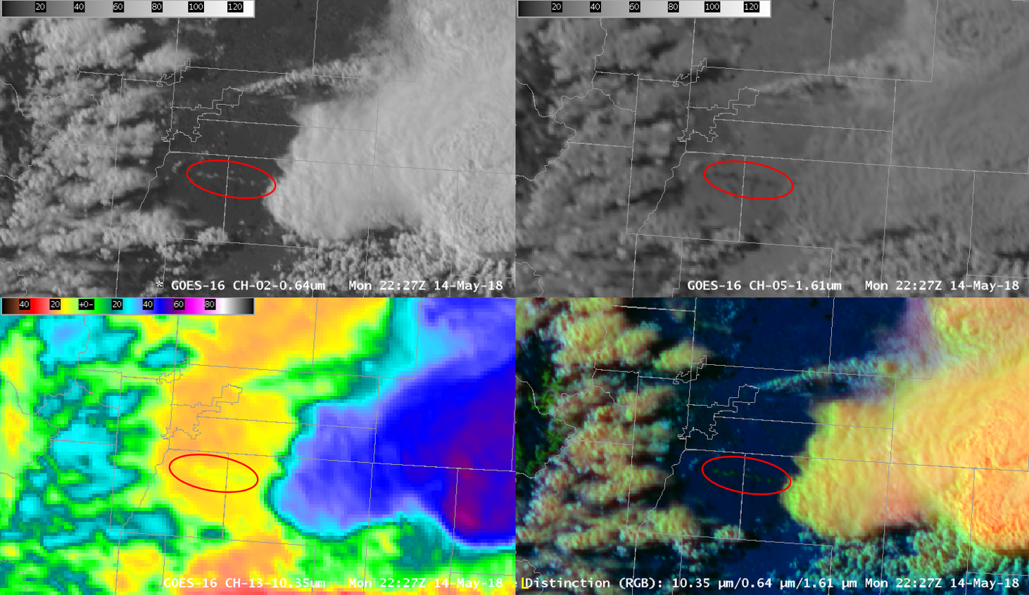
The hail swath left by the thunderstorm can easily be observed in GOES-16 imagery:
After the passage of the thunderstorms. The hail swatch can be seen as a line, see annotated image below for the hail swath:

The ground is white where hail accumulations occurred, much like snow cover. This is quite reflective in the visible (0.64 micron band) shown in the upper left, therefore it is white. At 1.6 microns (upper right), the hail absorbs radiation readily, therefore it is dark at this wavelength (black). In the lower left is the 10.3 micron band, the hail swath is colder than the surrounding ground, therefore it will have lower brightness temperatures than the surrounding ground. In this color table, yellow is colder than orange. Finally, the Day Cloud Phase Distinction RGB in the lower right. The Red component is the 10.3 micron band, the Green component is the 0.64 micron band and the Blue component is the 1.6 micron band. The hail swath shows up as green. Why? There is a strong contribution from the visible band (green) since the hail swath is highly reflective. There is little contribution from 1.6 microns since the ice absorbs efficiently (dark) and also from 10.3 microns since it is only slightly colder than the surrounding ground. Snow cover typically displays as green in this RGB for these reasons, in fact snow cover can be observed over the western portions of this scene along the mountains.
