Observing sea surface temperatures from GOES and JPSS
Observing sea surface temperatures (SSTs) from satellite is an important aspect in weather forecasting for a variety of applications. Applications consist of (but not limited to) forecasting hurricane intensity, sea fog, and convection over the oceans. But remember, oceans are vast, making up ~70% of the Earth’s surface, and more importantly, oceans are remote, where surface observations are scarce. This is where satellite observations come into play, and can complement other data observations (e.g. radar, surface) to address certain weather forecasting applications.
Below, is a comparison between GOES16 SST and GCOM AMSR-2 SST observing the Gulf Stream on 6 February 2019. The comparison will highlight the benefits and limitations of each product.
GOES16 – SST @1900Z, 6 February 2019
The geostationary product provides users hourly data (i.e. 15-minute data averaged into a 1-hour composite), at high spatial resolution of 2-kilometers. The product is derived from four, infrared, GOES16 ABI spectral channels: 8.4um, 10.3um, 11.2um, 12.3um. In the static GOES16 SST image below, notice the array of sea surface temperatures ranging from ~15°C to +30°C. However, also note the irregular, black colors, seen over the ocean. This irregularity is cloud cover and one of the limitations of GOES16 SST. Infrared satellite retrievals can only be produced in clear-sky environments.

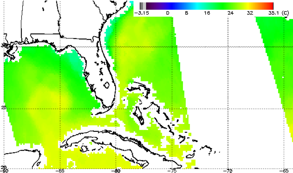
GCOM AMSR2 – SST @ ~1843Z, 6 February 2019
Now in contrast to GOES16 SST, GCOM (a polar-orbiting satellite) AMSR2 SST is able to produce passive microwave SST retrievals in both clear-sky and cloudy environments. However, precipitating regions are problematic as well. In the imagery below, over the same domain, at approximately the same time (offset by 17 minutes), GCOM AMSR2 SSTs are observed. Notice there is also missing data (expressed in white colors over the ocean) in the imagery, however it is not due to clouds. The missing data is expressed via ‘data gap’, east of Florida. This is one of the limitations of polar-orbiters, in that polar-orbiters provide coverage up to ~2 times a day and GCOM AMSR2’s orbital swath does not overlap. Other limitations are GCOM AMSR2 SST’s coarser resolution (10 kilometers) and missing data over coastlines. Since microwave radiation is significantly different between land and ocean, SST retrievals that ‘do not’ have land in the field-of-view are considered.

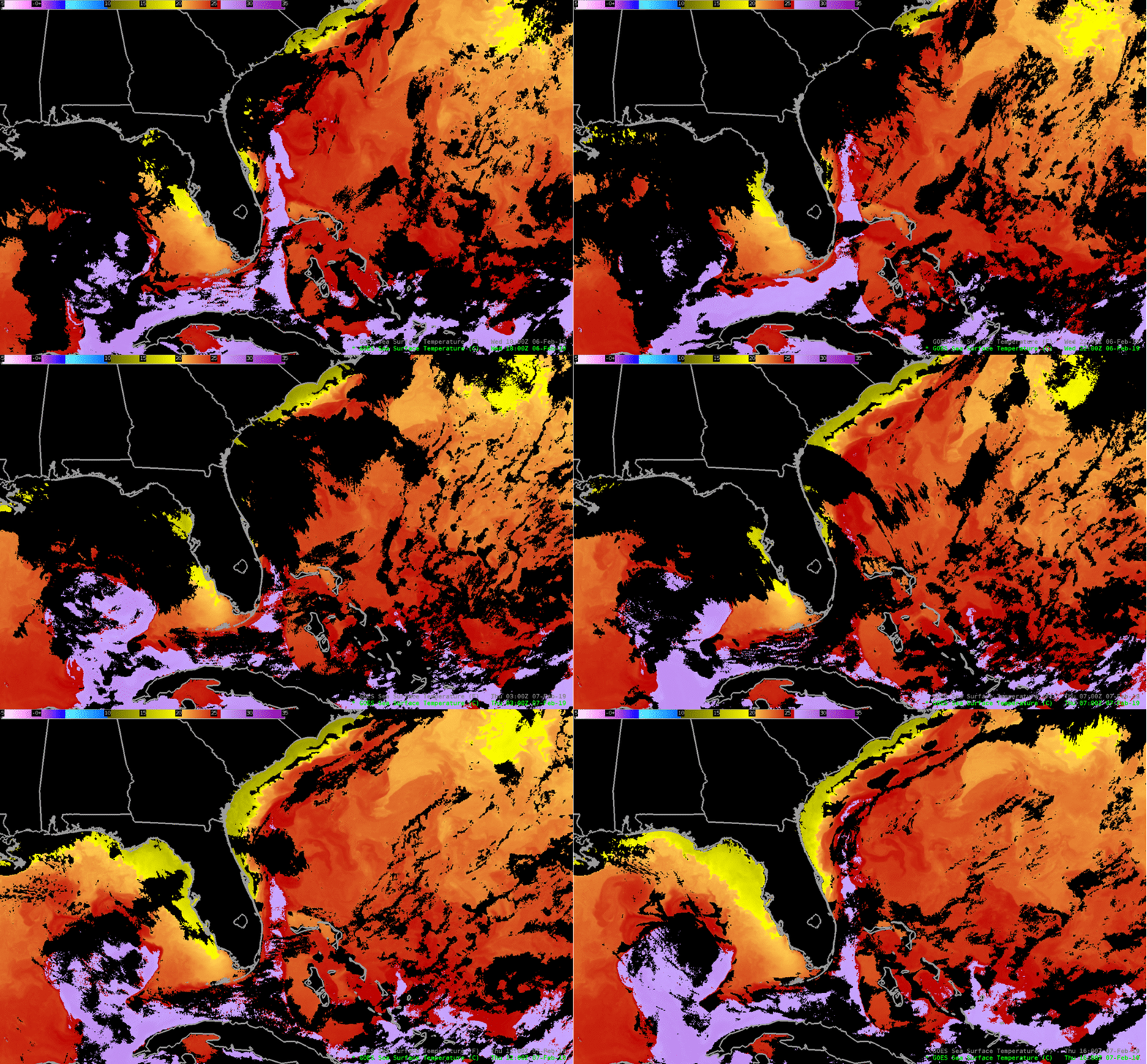
GOES16 – SST Animation from 18Z, 6 February 2019 –> 16Z, 7 February 2019
For fun, here is an animation of the GOES SST, demonstrating its high temporal resolution, while observing the Gulf Stream moving near and around Florida: moving northward, up the southeastern coastline.

For interested readers, click on the following link to discover examples of polar-orbiting and geostationary data, combined together, to produce blended 5-km SST retrievals.
