High Plains Snowstorm
A strong extratropical cyclone moved through the Rocky Mountains and western high plains over the course of 10 April 2019. The low-pressure system produced heavy precipitation in the forms of rain and snow, along with blustery winds.
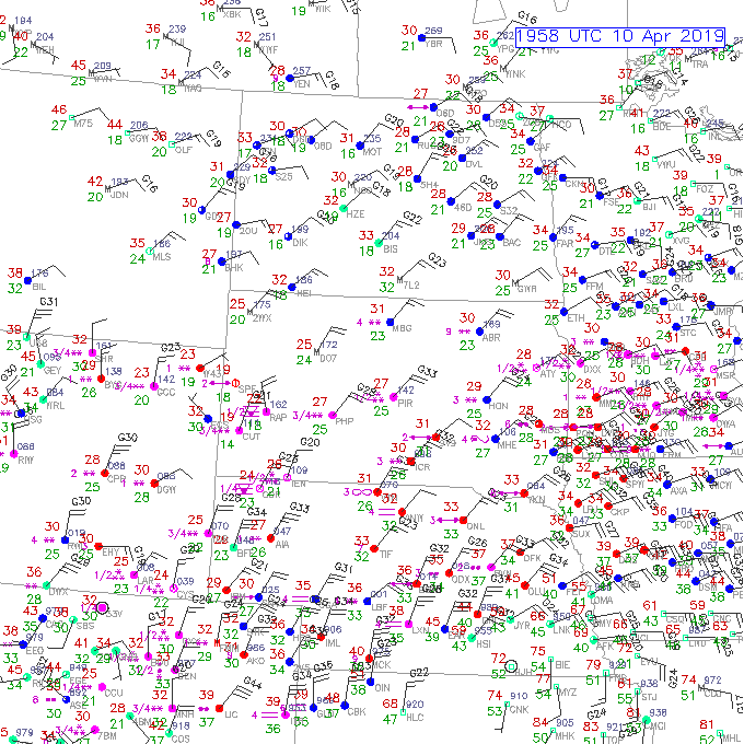
The system produced heavy snow over a large areal extent spanning from Colorado, Wyoming, portions of Nebraska and South Dakota. Below are surface observations captured at ~20 UTC, 10 April 2019. Note the areas of snow designated by pink asterisks, where the increase in the number of asterisks corresponds with the increase in snow intensity. Northerly and northeasterly high winds gusting over 40 mph were observed as well.
Surface Observations – at 1958 UTC, 10 April 2019

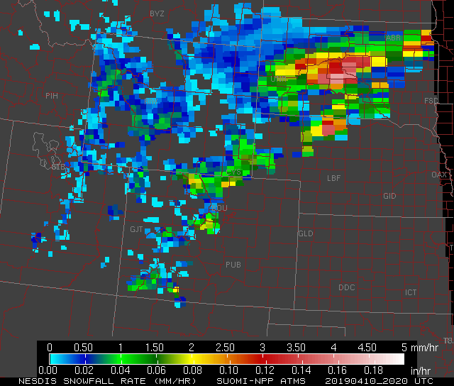
In complement to the surface observations are microwave observations from polar-orbiting satellites, notably, in the form of the Blended Snowfall Rate (SFR) product exhibiting a liquid equivalent snowfall rate. Image below is a static SFR product from the Advanced Technology Microwave Sounder (ATMS) instrument on-board the Suomi-National Polar-orbiting Partnership (S-NPP) satellite. Note high liquid equivalent snowfall rates are observed in north-central Colorado, southeast Wyoming, north-central Nebraska and South Dakota, where heavy snowfall rates in South Dakota ranged from 1.5-4 mm/hr or 0.06-0.16 inches/hr. Another benefit of SFR is the product can observe snowfall rates over large domains, where in comparison to radar, radar coverage can be limited due to data gaps or beam blockages.
S-NPP ATMS -Liquid equivalent snowfall rate at 2020 UTC, 10 April 2019.

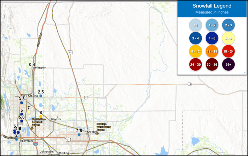
In the following two images, notice the National Weather Service (NWS) ‘preliminary’ high snow totals observed over western South Dakota and north-central Colorado are located over the same domains as the high snowfall rates observed by the SFR product.
NWS Preliminary Snow Totals as of o1oo UTC, 11 April 2019 over Western South Dakota

NWS Preliminary Snow Totals as of o1oo UTC, 11 April 2019 over the Front Range of Colorado

