21 October 2019 – nighttime detection of fog and outflow boundaries
During the overnight hours of 21 October 2019, we analyze multiple applications of GOES imagery at night.
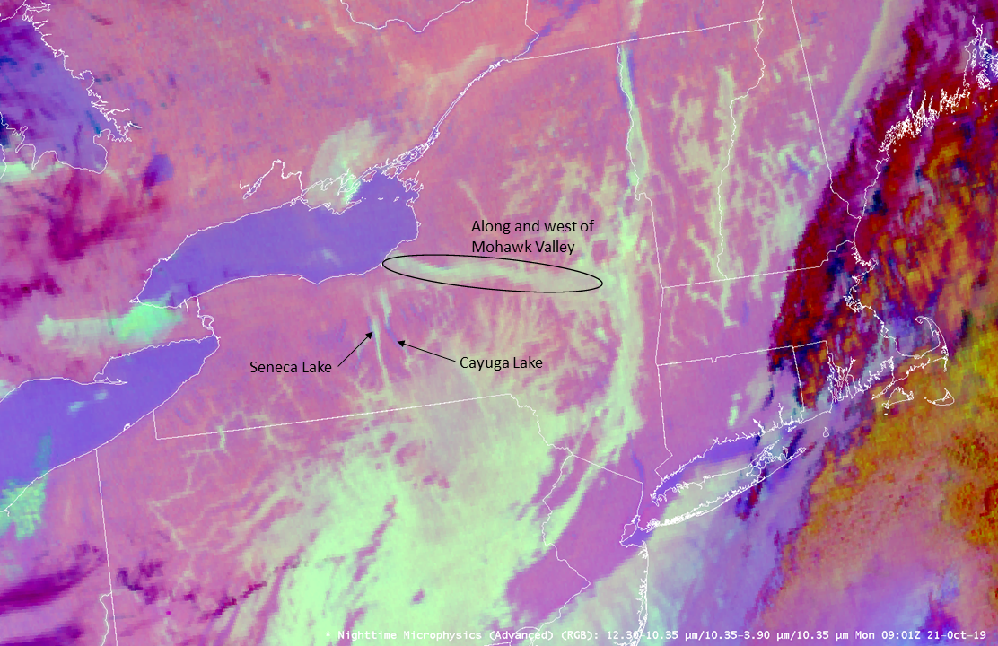
First, we look over the northeast where fog developed. Here is the GOES-16 nighttime microphysics product:
We observe large areas of fog (dull aqua) or low clouds (aqua) in Pennsylvania, New York, Vermont, New Hampshire and Massachusetts. Fog development in river valleys is particularly more easy to identify. Focus in over New York:

where the loop shows the westward movement of fog / low cloud from the Mohawk River Valley westward towards Lake Ontario. We also see the development of fog along Seneca Lake and Cayuga Lake.
Further southwest in Texas, severe thunderstorms developed during the evening hours of 20 October that continued through the overnight hours. The following GOES-16 imagery:
is a 4 panel display:
Upper-left: Split Window Difference / IR (10.3 micron) combination product
Upper-right: Nighttime microphysics RGB
Lower-left: IR (10.3 microns) with the default color table (IR_Color_Clouds_Winter)
Lower-right: Night Fog product (10.3 minus 3.9 micron)
Analyze the southern and western flanks of thunderstorms for regions of outflow (cooler brightness temperatures). Outflow boundaries can be important to analyze for mesoanalysis and potential future convection developing along or interacting with these boundaries.
Which of these imagery / products can you best identify the thunderstorm outflow air mass / boundaries with? Note that in some regions there are low clouds associated with the outflow. The IR imagery with the default color table has less contrast compared to other imagery / products for the detection of regions of outflow. Remember to look at other products for outflow detection at nighttime besides the IR (10.3 micron) band alone.
