Lake-effect snow from 7 November 2019
GOES-16 imagery depicts lake-effect snowbands over the western Great Lakes on 7 November 2019:
Upper left: 0.64 micron visible band
Upper right: 10.3 micron IR band with default color table (IR_Color_Clouds_Winter)
Lower left: 10.3 micron IR band with GOES Snow Squall color table
Lower right: Day Cloud Phase Distinction RGB
The 0.64 micron visible band provides detailed information on the location of the band, but reflectance values do not provide information about the intensity of the band.
IR imagery at 10.3 microns provides cloud top brightness temperatures, however lake-effect snowbands are typically shallow so that the difference in a precipitating lake-effect band and non-precipitating band is small. The small difference may not even be easy to identify if the color table has insufficient contrast around those brightness temperatures, as we see in the IR imagery with the IR_Color_Clouds_Winter color table. The IR imagery with the GOES Snow Squall color table helps somewhat but does not provide information on glaciation like the next product.
Finally, the Day Cloud Phase Distinction RGB provides the most useful information at a glance for assessing lake-effect snowbands. Not only does it identify the location of the snowbands, but also indicates clouds that are glaciated versus clouds that are not glaciated due to the 1.6 micron band. In this RGB product, glaciated clouds have transitioned from light blue to green (and perhaps even yellow if more developed although not shown in this case). This allows one to identify clouds that have glaciated and thus much more likely to be producing precipitation, even heavier precipitation if conditions are favorable.
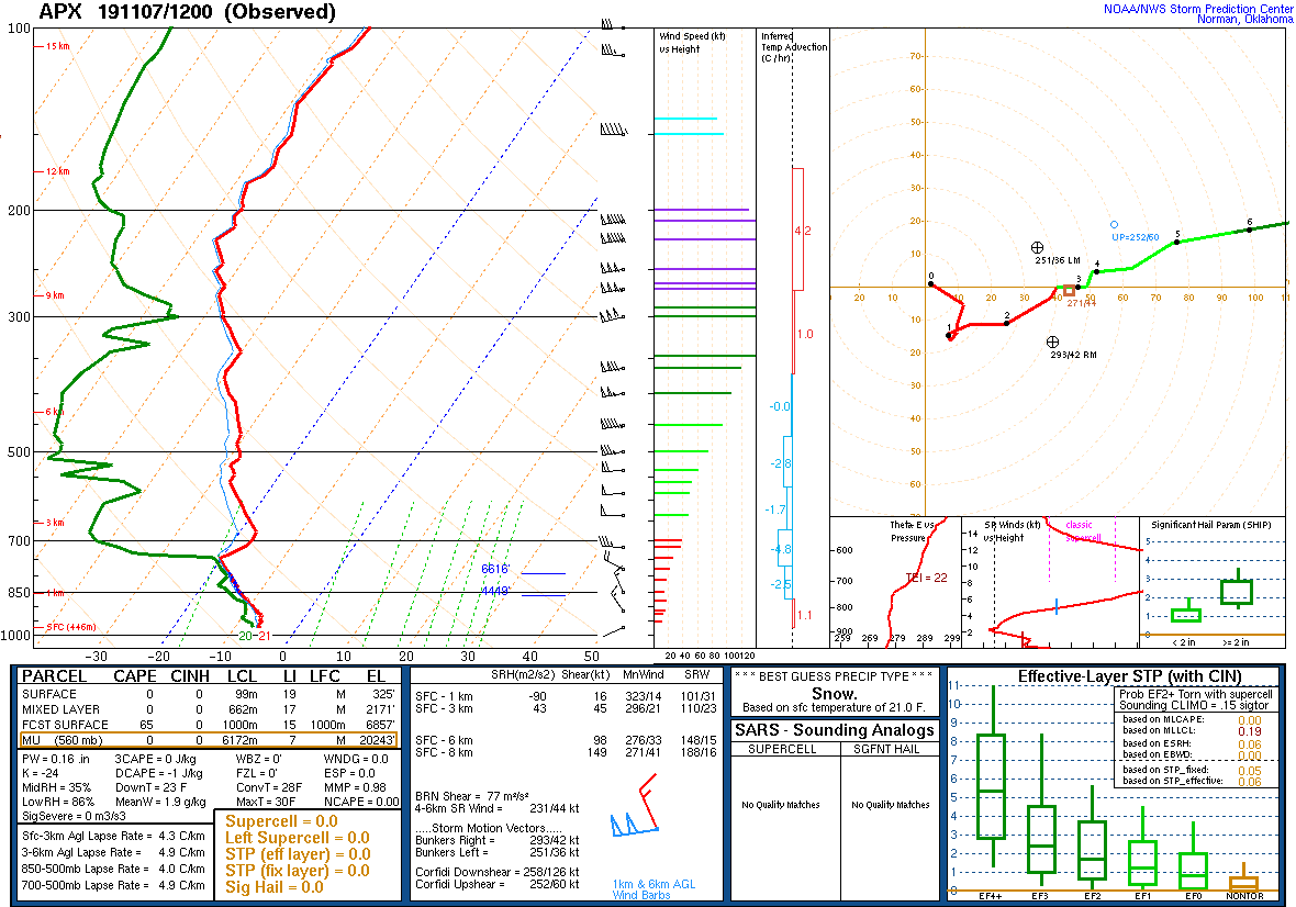
The sounding from Alpena, MI provides useful information about the environment:

The sounding supports lake-effect snow in the region with the deeper PBL and large low-level lapse rates under the capping inversion. Note the winds are northwest in this layer, indicating this airmass was modified by sensible and latent heat fluxes from Lakes Superior and Michigan.
