Elevated Mixed Layer event on 16 December 2019
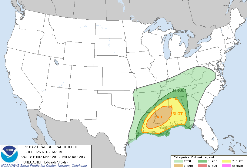
On 16 December 2019, SPC issued an enhanced risk of severe thunderstorms for portions of Louisiana and Mississippi:

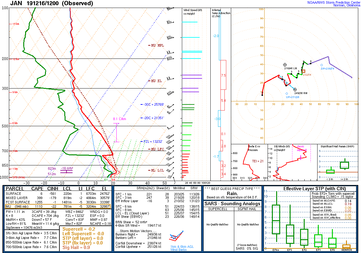
One of the favorable ingredients for this severe weather setup was the presence of an Elevated Mixed Layer (EML) which is depicted in the 12Z Jackson, MS sounding:

The EML is bounded between the capping inversion around 750 mb and the higher RH around 500 mb. Within this layer, the relative humidity is quite low with a source region off the elevated plateau of northern Mexico. Lapse-rates within this layer are relatively high, 700-500 mb lapse rate is 7.6 degrees C / km and the maximum is shown in the magenta layer on the sounding of 8.1 degrees C / km.
At times, the EML may show itself as a region of warmer brightness temperatures in the GOES 7.3 micron imagery. In this particular case, the region of warmer brightness temperatures may be traced back to diurnal heating from the previous day over the elevated Mexican plateau and advecting northeastward across Texas, Louisiana and Mississippi:
Clouds develop during the early morning hours which obscure the EML signature, however it may still be tracked via the Advected Layer Precipitable Water (ALPW) product:
ALPW is a product based on microwave instruments aboard polar satellites which can see through most clouds. The 700-500 mb layer is useful in that it depicts the source region of the dry air associated with the EML and it can be tracked towards Mississippi. This dry air exists underneath a moist air mass with origins from the Gulf of Mexico as seen in ALPW in the lower layers. ALPW allows a four dimensional perspective of assessing moisture in the vertical in time.
More information on EML tracking via satellite imagery and products:
