
Fall 2019 through Winter 2020 Heavy Precipitation Events
By Sheldon Kusselson
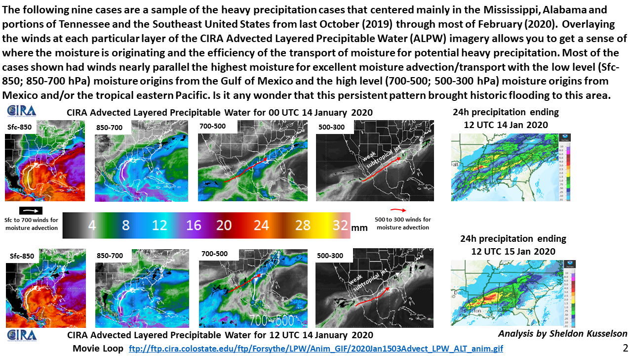
ftp://ftp.cira.colostate.edu/ftp/Forsythe/LPW/Anim_GIF/2020Jan1503Advect_LPW_ALT_anim.gif
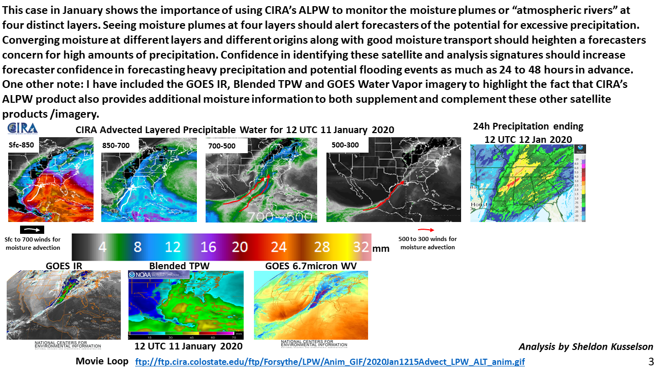
ftp://ftp.cira.colostate.edu/ftp/Forsythe/LPW/Anim_GIF/2020Jan1215Advect_LPW_ALT_anim.gif
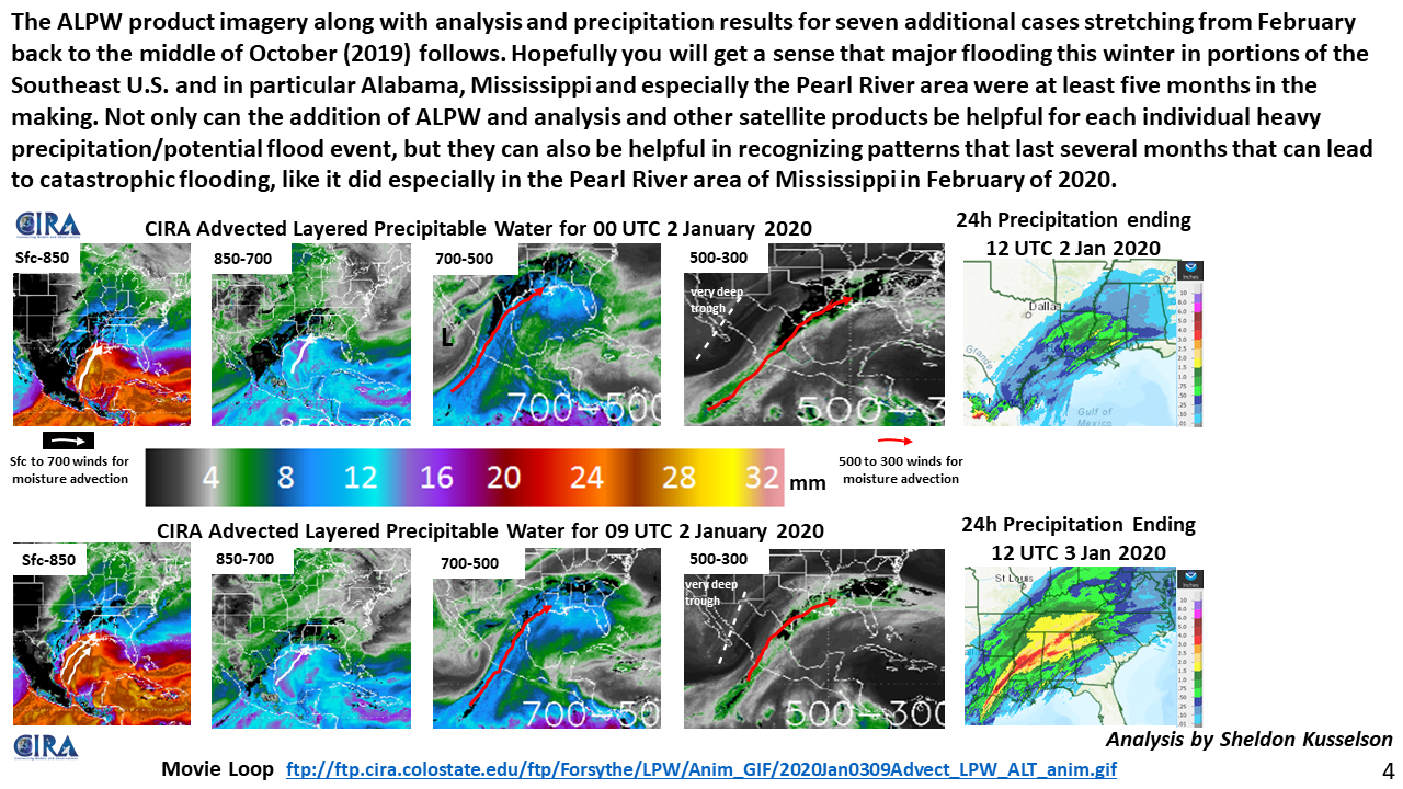
ftp://ftp.cira.colostate.edu/ftp/Forsythe/LPW/Anim_GIF/2020Jan0309Advect_LPW_ALT_anim.gif
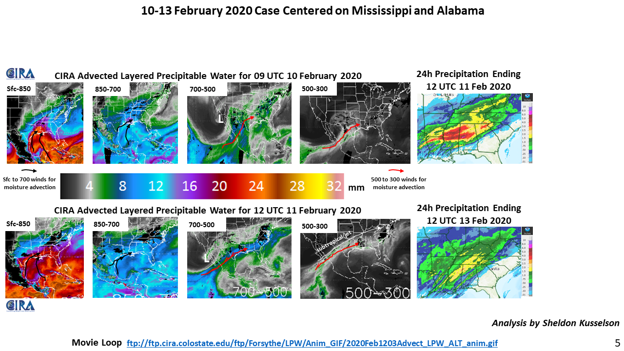
ftp://ftp.cira.colostate.edu/ftp/Forsythe/LPW/Anim_GIF/2020Feb1203Advect_LPW_ALT_anim.gif
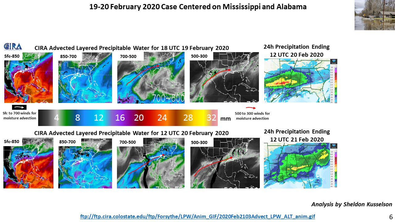
ftp://ftp.cira.colostate.edu/ftp/Forsythe/LPW/Anim_GIF/2020Feb2103Advect_LPW_ALT_anim.gif
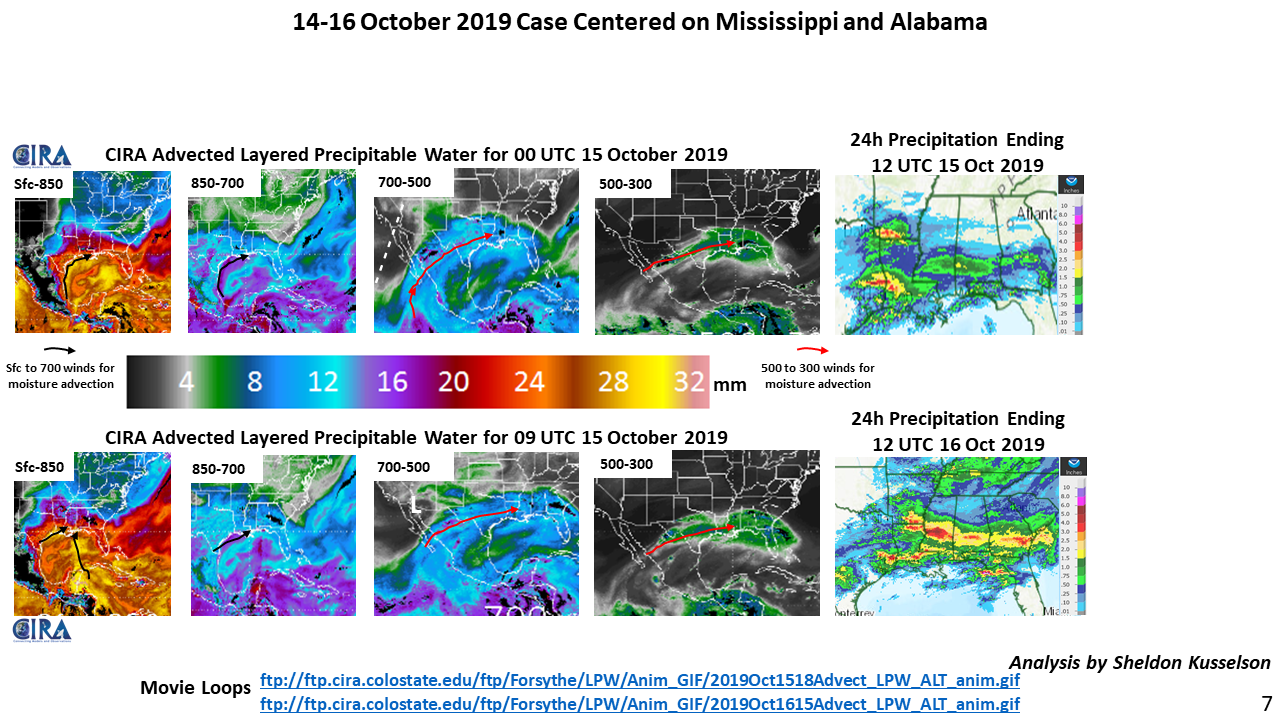
ftp://ftp.cira.colostate.edu/ftp/Forsythe/LPW/Anim_GIF/2019Oct1518Advect_LPW_ALT_anim.gif
ftp://ftp.cira.colostate.edu/ftp/Forsythe/LPW/Anim_GIF/2019Oct1615Advect_LPW_ALT_anim.gif
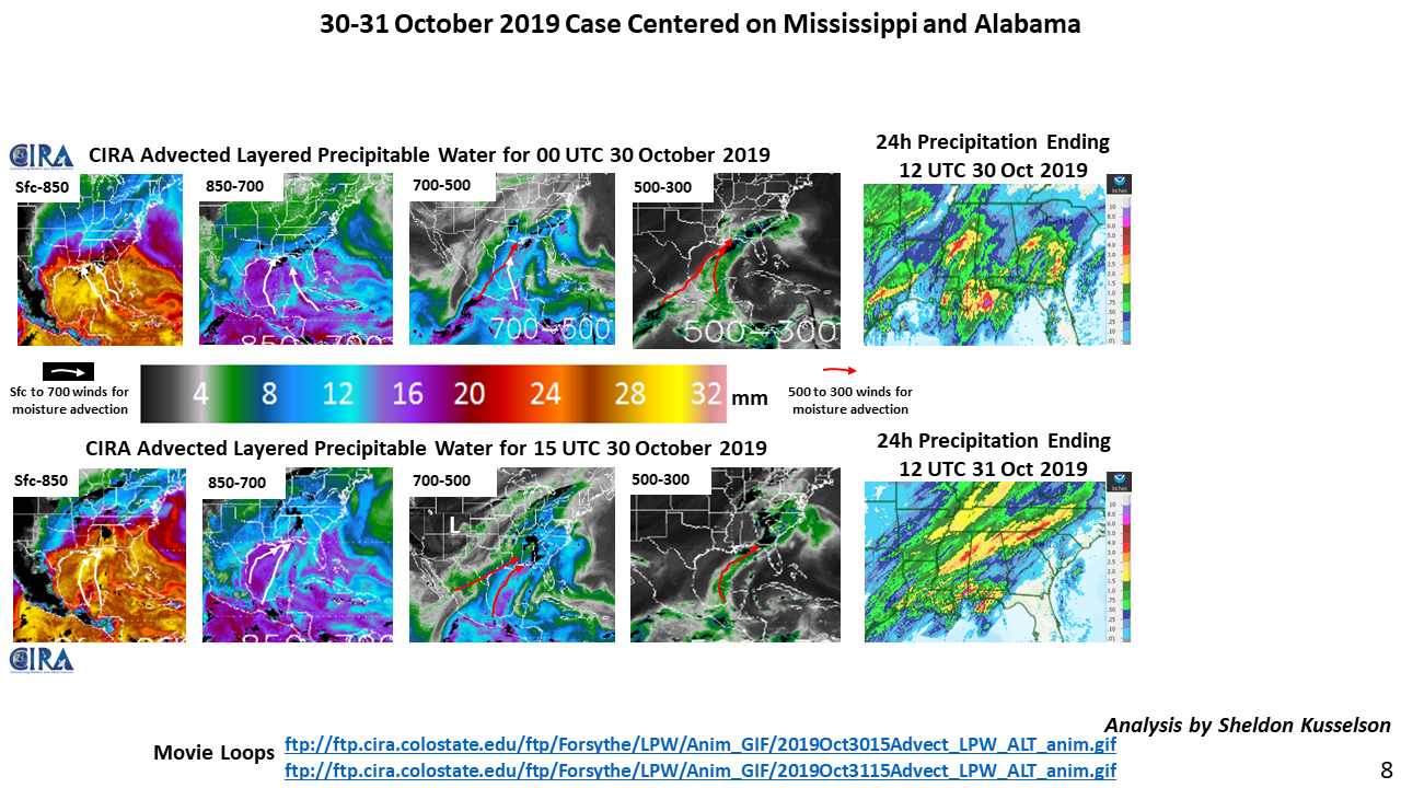
ftp://ftp.cira.colostate.edu/ftp/Forsythe/LPW/Anim_GIF/2019Oct3015Advect_LPW_ALT_anim.gif
ftp://ftp.cira.colostate.edu/ftp/Forsythe/LPW/Anim_GIF/2019Oct3115Advect_LPW_ALT_anim.gif
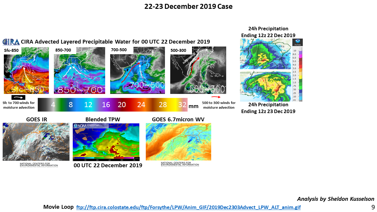
ftp://ftp.cira.colostate.edu/ftp/Forsythe/LPW/Anim_GIF/2019Dec2303Advect_LPW_ALT_anim.gif
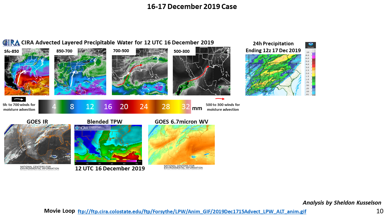
ftp://ftp.cira.colostate.edu/ftp/Forsythe/LPW/Anim_GIF/2019Dec1715Advect_LPW_ALT_anim.gif

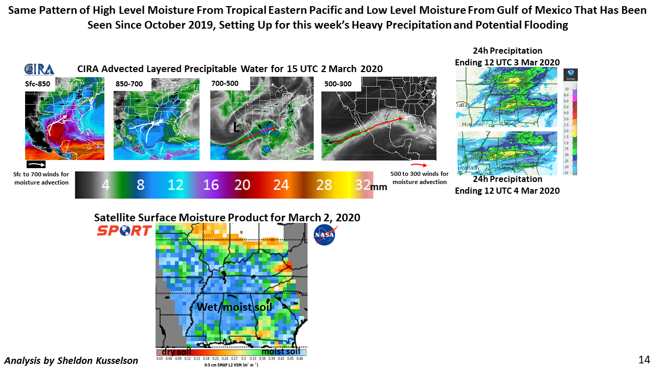
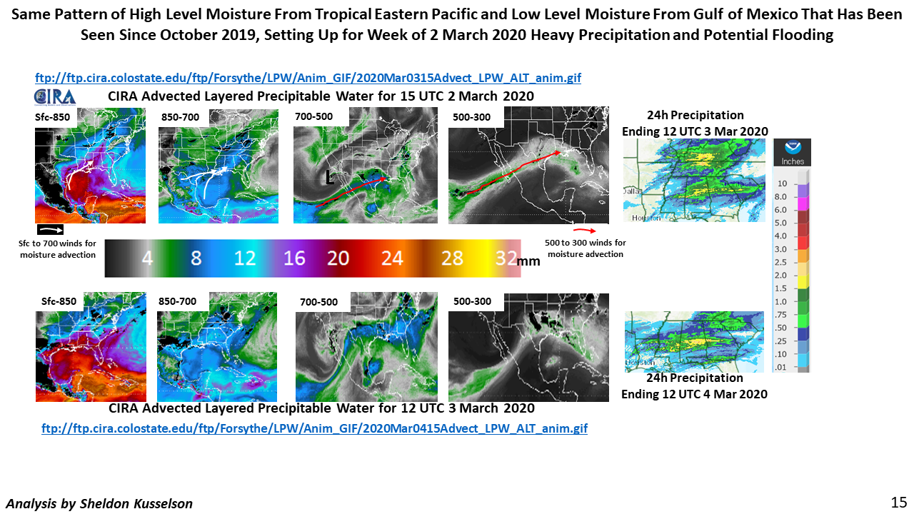
ftp://ftp.cira.colostate.edu/ftp/Forsythe/LPW/Anim_GIF/2020Mar0315Advect_LPW_ALT_anim.gif
ftp://ftp.cira.colostate.edu/ftp/Forsythe/LPW/Anim_GIF/2020Mar0415Advect_LPW_ALT_anim.gif
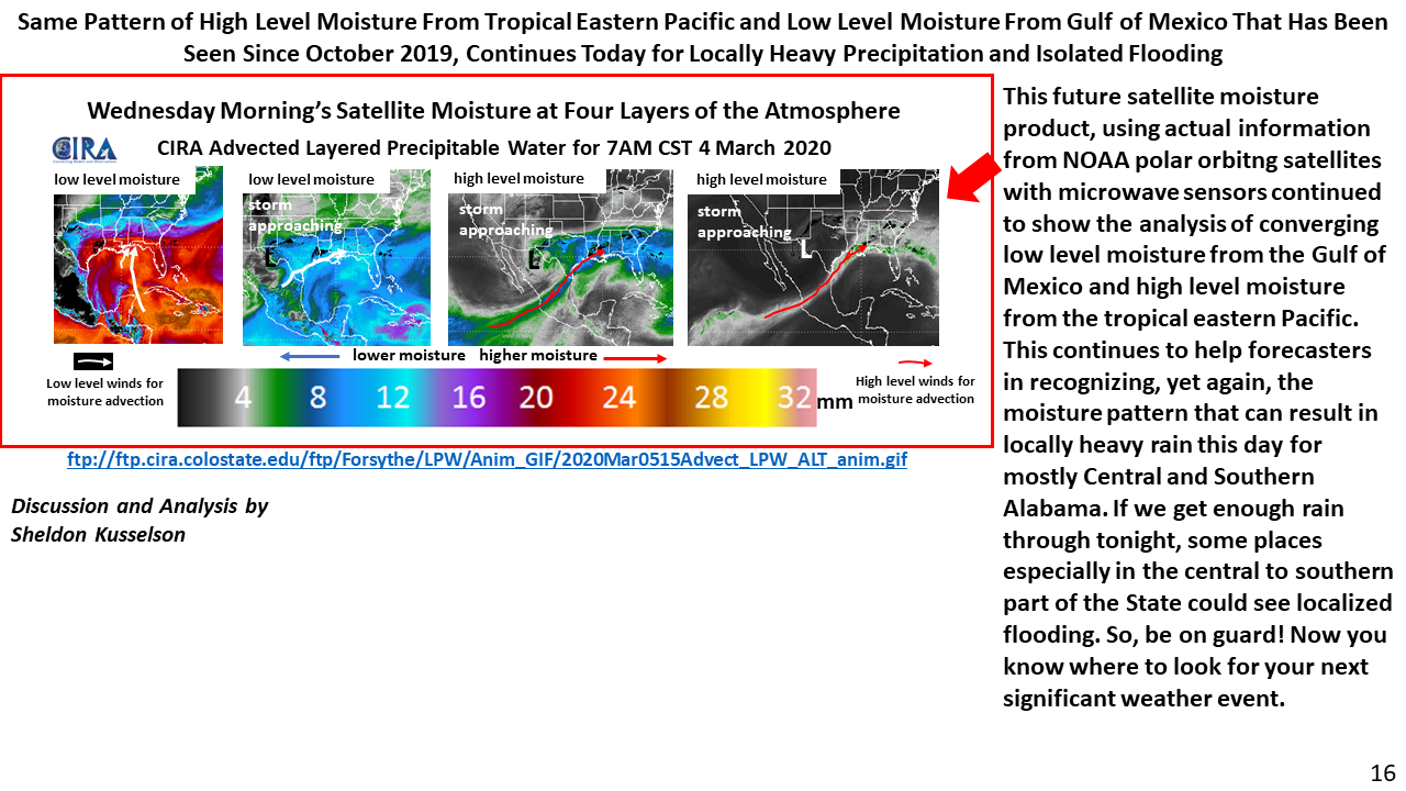
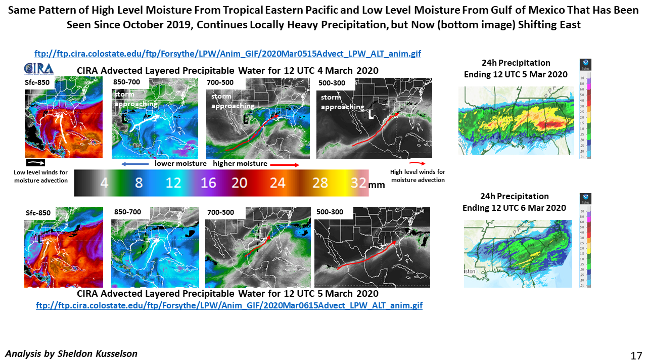
ftp://ftp.cira.colostate.edu/ftp/Forsythe/LPW/Anim_GIF/2020Mar0515Advect_LPW_ALT_anim.gif
ftp://ftp.cira.colostate.edu/ftp/Forsythe/LPW/Anim_GIF/2020Mar0515Advect_LPW_ALT_anim.gif
ftp://ftp.cira.colostate.edu/ftp/Forsythe/LPW/Anim_GIF/2020Mar0615Advect_LPW_ALT_anim.gif