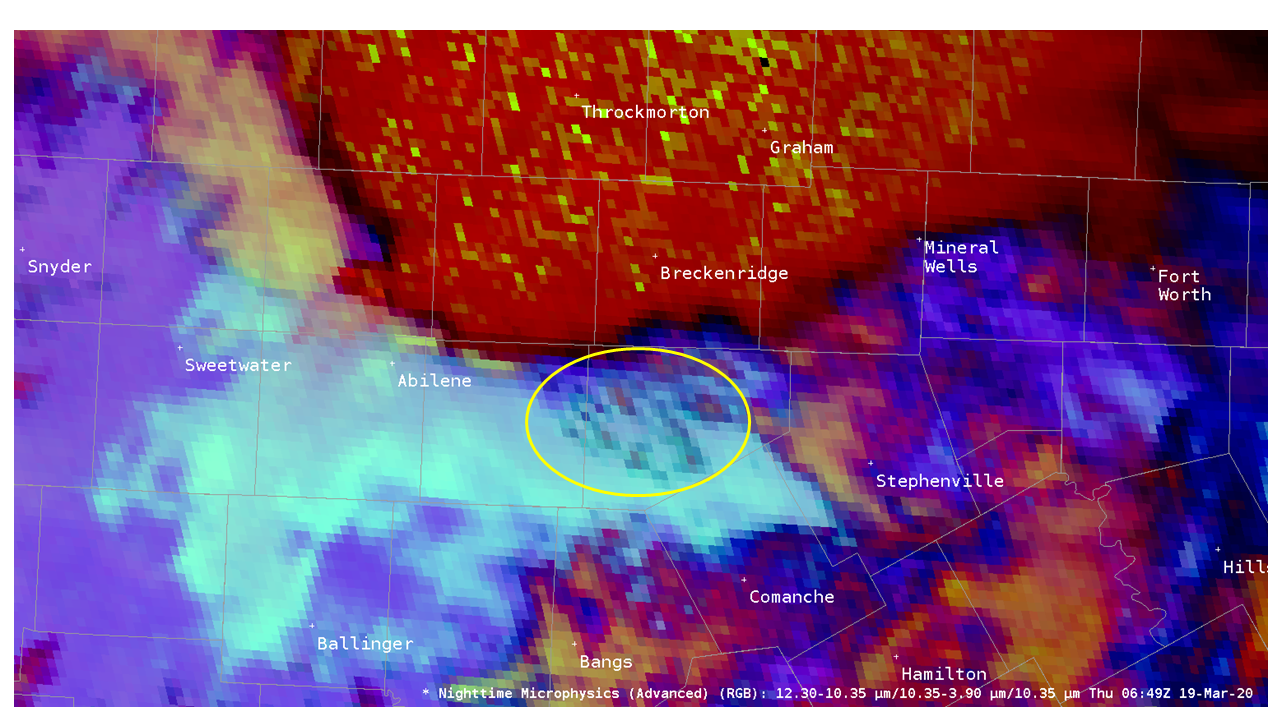
Nighttime view of inflow feeder clouds from GOES Nighttime Microphysics RGB
During the overnight hours of March 18-19, 2020, there were numerous reports of severe weather (including tornadoes) in north Texas:
https://www.spc.noaa.gov/climo/reports/200318_rpts.html
This blog entry will focus on the storm repsonsible for the tornado reports between 0615 – 0650 UTC near Abilene, TX.
The storm of interest can be viewed in this 4-panel display zoomed in to the storm near Abilene, TX:
Upper-left: GOES-16 Nighttime Microphysics RGB
Upper-right: GOES-16 IR (10.3 micron) band with default color table
Lower-left: GOES-16 Flash Extent Density grid (1 minute update)
Lower-right: MRMS 0.5 km MSL composite reflectivity
Note the clouds that develop east of Abilene that are circled here:

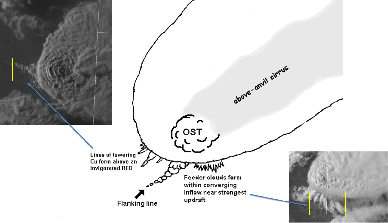
The clouds are bands oriented parallel to the low-level wind direction and exist in the converging inflow region of the storm. These are inflow feeder clouds – see this schematic which depicts where they are typically found (to the right of the flanking line in this diagram) and some examples to illustrate how they may appear in visible imagery:

Since the resolution of the IR bands more coarse than that of visible bands, it’s typically more difficult to identify storm scale features seen from satellite at night such as inflow feeder clouds. In this case, they are not obscured by anvil cirrus and can be seen, albeit not as clearly as they typically appear with visible imagery analysis during daytime.
Let’s zoom in to view a larger perspective of the nighttime microphysics RGB:
Note that a mesoscale domain sector was available at this time, providing 1-minute imagery that was likely crucial for detecting inflow feeder clouds. How does this compare with other bands and products?
First, the IR imagery with the default color enhancement:
A different color table applied to the same imagery:
and the fog product:
The nighttime microphysics product appears to offer the most unambiguous view of the inflow feeder clouds at night.
