Mountain Fire, California
On the morning of 6 November 2024, the Mountain Fire erupted, and fueled by strong winds, the fire spread southwestward towards cities located along the California coastline. The GOES-18 GeoColor product (see below) observed the fire and the corresponding smoke plumes from ~18-21Z, 6 November 2024. The narrow, long, smoke plumes advected westward offshore and eventually inundated the neighboring Anacapa, Santa Cruz and Santa Rosa islands.
Over the same time period, the GOES-18 Fire Temperature RGB provided a qualitative estimate of the fire intensities of the Mountain Fire. The RGB depicts fire pixels as red, orange, yellow and white colors. The red colors exhibit “warm fires”, orange colors as “very warm fires”, yellow colors as “hot fires” and white colors as “very intense fires”. Notice the rapid change in fire intensities and the fire spread towards the coastline.
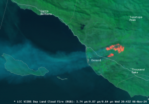
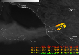
At approximately 20:43Z, 6 November 2024, the VIIRS instrument on-board the NOAA-20 satellite captured the Mountain Fire at a high spatial resolution of 375-m. The VIIRS Day Fire RGB (bottom-left) depicts the active fires (red colors) and the smoke seen in blue over Oxnard, CA (and offshore) while the quantitative VIIRS Active Fires product (bottom-right) shows the fire intensity (i.e., Fire Radiative Power, FRP) values expressed in MegaWatts (MW). Note, the VIIRS Active Fires product exhibits yellow to dark red fire pixels that indicate increasing fire intensity values, where yellow pixels indicate “cooler fires” and dark red pixels as the “most intense fires”.
VIIRS Day Fire RGB (a.k.a., Day Land Cloud Fire RGB) and the VIIRS Active Fires product


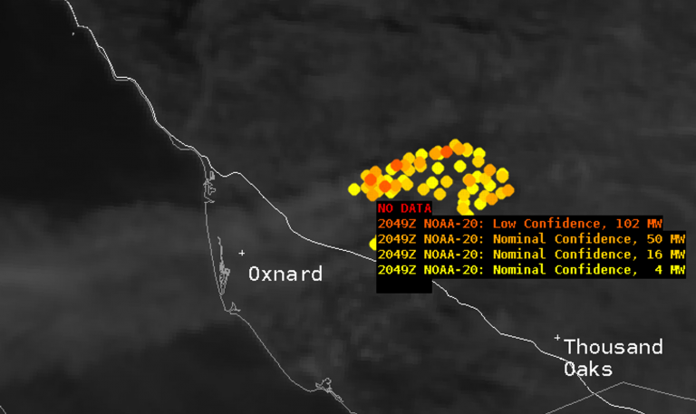
Given a closer look at the fire intensity values, forecasters can utilize the sample function in AWIPS, where the cursor readout values show several characteristics of the fire pixels: the time stamp, the polar-orbiting satellite, the fire confidence intervals (i.e., low, nominal or high), and the FRP values expressed in MW.

As of 8 November 2024, the Mountain Fire burned 20,000+ acres that included dozens of structures, and led to mass evacuations of homes, schools and businesses. The fire is 7% contained. To further monitor the Mountain Fire, users can refer to the CalFire webpage.
