New Orleans Snowstorm
A historic winter storm impacted the southern United States, blanketing several states with multiple inches of snow, spanning from southeast Texas (i.e., Houston metro area) to Florida and the Carolinas. Numerous flights were delayed or cancelled at the Louis Armstrong New Orleans International Airport from 21-22 January 2025, where the airport accumulated 8 inches from the storm. Additional unofficial snow reports across the New Orleans metro area, that also includes neighboring parishes and counties can be accessed via National Weather Service (NWS). Photos and videos of the snowstorm in New Orleans were collected and depicted by Axios. The Weather Channel has the latest updates covering the winter storm and its impacts.
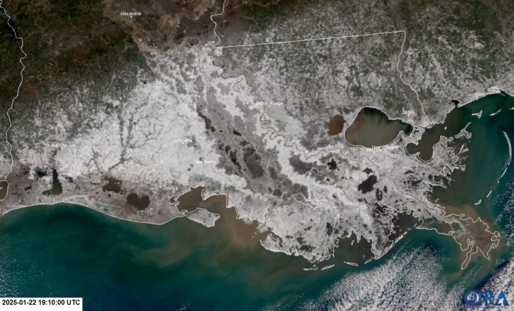
The fresh snowpack was captured by the VIIRS instrument on-board JPSS polar-orbiting satellites. The NOAA-21 VIIRS GeoColor product observed the snow cover over southern Louisiana and Mississippi at 750-m spatial resolution. Notice the sharp gradient of snow cover (seen in white) located south of Alexandria, LA, exhibiting a southwest-to-northeast orientation. Widespread snow cover can be seen near or along the coastline as well.

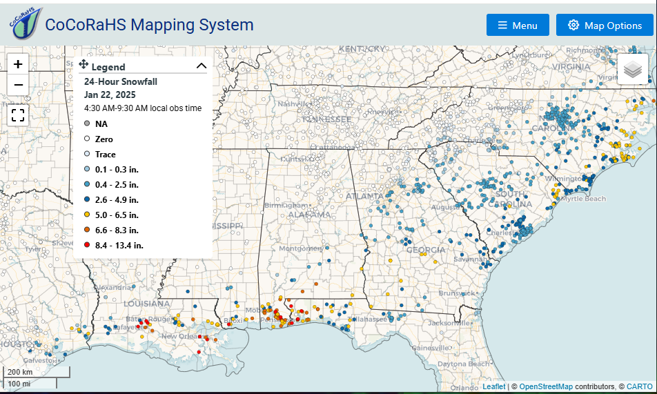
Zooming out over the southern U.S., the snow cover can be seen by multiple overpasses from the SNPP, NOAA-20, and NOAA-21 VIIRS Day Cloud Phase Distinction RGB on 22 January 2025. From this RGB, the snow cover is seen in green, extending from southeast Texas to the Carolinas. The snow cover observations seen by the imagery, express similar agreement with the CoCoRaHS 24-hour snowfall reports observed over the same domain.

