West Texas Windstorm: 8 February 2009
Ken Pryor
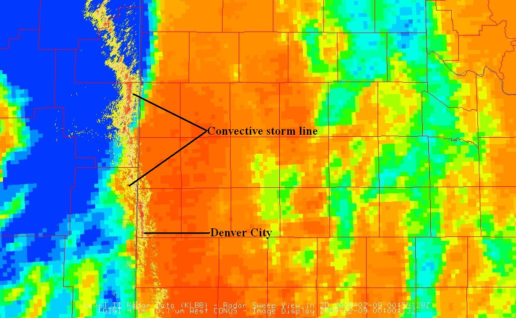
A convectively active late winter season over the Great Plains has proven fruitful for the assessment of the GOES-11 imager microburst risk product. During the evening of 8 February 2009, a line of convective storms tracked through eastern New Mexico and western Texas, producing several strong downbursts west of Lubbock. This event served as another good example of the utility of the GOES‐West (GOES‐11) imager microburst algorithm described in the previous blog entry (“Forecasting Convective Downburst Potential”, 29 January 2009). This downburst event occurred at the end of a day of boundary layer mixing due to a combination of strong surface heating and low-level wind shear, and thus, demonstrated the importance of the evolution of the convective mixed layer in downburst generation as reflected in the GOES microburst product imagery. The line of convective storms crossed the New Mexico border into Texas around 0100 UTC 9 February. The first downburst recorded in Texas was observed at Denver City West Texas Mesonet station with a wind gust of 47 knots at 0100 UTC, followed by a stronger downburst with a wind gust of 60 knots at 0125 UTC. Further downburst activity was observed at Anton (50 knots) and Reese Center (46 knots) mesonet stations west of Lubbock at 0225 UTC and 0235 UTC, respectively.
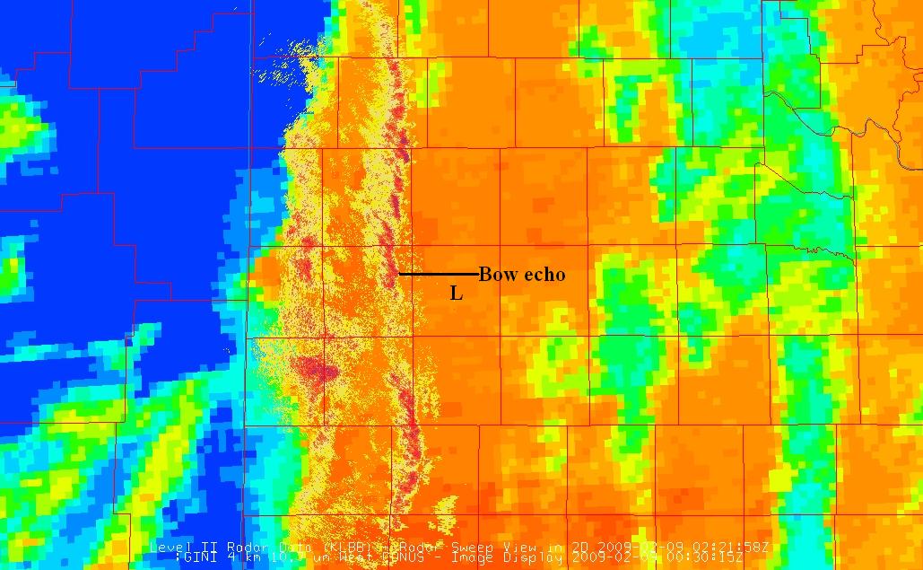
The image above is a recent example of the GOES‐11 imager microburst risk product at 0000 UTC 9 February 2009 with overlying radar reflectivity imagery from Lubbock (KLBB) NEXRAD at the time of downburst occurrence at Denver City, 0100 UTC. The product image was visualized by McIDAS-V software, available online at http://www.ssec.wisc.edu/mcidas/software/v/. The image was filtered to display only reflectivity higher than 35 dBZ to emphasize the heaviest precipitation cores where downbursts are likely to be generated. Apparent in the product image is the storm line crossing the Texas border, propagating into a region of high microburst probability as indicated by the progression from orange and red shading in the image. Clouds are represented by light to dark blue shaded areas in the product image. The next product image, valid at 0030 UTC with overlying radar reflectivity imagery at the time of downburst occurrence, shows the eastward progression of the storm line. 0221 UTC radar reflectivity data indicated a small bowing segment of the line northwest of Lubbock (L), associated with the downburst in progress at Anton.
Note that the Anton downburst again occurred in close proximity to elevated imager microburst risk values as displayed by darker orange shading. This case demonstrated that the GOES-11 imager microburst algorithm output, when combined with radar reflectivity data into a composite product image, can effectively show forecasters where microbursts are likely. The GOES-11 microburst algorithm models the preconvective environment by utilizing brightness temperature differences between the midwave and longwave infrared channels to approximate favorable temperature and moisture gradients in the boundary layer that would enhance convective downdraft generation. More information about the GOES-11 microburst product can be found in the VISIT lesson titled “Forecasting Convective Downburst Potential Using GOES Sounder Derived Products”.


