South-Central Colorado: Junkins Fire
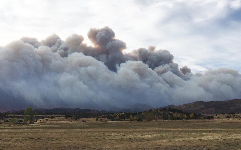
Another fire started in south-central Colorado, tabbed the ‘Junkins Fire’. According to the Denver Post, the cause of the fire is unknown however, it was first spotted at 0345 AM MDT in Custer County on 17 October 2016. The fire has spread rapidly over the past day and a half due to high winds and low relative humidity. As of this morning, 18 October 2016, the Junkins Fire had burned over 15,000 acres of land and 0% of the fire was contained. Several structures in the area have already been burned while more than 175 homes have been evacuated. Figure 1 shows an image of the fire and can be seen below via the ‘Wildfire Today‘ website.
Figure 1: An image taken of the Junkins Fire in south-central Colorado during the early morning hours of 17 October 2016 (Source: Wildfire Today).
To aid in monitoring the Junkins Fire, polar-orbiting satellite data from the Suomi National Polar-orbiting Satellite (Suomi-NPP) can be utilized. One of the polar-orbiting satellite data products is the Near Constant Contrast (NCC). NCC can monitor and observe night-time light emissions (e.g., wildfires, city lights) and atmospheric features (e.g. clouds, lightning) utilizing a sun/moon reflectance model. An NCC animation (Animation 1) is shown below highlighting south-central Colorado on 17 October 2016 @ 0819Z (0219 local time) and 18 October 2016 @ 0800Z (0200 local time). Make sure to click the image and the animation will start.
Animation 1: The animation spans over two days, 17-18 October 2016, and displays where the emitted lights of the Junkins fire is relative to the emitted city lights of Pueblo. The percent visibility of the moon, and the elevation angle of the moon above the horizon are seen in the top right-corner of the animation. The Junkins Fire via satellite imagery can be seen quite well since the fire is occurring during the Full Moon stage of the lunar cycle, and where the moon is above the horizon.
If one takes a closer look at the Junkins fire in Figure 2 below, one can see how close this fire is in proximity to the smaller towns around the area (i.e., the towns of Wetmore, Beulah and Rosita). This close proximity is prompting current evacuations for people that are living in and or near those areas.
Figure 2: An NCC image of the Junkins Fire (white circle) relative to the neighboring towns, I-25, and the city of Pueblo.
For more information on the status of the fire refer to the Denver Post website and the Weather Channel.


