Is it Real, or is it…Synthetic GOES-R Imagery?
Jeff Braun, Louie Grasso and Dan Lindsey
As part of the GOES-R Proving Ground activities, synthetic GOES-R imagery has been produced from model output run at the National Severe Storms Laboratory (NSSL). This model is being run with horizontal grid spacing of 4 km over the continental United States during the spring of 2010. An automated system was designed at the Storm Prediction Center (SPC) to send model output to the Cooperative Institute for Research in the Atmosphere (CIRA) as soon as it is produced. At CIRA, an automated system was also in place to generate synthetic GOES-R imagery at selected wavelengths. Once the imagery is ready, the data is converted into McIdas AREA files and placed on an ADDE server at CIRA. These AREA files are then acquired at the SPC for viewing on an NAWIPS system.
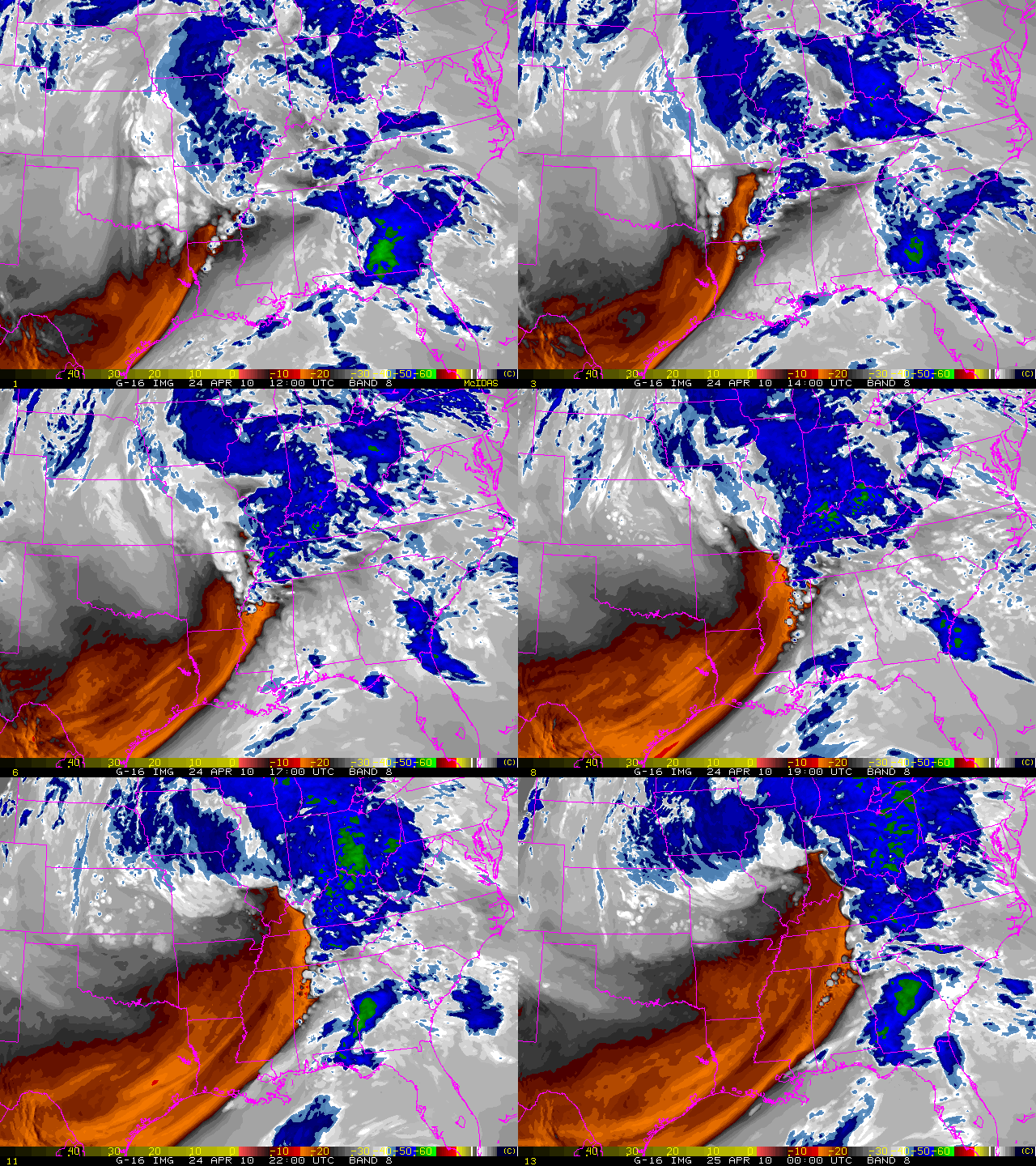
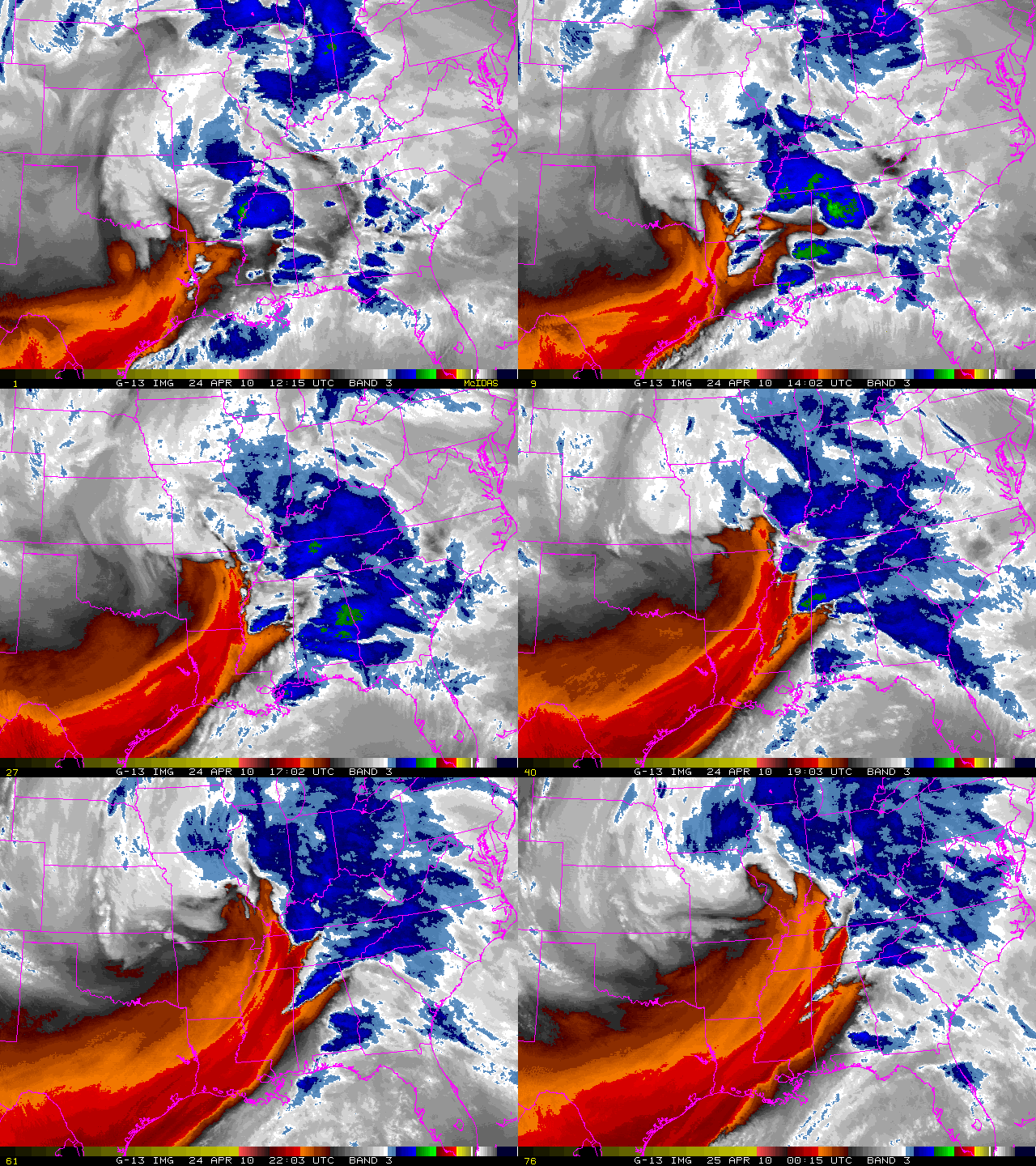
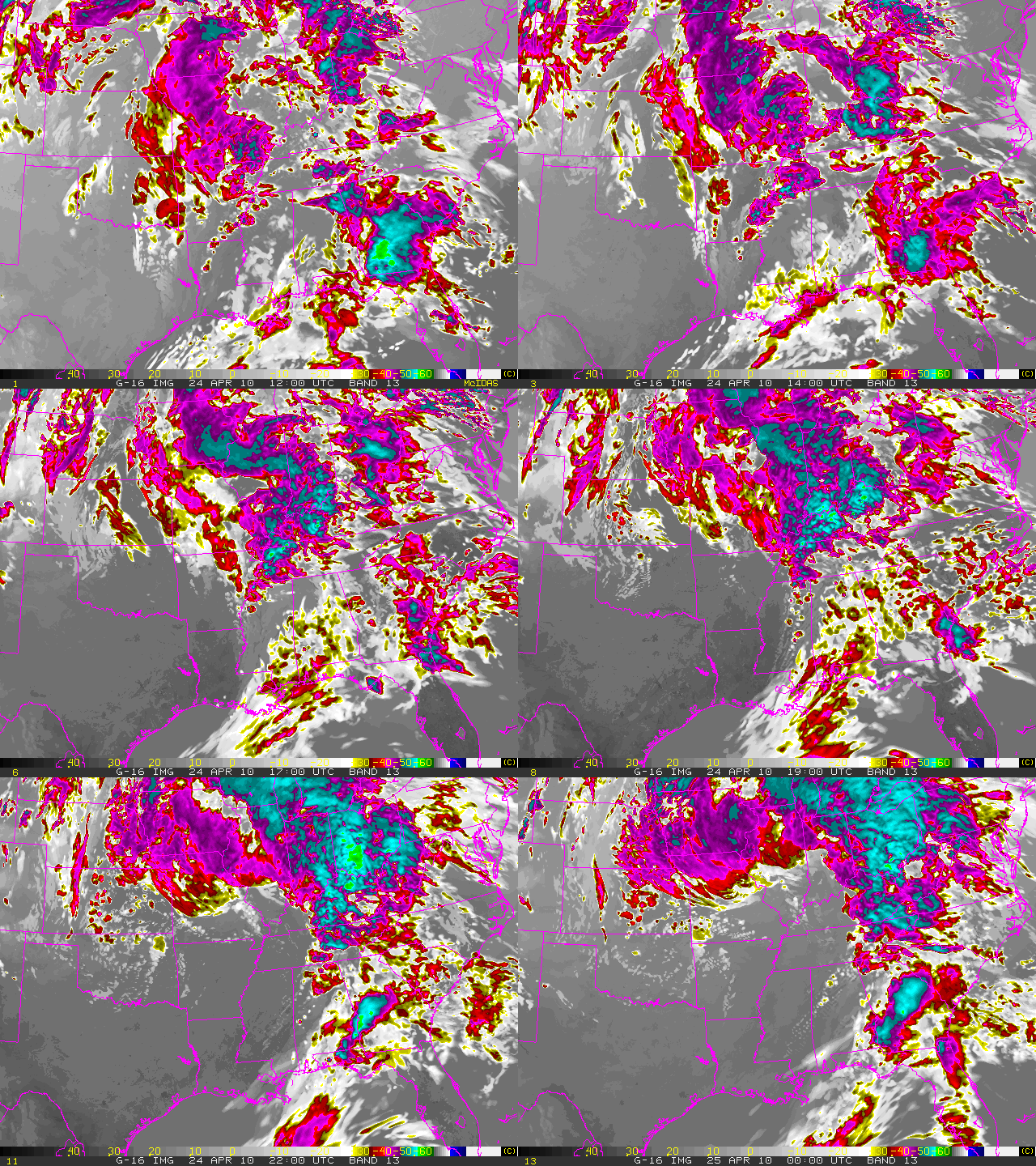
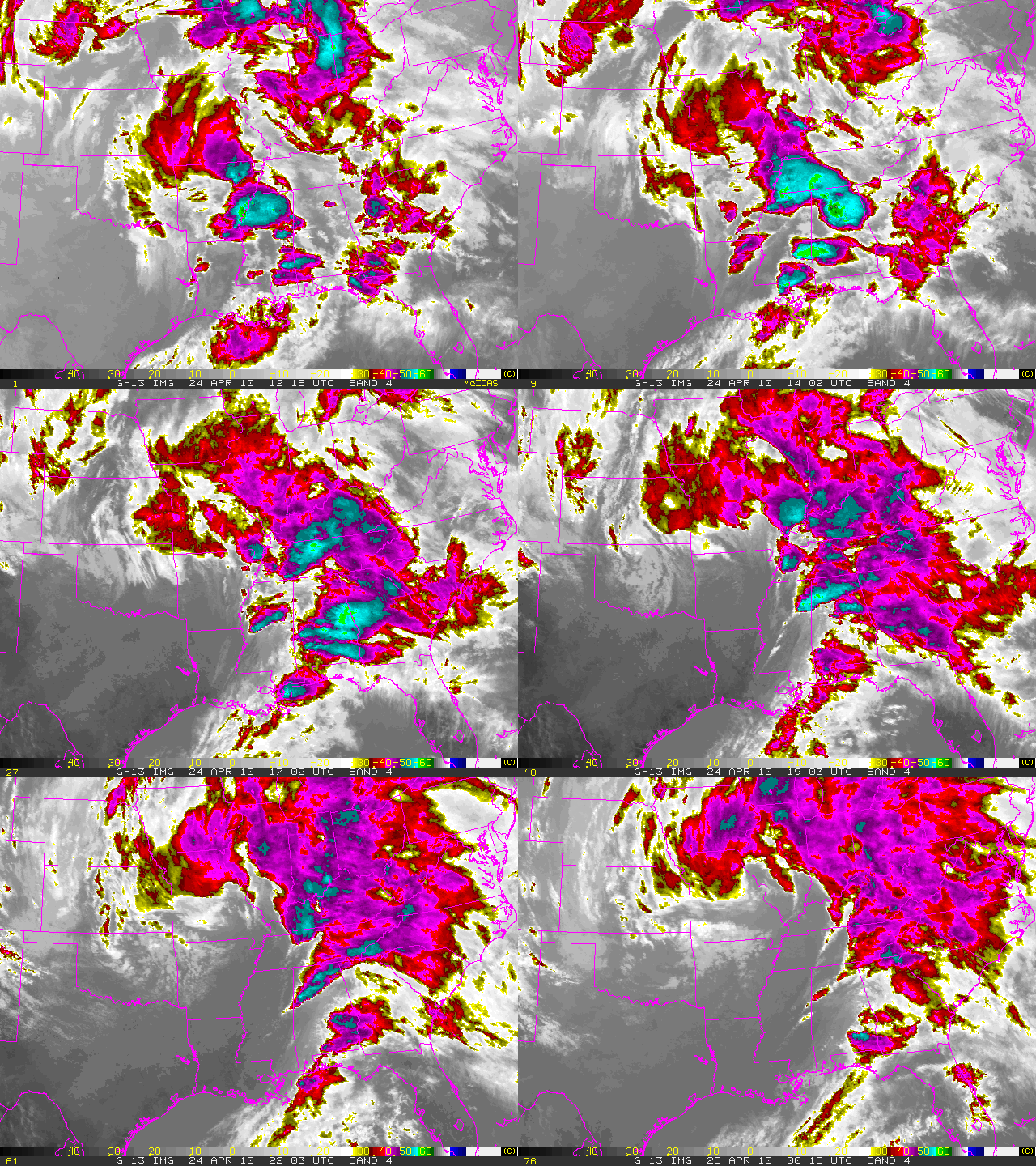
As a result of the automated system, such imagery represents a real time forecast of GOES-R imagery. Due to resource limitations, only four GOES-R bands could be generated in a real time setting. As an example, Figures 1 and 2 show a twelve hour loop (The twelve hour loop shows images every hour from 1200 UTC to 0000 UTC) of GOES-R synthetic WV forecast imagery (top)with that of the corresponding GOES-13 WVobserved imagery (bottom). Figures 3 and 4 show the same 12 hour period for both forecast and observed imagery, only for the longwave IR channel. Differences in brightness temperatures between GOES-R synthetic and GOES-12 observed may be due to the different central wavelengths and band widths (GOES-R 6.185 µm vs GOES-13 6.5 µm – for the WV channels – and GOES-R 10.35 µm vs GOES-13 10.7 µm – for the IR channels).
 (Figure 1: Animated gif of GOES-R 6.185 µm synthetic forecast WV brightness temperatures. The twelve hour loop shows forecast images every hour from 1200 UTC to 0000 UTC – April 24, 2010.)
(Figure 2: Same as figure 1, but for GOES-12 6.5 µm WV channel observed brightness temperatures.)
 (Figure 3: Same as figure 1, but for GOES-R 10.35 µm forecast synthetic IR brightness temperatures.)
 (Figure 4: Same as figure 1, but for GOES-12 10.7 µm observed brightness temperatures.)
Note of interest – this imagery was forecast and observed for April 24, 2010 which was a day of extreme severe weather over the southern portion of the USA…particularly for Mississippi and Alabama. Nearly 60 tornadoes were counted for April 24 alone (about 40 of these were discrete tornado reports). At least 12 people lost their lives on this day. A three day total for this spring’s strongest severe weather system (up to now) was that it spawned around 110 tornadoes (about 90 when adjustments were made for duplicate reports) between April 22nd and April 24th. This three day period produced more tornadoes than had been reported during the entire previous four months!
