Smoky in the Northeast U.S.
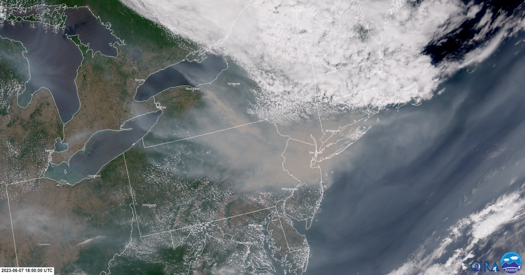
Over the past week, the northeastern United States was inundated with smoke that was produced from fires raging in the Canadian province of Quebec. On the backside (i.e., west side) of a lingering upper-level low, wildfire smoke transported hundreds of miles southward and southeastward toward the northeastern U.S. New York City, NY, along with other cities in the northeast, were significantly impacted by high smoke concentrations near the surface. On 7 June 2023, a recorded timelapse showed the smoke reducing the visibility of the New York City skyline. Even professional sports games were rescheduled and airline flights were grounded due to the smoke and poor air quality that spread across the region.
The VIIRS GeoColor, a product that is quite useful for aerosol detection applications can be seen below. The product animation shows the smoke transport from Quebec to the northeast U.S. and consists of daytime overpasses from NOAA-20, NOAA-21, and SNPP VIIRS from 5-7 June 2023. Users will notice the smoke from numerous fires in Quebec that travels southward across southern Canada, the Great Lakes, the northeast U.S., and eventually over the North Atlantic Ocean. If users look closely, a few smoke plumes can be seen over southeastern Ontario as well.
Zoomed-in on the northeast U.S., the NOAA-20 VIIRS GeoColor observes the thick smoke offshore and across the states of New Jersey, Pennsylvania, New York and Connecticut on 7 June 2023 at ~18Z. See the image below.

Thanks to the newly released CIRA JPSS CONUS Sector, users can compare the smoke observations between the VIIRS GeoColor and the Advanced Baseline Imager (ABI) GeoColor at ~18Z, 7 June 2023. For users that are unaware, the ABI is an instrument onboard NOAA’s geostationary satellites, GOES-16 and GOES-18. Click the animation below, and notice the finer details of the smoke and clouds observed by VIIRS (~750-m spatial resolution at nadir) compared to the coarser ABI (~1-km at nadir). Users should keep in mind that the ‘actual resolutions’ of VIIRS and ABI vary across the VIIRS swaths and the ABI domains: their spatial resolutions degrade as the satellite viewing angle becomes larger. With oblique (i.e., non-nadir) viewing angles, parallax is also an issue; users can read more about it, here from gina.alaska.edu and here from the Satellite Liaison Blog.
